


Our Travelogue
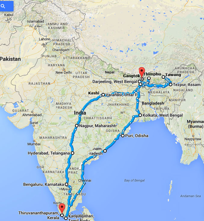
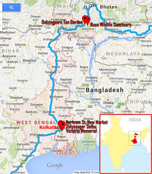
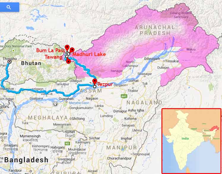
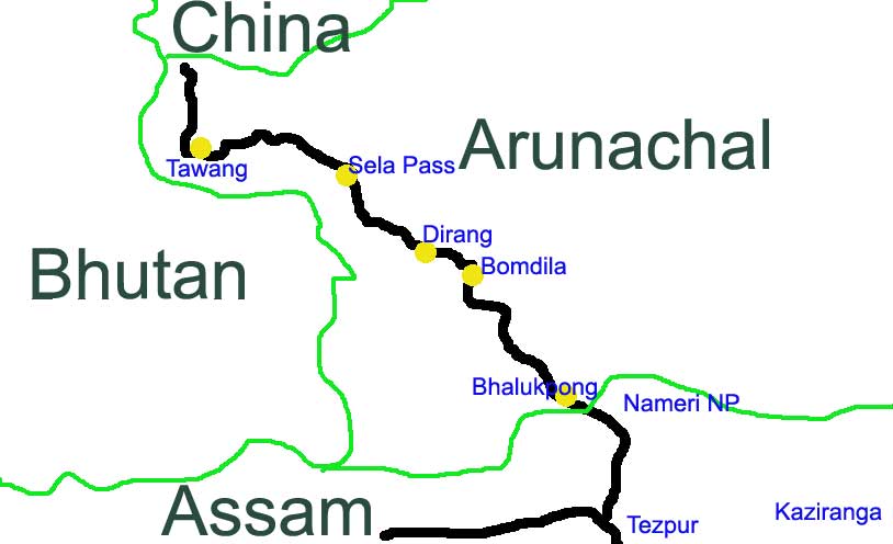
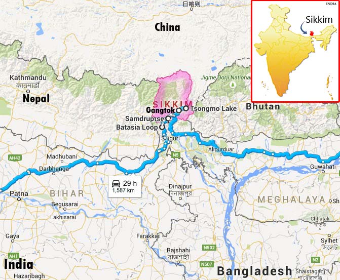
This page contains detailed information of our 19 days long travel by road. We drove more than 10,000 KMs, covered 14 states in India and main regions of Bhutan. The below picture describes the travel map. Our starting date of Travel was 20th January and we returned our home on 9th February. Our main aim was to explore the eastern part of Himalaya.
Note : This page is a Timeline representation of our travel and will get a summary by default. By expanding/collapsing each node/title, it is possible to read its content very easily. Also one can expand/collapse as a whole using the [Expand All/Collapse All] button.
20 January 2015 | Kerala
- Overview
-
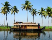
Kerala, the land of kera or coconut trees, is a state with never-ending array of coconut trees... very beautiful beaches which blanched with sun light... kettuvallams over enchanting backwaters... magical monsoon showers... silent valleys vibrant with flora and fauna... misty mountains of Western Ghats... fragrance of spices... evenings reverberating with the rhythm of a thousand art forms...fairs and festivals... these all making Kerala extremely beautiful!
Kerala is a small state in India with an area of 3.88 million Hector (1% of total area of India) where 2.7% of the total Indian population is living. Kerala's economy depends on emigrants working in foreign countries, mainly in the Gulf states countries such as United Arab Emirates and Saudi Arabia, and remittances annually contribute more than a fifth of GSDP. In 2011-12 tertiary sector such as transport, storage, communications, tourism, banking, insurance and real estate contributed 63.22% of states GDP and has less agriculture contribution which was about 15% of SGDP. Nearly 21% from construction and utilities in the same period.
- Travel Info
-
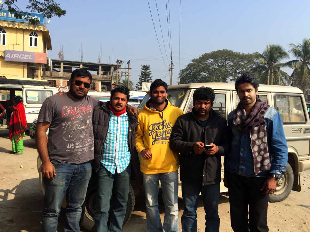
We all born and brought up in Kerala. Rathish M.M, who is a native of Thrissur, "the cultural capital of Kerala" because of its cultural, spiritual and religious leanings throughout history. Krishnakumar, who is a native of Thiruvananthapuram, the capital of Kerala. Prathap is also from Thiruvananthapuram.
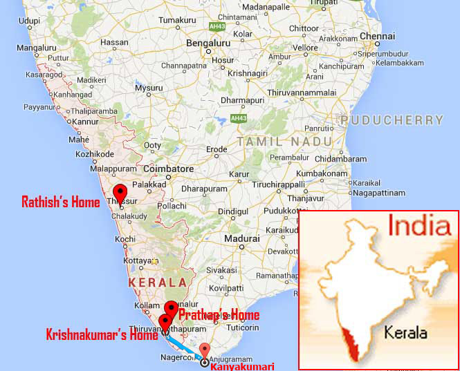 Kerala Map with our home
On 20th January 2015 at 6.30 PM, we started our travel from Chempazhanthy, Thiruvananthapuram. At that time we were extremely happy by thinking about the wonderful moments ahead of us...the moment of enjoyment and experiences. The first target was to travel to Kanyakumari, the southern tip of India also called Cape Comorin.
20 January 2015 | Tamil Nadu
- Overview
-
Tamil Nadu is a State with several distinguished tourism genre. It has cerulean mountains, verdant vegetations, sandy beaches, mammoth monuments, timeless temples, fabulous wildlife, scintillating sculptures and reverberating rural life. It has picturesque spots, continuing heritage, cultural confluence and aesthetic magnificence. Tamil Nadu has excellent hill stations like Ooty, Kodaikanal, Yercaud, Elagiri, Javvadhu Hills, Kolli Hills, Sirumalai Hills, Valparai, Topslip, Parvathamalai Hills and Pachamalai Hills. It has silvery cascades in Courtallam, Hogenakkal, Thiruparappu, Monkey falls, Thirumurthi Malai, Akasa Gangai and Papanasam. It has excellent National Parks like Guindy National Park and Anamalai National Park. It has wildlife sanctuaries in Mudumalai, Kodiakarai, Kalakkad, Mundanthurai and Berijam. It has Botanic Gardens in Ooty, Kodaikanal and Coimbatore. It has UNESCO declared monuments like living Chola temples at Thanjavur, Darasuram and Gangaikondacholapuram, monuments at Mamallapuram and Nilgiris Heritage Train. The vast coastline of Tamil Nadu has many silvery beaches like the Marina, Elliots, Thiruvanmiyur, Tiruchendur, Rameswaram and Kanniyakumari. The temples of Tamil Nadu reverberate with spirituality and music. Madurai, Rameswaram, Kumbakonam, Chidambaram, Thanjavur and Tiruchirappalli have innumerable temples with different deities. The finely hewn grandeur sculptures reflect artistic excellence and cultural splendour.
Tamil Nadu has an area of 13 million hector (4% of Total area of India) and about 6% of population is living here. 45% of economic contribution is from services, 34% from manufacturing and 21% from agriculture.
- Travel Info
-
Nearly 9 PM, we entered Tamilnadu. Our ultimate target was to reach Odisha as soon as possible. So even though plenty of tourist locations were there in Tamil Nadu, we never mind those places. The only place that we visited was Kanyakumari.
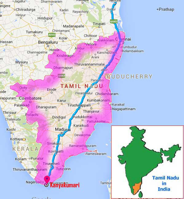 Tamil Nadu map and our travel path
 - 09:00 PM | Kanyakumari
-
Described as the southernmost end of Tamil Nadu, the land's end of India or the point where the three seas meet, enchanting Kanniyakumari or Cape Comorin is one of the most popular tourist spots in the state. Part of the fascination is of course due to the fact that it is the very tip of the Indian peninsula and the confluence of the Bay of Bengal, the Arabian Sea and the Indian Ocean. Nature is so spectacular at Kanniyakumari that several other Indian beaches pale by comparison. Cape Comorin is at its best during Chitra Pournami (the full moon day in April) when the sun and moon are face to face on the same horizon but other full moon days are also special and you can see the sun set and the moon rise almost simultaneously.
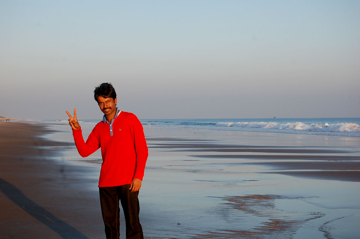
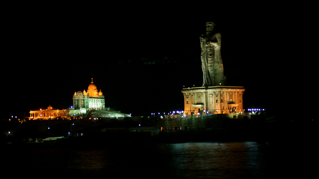 Kanyakumari - A night view
21 January 2015 | Tamil Nadu
- Travel Info
-
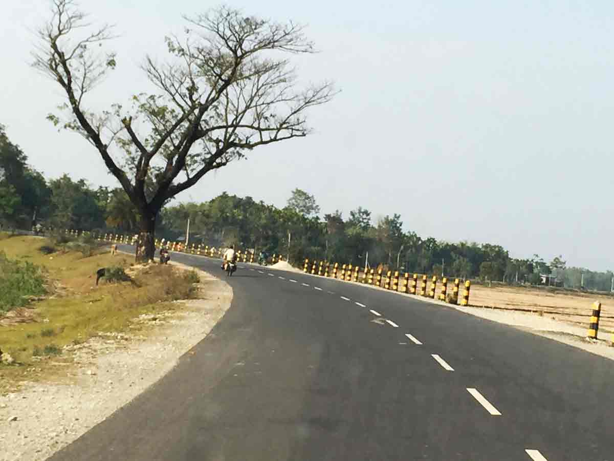
Our ultimate aim was to reach Odisha as soon as possible. So even though plenty of tourist locations were there in Tamil Nadu, we never mind those places. The roads were really good. Driving above 100 KM/h is not a challenging task. HMPD (Highways & Minor Ports Department) of Tamil Nadu is primarily responsible for construction and maintenance of roads including national highways, state highways and major district roads in Tamil Nadu.
Tamil Nadu is famous for Wind Energy. The wind energy installed capacity of state is 7349 MW as on 31-July-2014. Tamil Nadu is endowed with three prominent passes having high wind potential. Most of the passes and installed wind turbines can be seen when one travel by road.
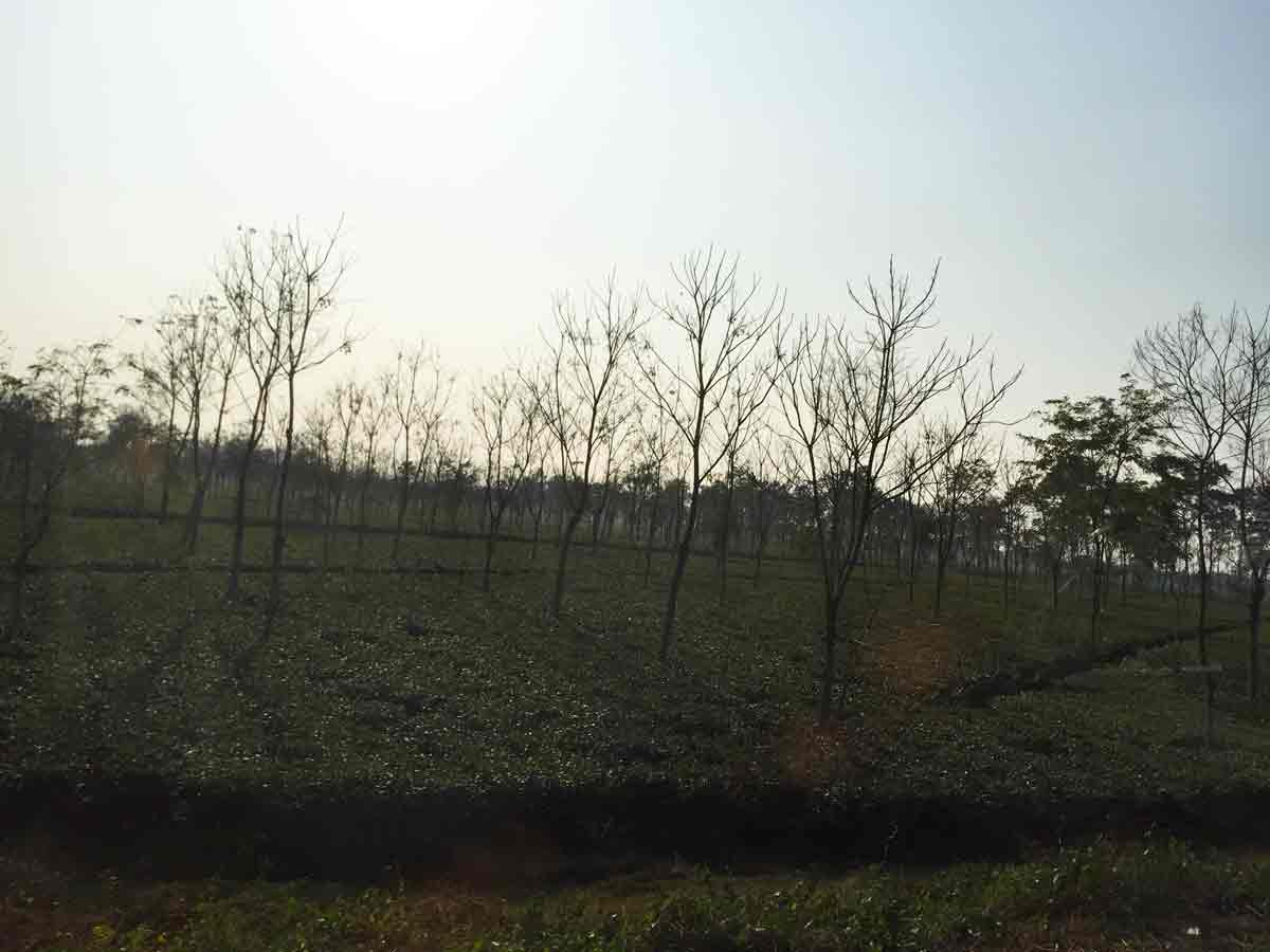
In some location of the state, both sides of the highways, one can see uncultivable lands extended beyond horizon. Also whenever cultivable areas reached, then limitless area of cultivable lands can be seen which includes paddy and flowering plant cultivation. Anyway one can enjoy those mind blowing sceneries.
21 January 2015 | Andhra Pradesh
- Overview
-
Andhra Pradesh Tourism has always been the frontrunner in attracting greatest number of tourists, inland and foreign, as it boasts of a naturally, ecologically, culturally and religiously rich and diverse variety of tourist destinations that are treasures of visual treat where one can continuously explore new experiences of visitor gratification and delight. Abounding in natural resources, the state of Andhra Pradesh having the longest eastern coastline and with a trail of Buddha Period glory, houses and holds many heritage sites adorned with pristine splendor, the forts, citadels and architectural masterpieces built by the past Royal hegemony and its noble Emperors. The magnificent palaces and places, monuments, memorials, tombs and stately structures built by them reflect the art and craftsmanship, architecture and culture that originated on this land. There are beautiful dams, valleys, hills and ridges with the scenic dale, tranquil lake waters, swirling beach waves, meadows, resorts, hill stations, caves, virgin forests, sanctuaries and national parks which a visitor can enjoy to his heart's content.
4% of total India's population is in Andhra Pradesh having approximately 5% of total land area. Economy of the state is mainly based on agriculture and livestock. Andhra Pradesh is an exporter of many agricultural products and is also known as "Rice Bowl of India". Four important rivers of India, the Godavari, Krishna, Penna, and Thungabhadra, flow through the state, providing irrigation. Agriculture is the main occupation and 60 percent of population is engaged in agriculture and related activities. Rice is the major food crop and staple food of the state.
Kuchipudi is a Classical Indian dance from Kuchipudi Village, Krishna district, Andhra Pradesh. It is also popular all over South India.
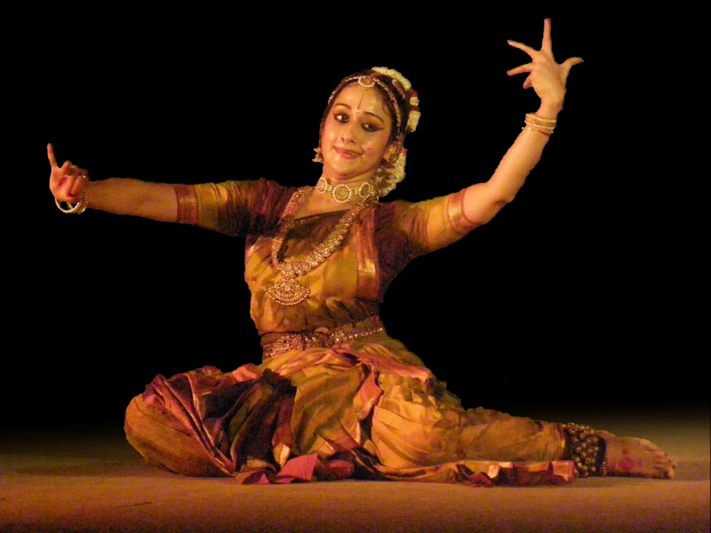 Kuchipudi Dance
 - Travel Info
-
Nearly 10.30 AM, we reached Andhra Pradesh. Even though the state is very beautiful and has a lot of tourist locations including beaches, temples, Shrines, heritages sites and all, we passed this state as soon as possible to reach our ultimate start destination - Odisha.
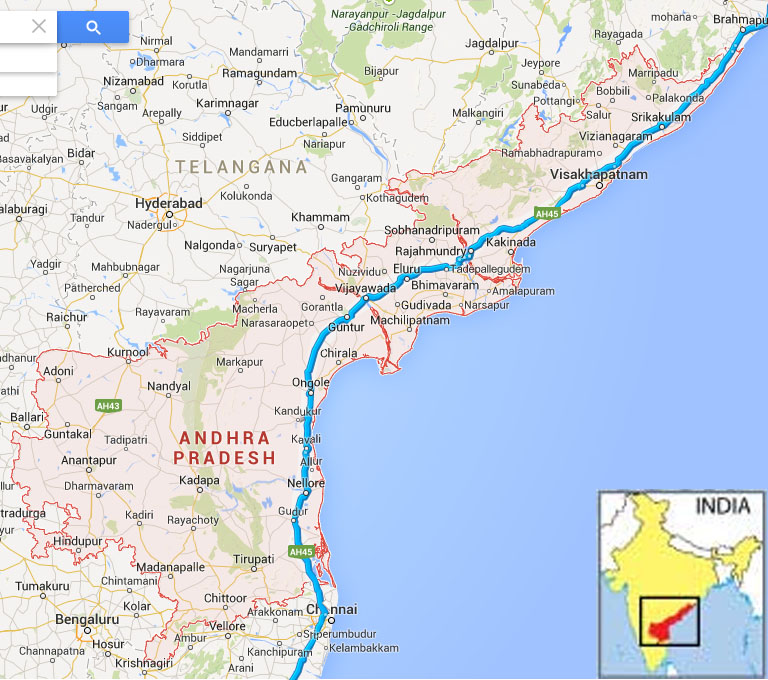 Map of Andhra Pradesh and our travel path
22 January 2015 | Odisha
- Overview
-
Odisha (previously known as Orissa) is a great place for tourism and is filled with exquisite temples and monuments, home to many prolific artists and craftsmen, lots of beaches, wild life sanctuaries, beautiful natural landscapes etc. Odisha has 9th position in geographical area in India and nearly 3.4 % of Indian population is living here. State capital is Bhubaneswar. Konark Temple at Odisha is a world heritage site. More than 94 % people practising Hinduism, but Christianity, Islam and other religions are also practising. Odisha is the first state in India formed on linguistic basis in 1936. Odisha's industry is mineral based and mineral contribution in its value is highest in the country. This state is a highest producer of aluminum in India. Important minerals in Odisha are iron ore, coal, bauxite, chromite, manganese and graphite. Odisha contains a fifth of India's coal, a quarter of its iron ore, a third of its bauxite reserves and most of the chromite. Odisha also good at agriculture. Paddy still continues to be the dominant crop in Odisha and it constitute 90 percent of the total food grain production. Odisha's industries are mostly mineral based and retain 10 percent of total capacities of the nation. Odisha is the most favored foreign direct investment destination in India. Odisha has abundant natural resources and a large coastline. Rourkela Steel Plant was the first integrated steel plant in the Public Sector in India. India's topmost IT consulting firms, including Satyam Computer Services, TCS (Tata Consultancy Services), MindTree Consulting, PricewaterhouseCoopers and Infosys have large branches in Odisha. IBM, Cognizant, Bosch and Wipro are setting up development centers in Odisha. Odisha boasts three of the major ports in India i.e. Paradip Port, Dhamra Port and Gopalpur.
- Travel Info
-
Nearly 5.00 AM, we entered to Odisha State. The Climate was really good. Road conditions were very good.
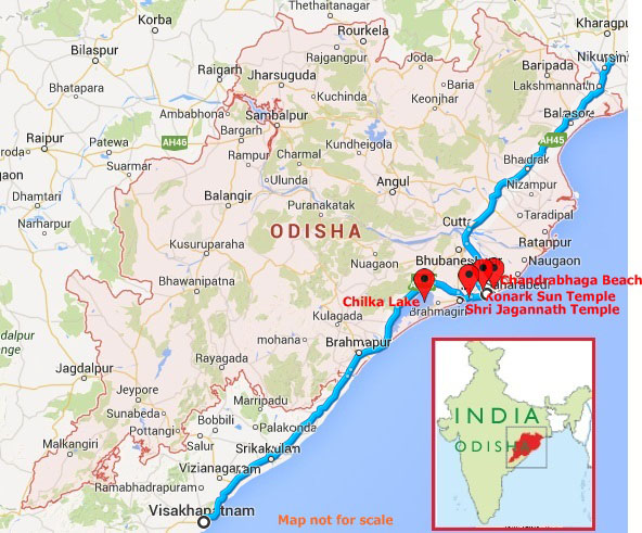 Map of Odisha and our travel path
 - 08:40 AM | Chilka Lake
-
This lake is entirely inside Odisha spread over Puri, Khurda and Ganjam districts and is Asia's largest Brackish Water Lagoon which spread 1100 million hectare area in rainy season. Because of its rich bio-diversity and socio-economic importance, Chilika was designated as a Ramsar site in 1981 to afford better protection. Chilika Lake offers visitors a spectacular display of its colorful avian charms in a thousand different hues presented by over 160 species in the peak season between November and February.
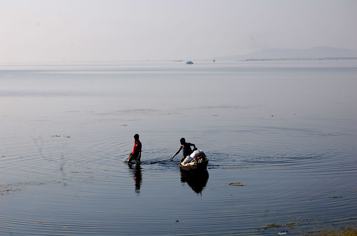 Chilka Lake
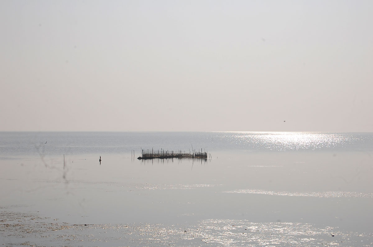 Chilka Lake
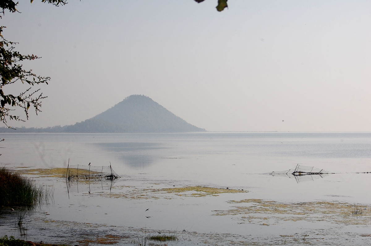 Chilka Lake
Nalaban Island:
It is a bird sanctury inside Chilka Lake. Here one can seen thousands of birds descending during the migratory season. The island disappears during monsoon season due to inundation, and post-monsoon, the island emerges again.
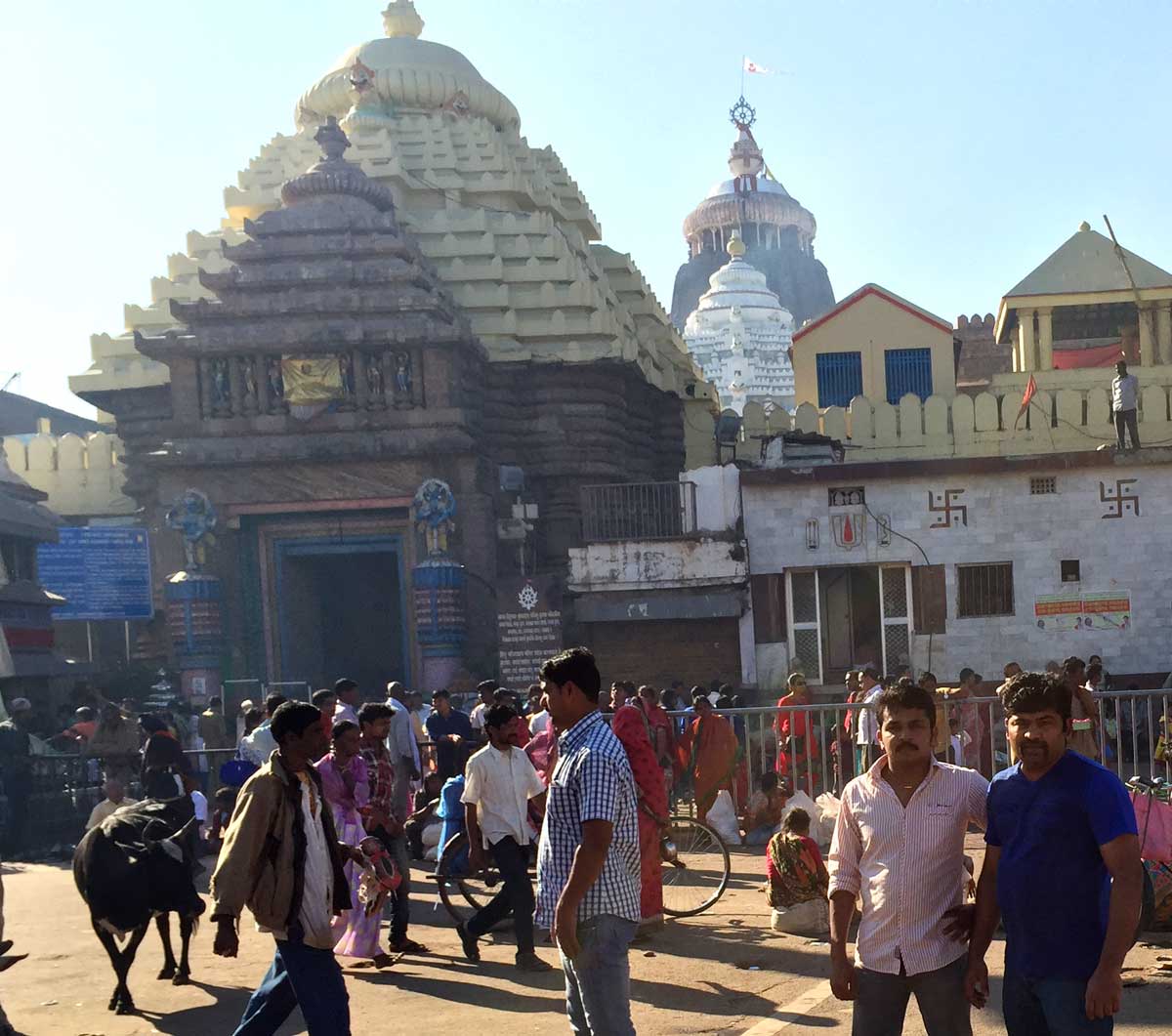
- 03:00 PM | Shri Jagannath Temple, Puri
-
Jagannath Temple is one of the biggest temple of Odisha established in 12th century and is dedicated to Lord Jagannath (Lord Krushna). The credit for laying the foundation of the Jagannath temple of Puri goes to Raja Ananta Varman Chodaganga Dev.The pillars that provide support to the temple are adorned with pictures depicting the life of Lord Krishna. In the list of the most splendid monuments of Orissa, Jagannath temple occupies a supreme position. One of the most popular attractions of the Jagannatha Temple of Puri comprises of its Rath Yatra that is organized every year. It is basically a chariot festival, where idols of Lord Jagannath, Lord Balabhadra and Goddess Subhadra, the main deities of Srimandir, are taken to the Gundicha temple in bejeweled chariots and are brought back to the mandir in the same way.
The central forms of Jagannath, Balabhadra and the goddess Subhadra constitute the trinity of deities sitting on the bejewelled platform or the Ratnavedi in the inner sanctum. The Sudarshan Chakra, deities of Madanmohan, Sridevi and Vishwadhatri are also placed on the Ratnavedi. The deities of Jagannath, Balabhadra, Subhadra and Sudarshan Chakra are made from sacred Neem logs known as Daru Bramha. Depending on the season the deities are adorned in different garbs and jewels. Worship of the deities pre-date the temple structure and may have originated in an ancient tribal shrine.
 Shri Jagannath Temple
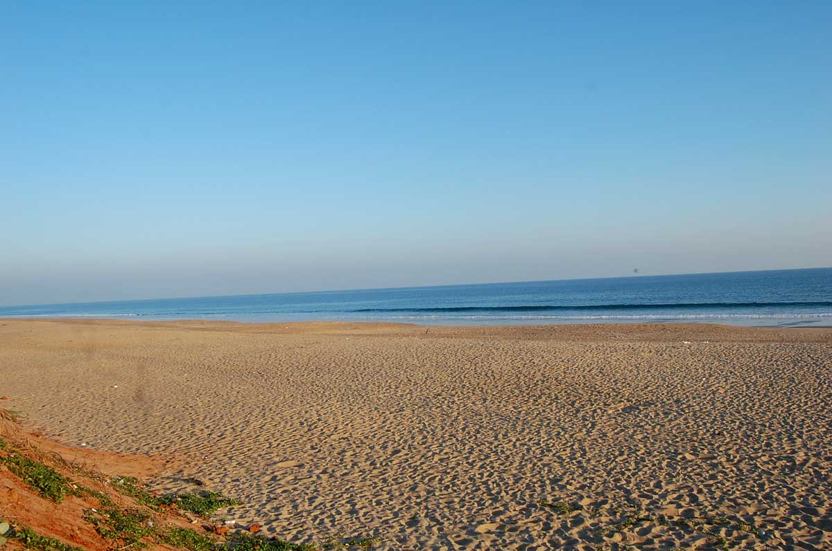
- 04:50 PM | Chandrabhaga Beach, Puri
-
Chandrabhaga beach is a very beautiful beach situated near to Konark temple. This beach derived its name from the sacred River Chandrabhaga, which once flowed through the precincts of the Sun Temple of Konark, towards the Bay of Bengal.
Chandrabhaga Beach plays an important role in the cultural and traditional identity of Orissa. It witnessed the rise and fall of the Sun Temple of Konark. Chandrabhaga Beach is famous for its long stretch of golden sand bordered with casuarinas, is counted among the best beaches in India due to its ideal spot on the eastern coast. The beach holds an important place in the map of Orissa tourism. Chandrabhaga Beach, apart from pilgrimage and cultural activities, offers activities like sun bathing, surfing, swimming, etc. it is also famous for its sun rise views. Chandrabhaga Beach also offers excursions to tourist destinations like Gopalpur Beach, Puri, Chilika Lake and Bird Sanctuary, Bhubaneswar, etc.
 Chandrabhaga Beach
 Chandrabhaga Beach
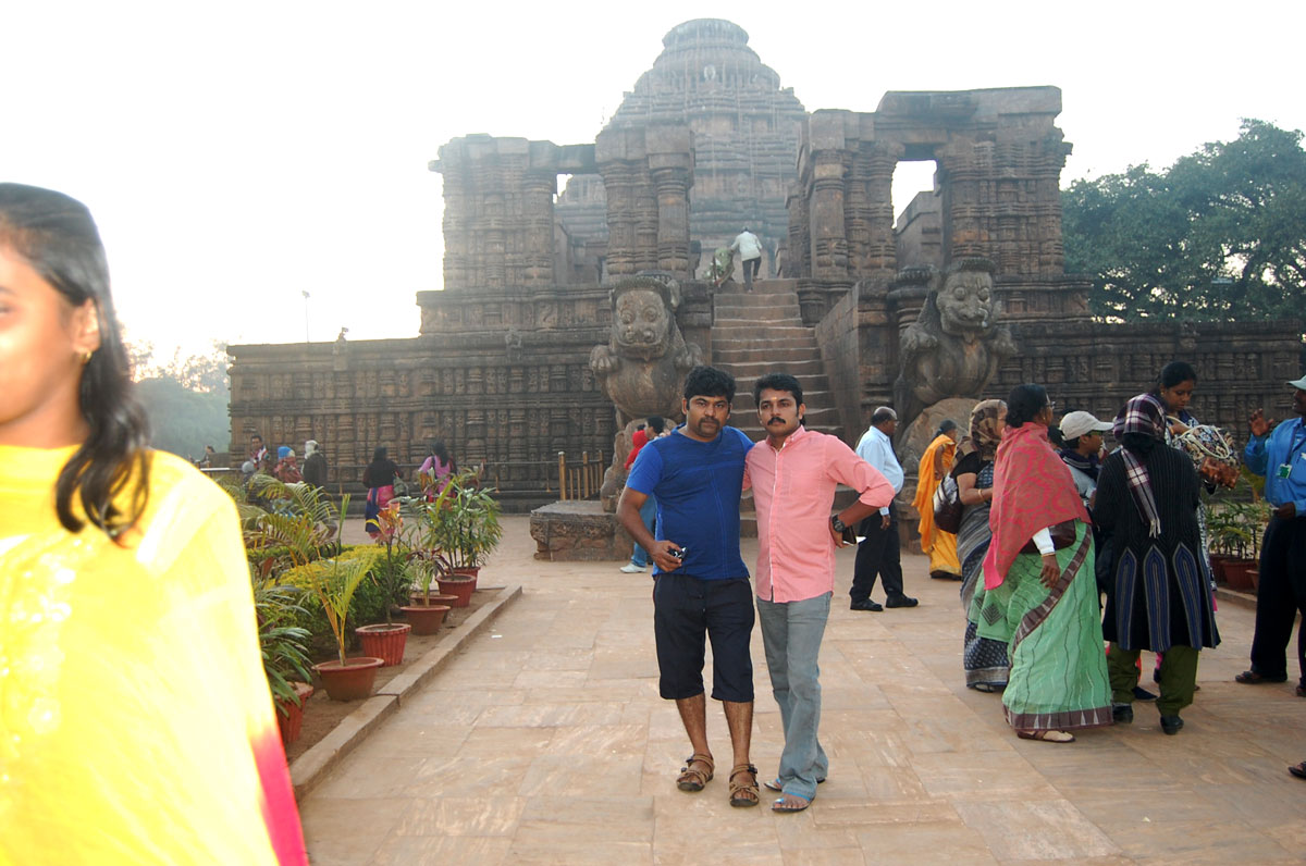
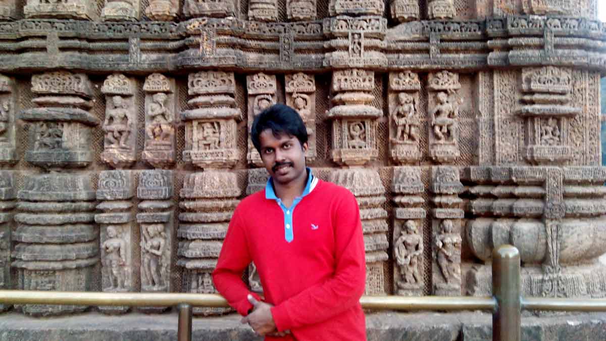
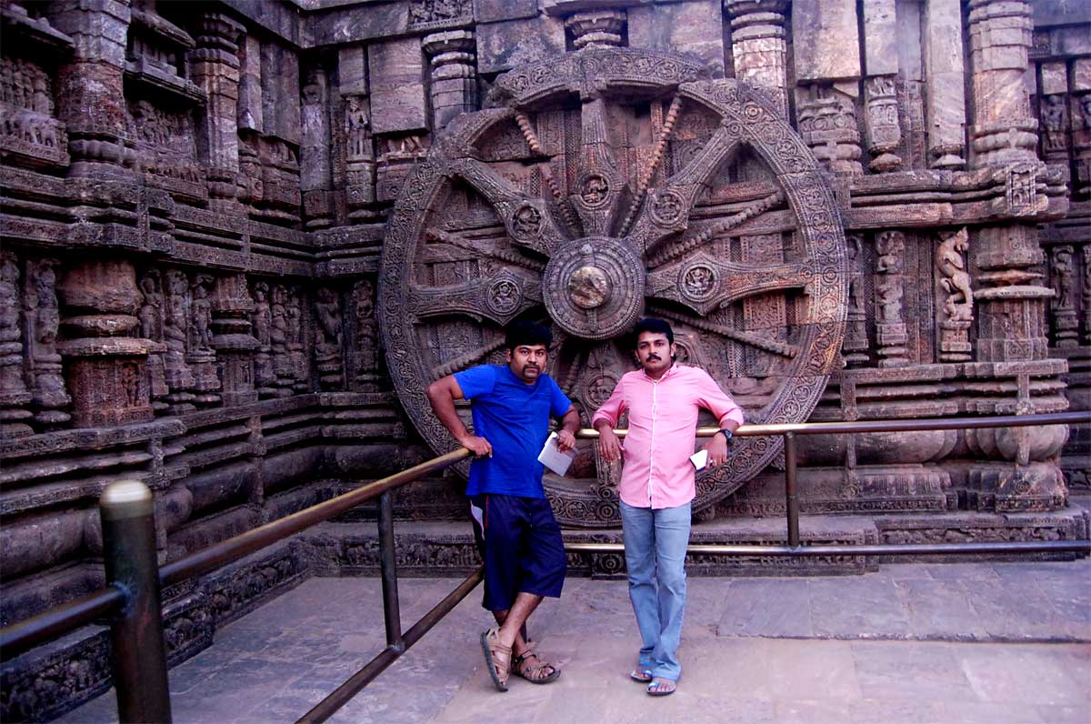
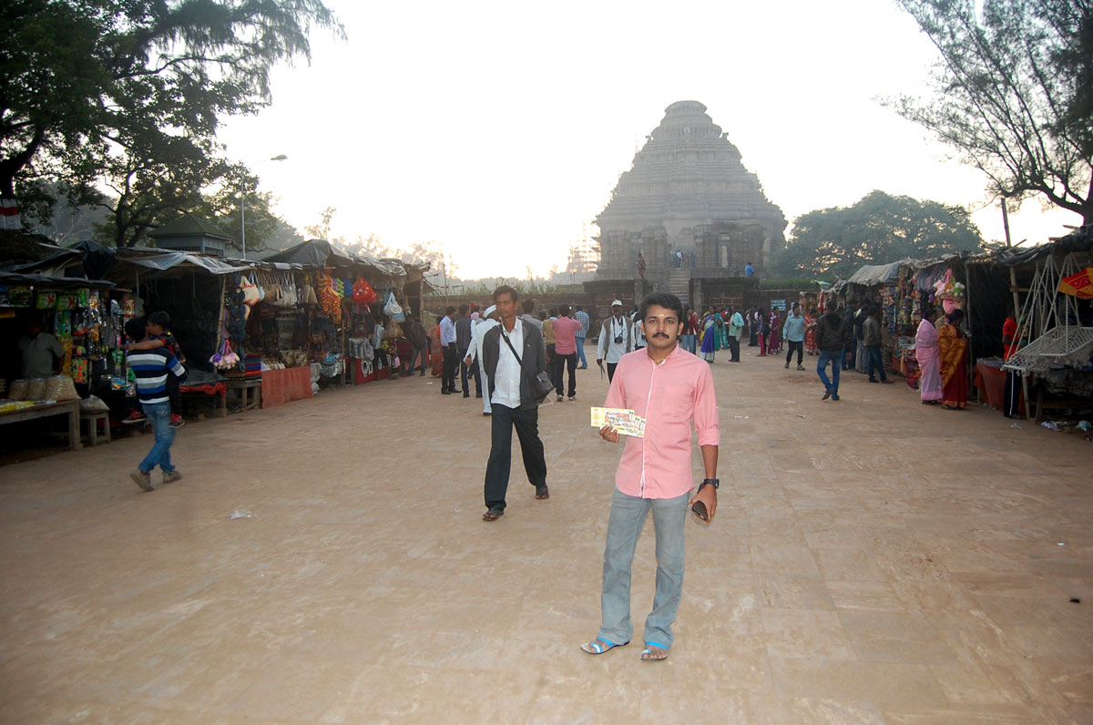
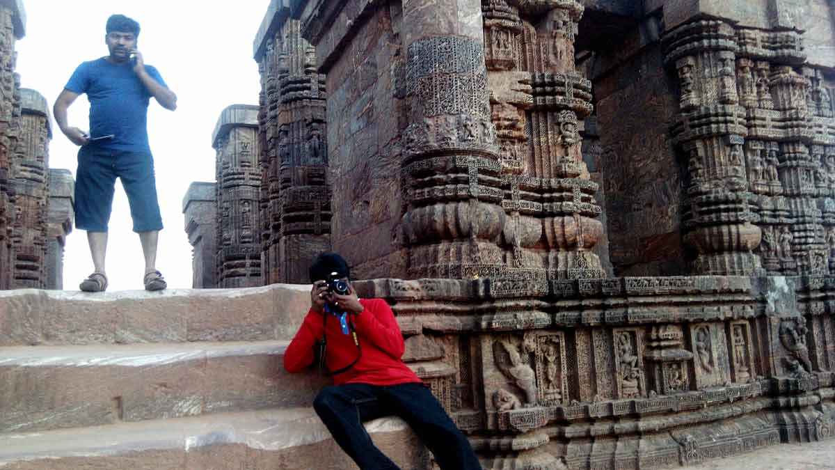
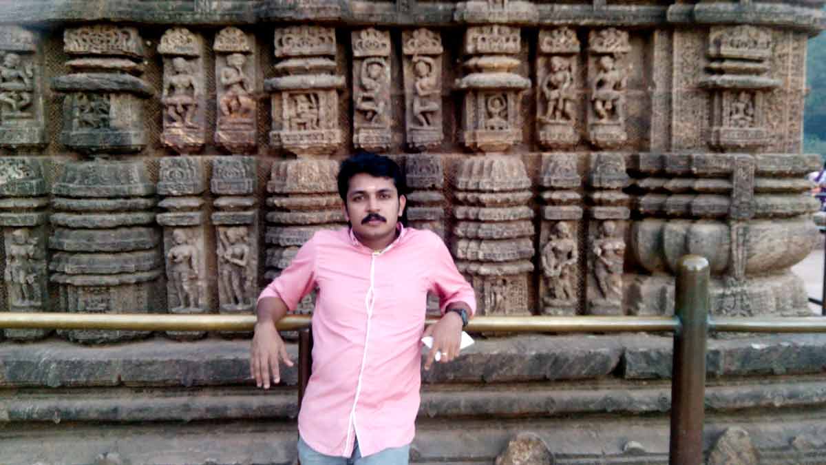
- 05:40 PM | Konark Sun Temple, Konark
-
The Sun Temple is built in the thirteenth century was conceived as a gigantic chariot of Sun God, with twelve pairs of exquisitely ornamented wheels pulled by seven pairs of horses. Majestic in conception, this Temple is indeed one of the most sublime monuments of India, famous as much for its imposing dimensions and faultless proportions as for the harmonious integration of of architectural grandeur with plastic allegiance. It is admittedly the best in Orissa. Its fine traceries and scroll work , the beautiful and natural cut of animal and human figures, all give it a superiority over other temples. The chief quality is its design and architectural details. The Sun temple belongs to the Kalinga School of Indian Temples with characteristic curvilinear towers mounted by Cupolas. In shape, the Temple did not make any major departure from other sikhara temples of Orissa. The main sanctum which (229 ft. high) was constructed alongwith the audience hall (128 ft. high) having elaborate external projections. The main sanctum which enshrined the presiding deity has fallen off. The Audience Hall survives in its entirely but of the other two viz the Dancing Hall(nata Mandir) and the Dining Hall (Bhoga-Mandap), only small portions have survived the vagaries of time. The Temple compound measures 857 ft. by 540 ft.
The temple is a UNESCO World Heritage Site.
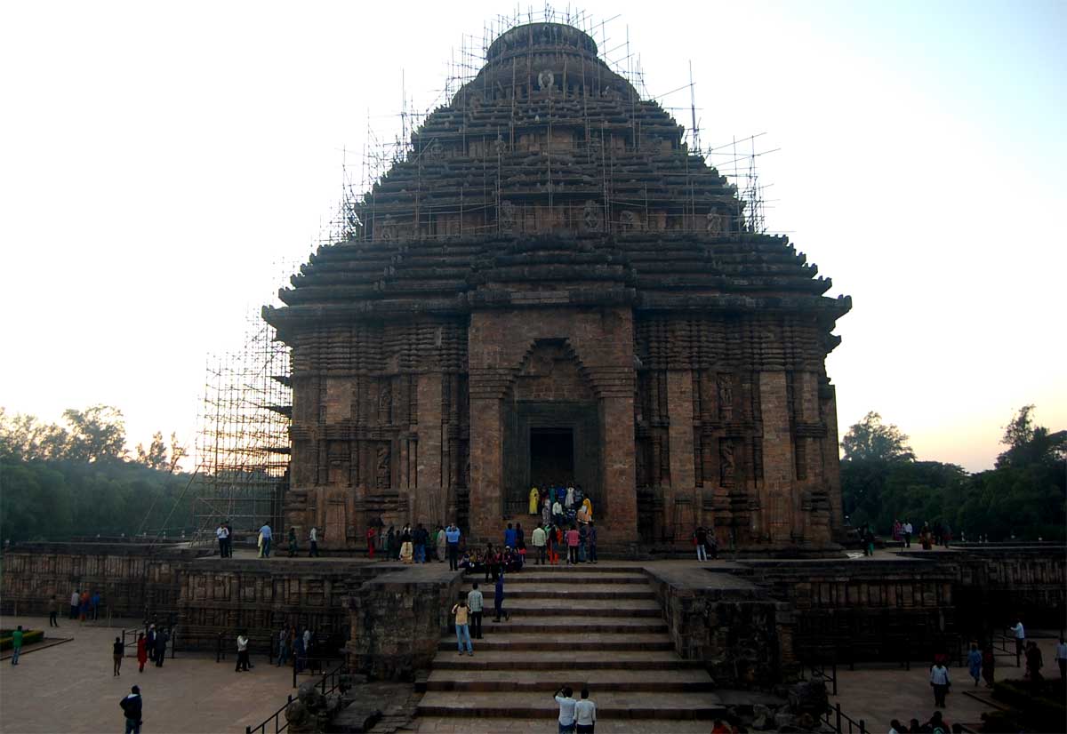 Konark Temple
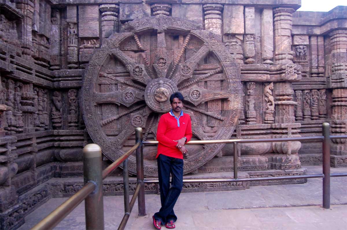 Prathap
 Krishnakumar & Rathish
 Rathish
23 January 2015 | West Bengal
- Overview
-
West Bengal is a very beautiful state with many tourist attractions like monuments, temples, mountains, wild animals, beaches, bird sanctuaries, Wild life sancturies, rivers, bridges etc. A part of the world's largest Mangrove forest "Sundarbans" is located at West Bengal. The Bengal tiger is the most numerous tiger subspecies found in West Bengal, Bangladesh etc.
West Bengal is a state in India where 7.5 % of the total population is living which is 4th in place. 1757 onwards the East India company cemented their hold in West Bengal and Culcutta served for many years as the Capital of British India. In agriculture, West Bengal is a major producer and is the 6th largest contributor to India's net domestic product (NDP). West Bengal is noted for its cultural activities and presence of cultural and educational institutions; the state capital Kolkata is known as the "cultural capital of India".
Kolkata Metro is the first underground metro railway system in India with 28.14 KM length (Line 1), opened for commercial services in 1984. So Kolkatta is a place where people depending most modern rail system to the man pulling Rikshaw for travelling. Rickshaws are the most effective means of transportation through the flooded streets of the monsoon season. When Kolkata floods rickshaw business increases and prices rise.
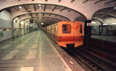 Kolkatta Metro
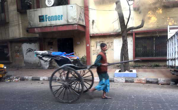 Rickshaw Puller at Kolkatta
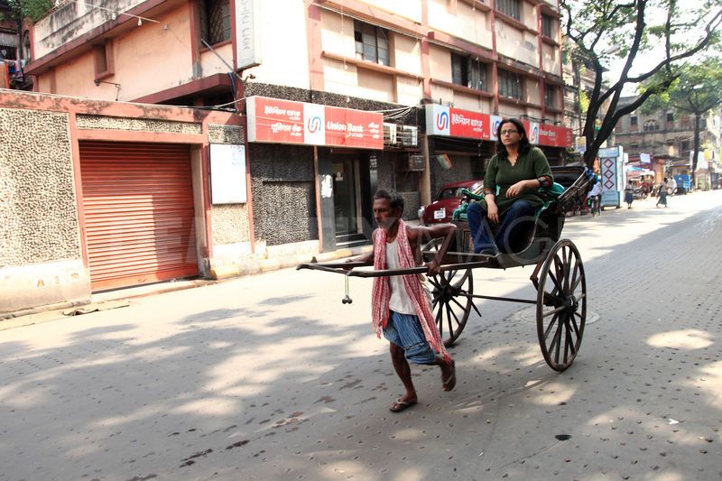 Rickshaw Puller transporting a woman at Kolkatta
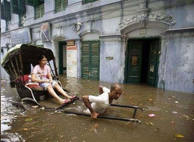 A rickshaw puller transports a girl through a flooded street in Kolkata
- Travel Info
-
Nearly 2.00 AM, we reached West Bengal and around 9.00 AM, we reached Kolkatta. From Odisha Border, driving to Kolkatta was not a challenging task. The roads were really good. But the only problem was heavy fog.
 West Bengal map and our travel path
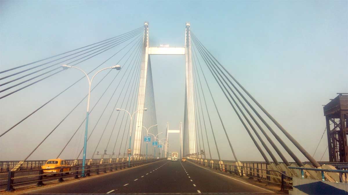
 - 08:30 AM | Vidyasagar Setu
-
It is a toll bridge over Hoogly River also known as second hoogly bridge. This bridge is the longest cable-stayed bridge in India and one of the longest in Asia with a total 823 meter length. It costs RS 3.88 billion to built. Vidyasagar Setu crosses Hoogly River (called Ganga), which is the distributery of Ganges river.
 Vidyasagar Setu
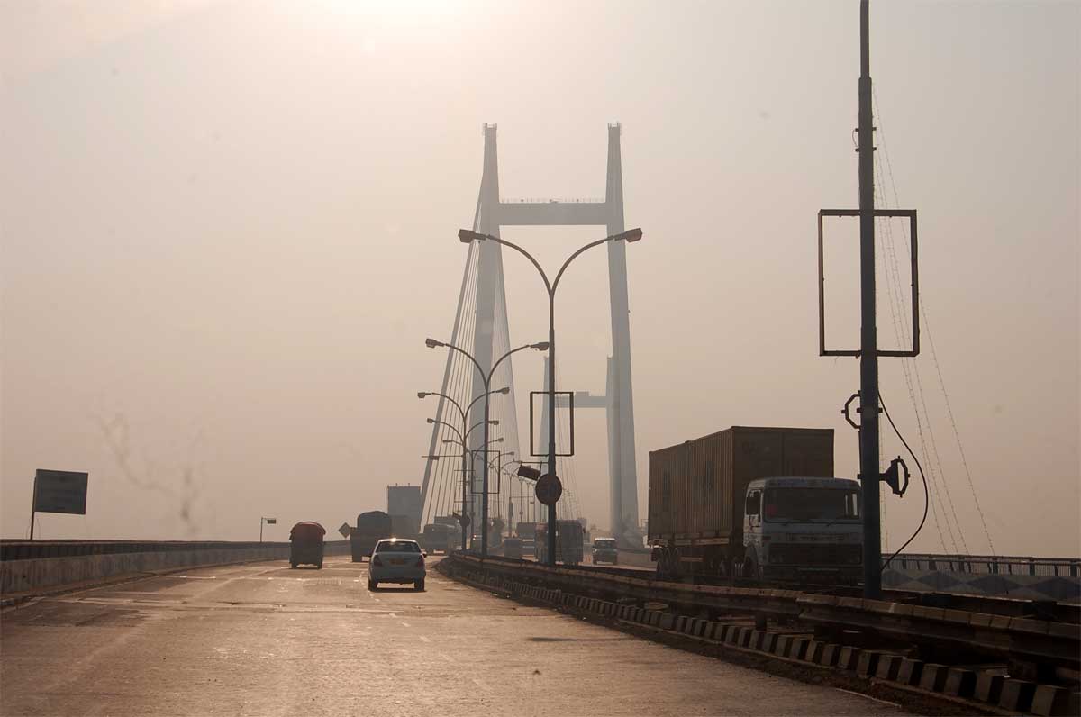 Vidyasagar Setu
 - 03:26 PM | Victoria Memorial, Queens Way, Kolkata
-
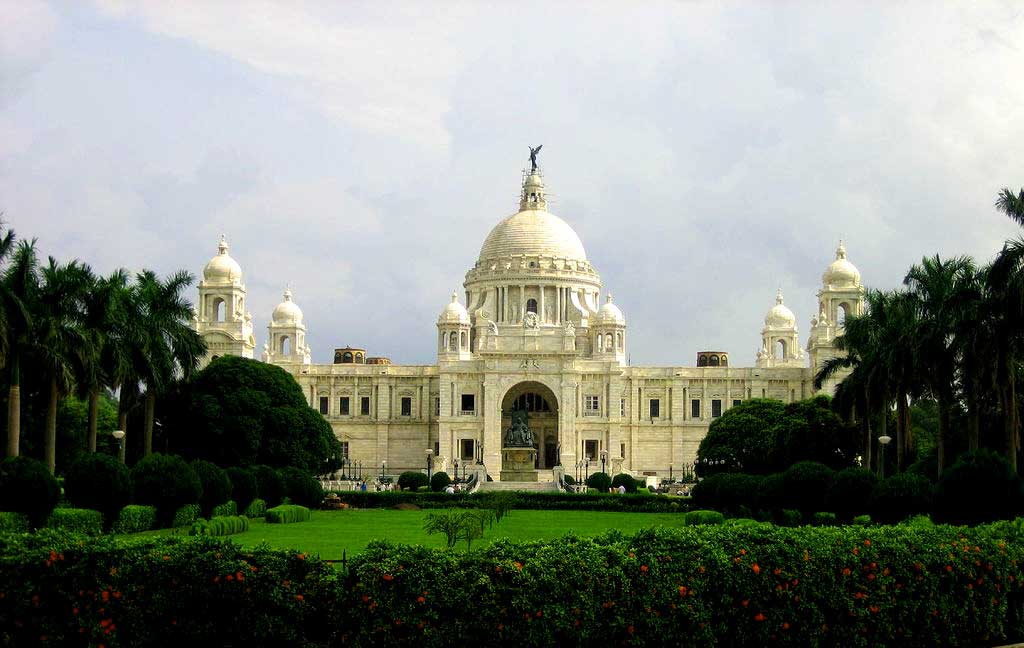
The Victoria Memorial was built to commemorate the peak of the British Empire in India. The Victoria Memorial, conceived by Lord Curzon, represents the architectural climax of Kolkata city. Lord Curzon, the then Viceroy specified its classical style but the actual plan of Victoria Memorial was laid down by the well-known architect, Sir William Emerson. The Victoria Memorial blends the best of the British and Mughal architecture. The Victoria Memorial hall was built with white Makrana marbles. The Prince of Wales laid the foundation stone of Victoria Memorial in 1906 and it was inaugurated in 1921 in memory of Queen Victoria. The Victoria Memorial is 338 by 228 feet and a height of 184 feet.
 Victoria Memorial Hall
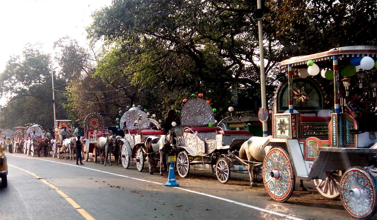 Horse carriages used to ride outside the memorial
- 04:30 PM | New Market, Bertram St, Kolkata
-
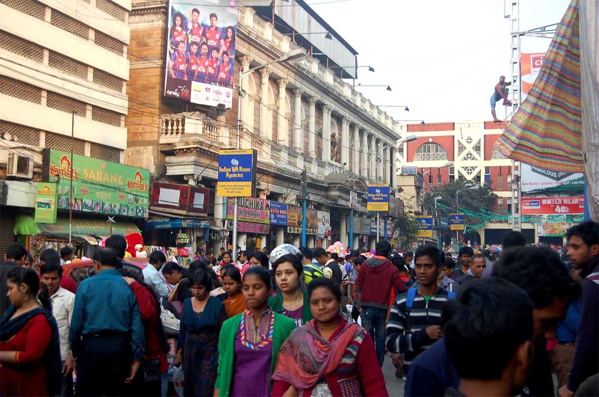
New Market has the honor of being Kolkata's oldest and most well known market. It was built by the British in 1874 and started off as the Sir Stuart Hogg Market, named in honor of the then Commissioner. It's still often fondly referred to as Hogg's Market.
In its early days, New Market had a distinctly upper class British air about it, but it's well and truly evolved into something completely Indian. It can be crowded and chaotic, and your best bargaining skills are a must.
New Market is renowned for the variety of goods it has on offer. Shoppers are treated to over 2000 stalls selling everything from clothing to cheese.
 New Market
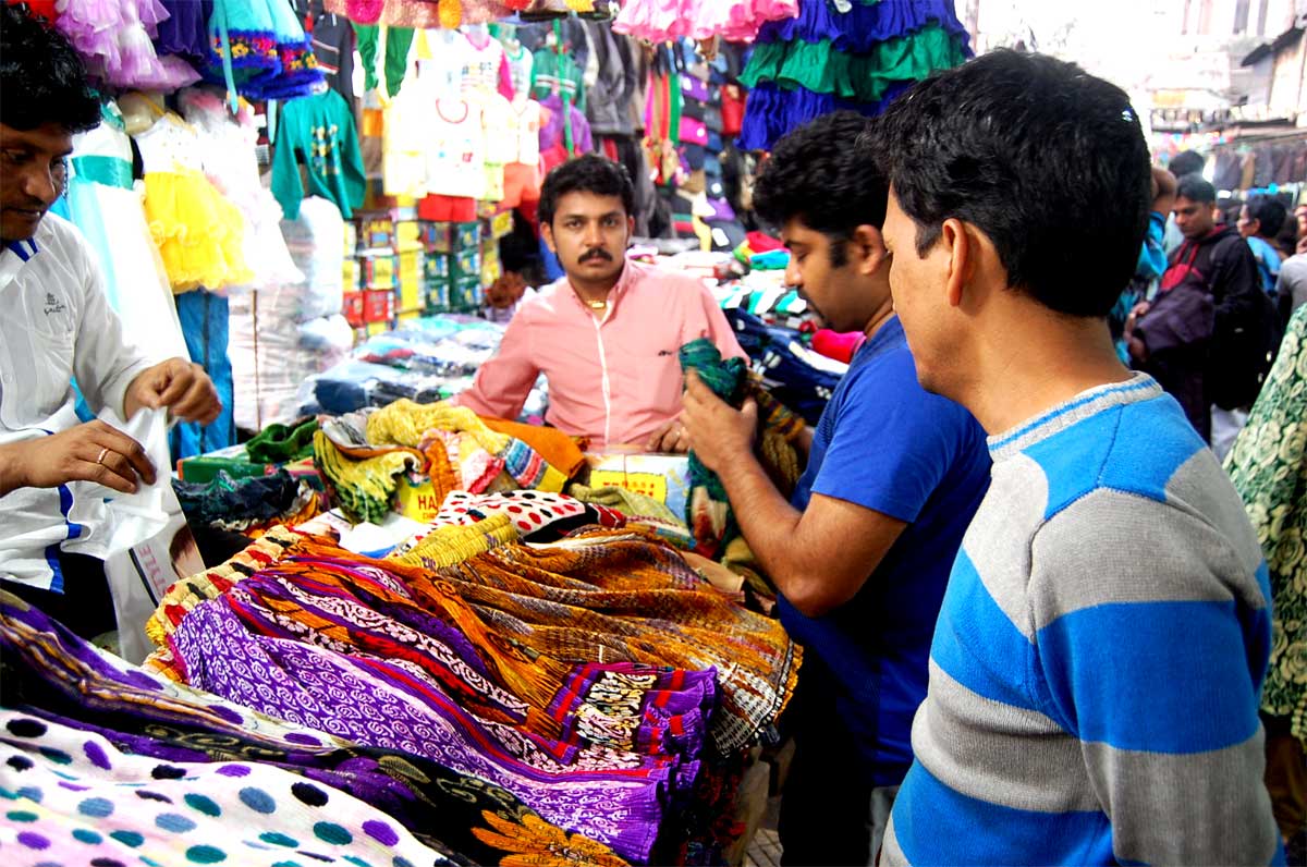 New Market
24 January 2015 | West Bengal
- Travel Info
-
From Kolkatta, we travelled the whole day continuously and the next day (25th Jan) 2.40 AM, we reached Siliguri and nearly 1.30 PM, we crossed Bhutan border.
West Bengal map and our travel path - 08:47 AM | Vidyasagar Setu
-
We were not familiar with Kolkata city and used google map for travel inside the city. But almost all the map directed routes were one way as we couldn't enter to that road. That was the first incident that we faced even the google map was failed in Kolkatta city. Don't know why? The traffic system might be regularly change inside the city. Anyway after a long time travel inside Kolkata city, we exited and whenever we saw Vidyasagar Setu again, we were extremely happy.
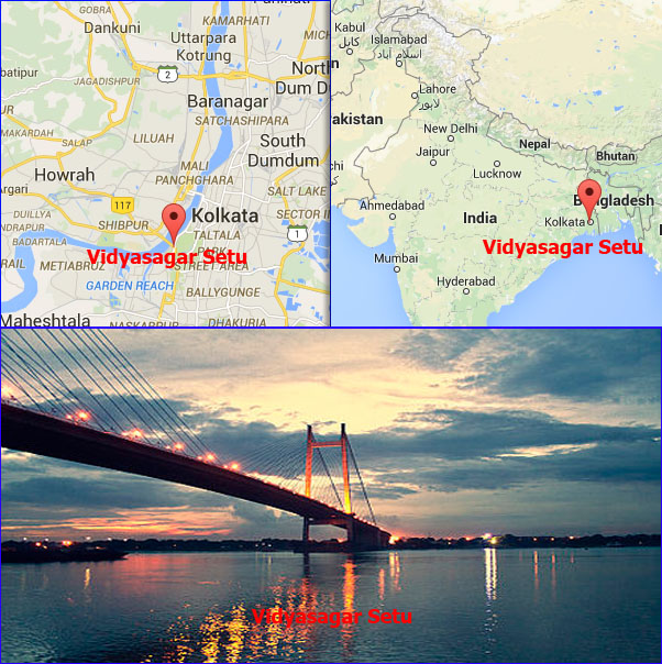 Vidyasagar Setu - Location
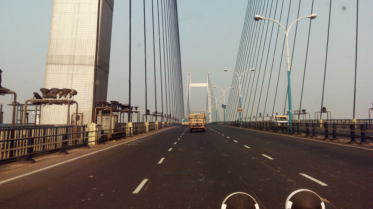 Vidyasagar Setu
 - 12:40 PM | Bardhaman
-
Bardhaman is the most advanced district in West Bengal both industrially and agriculturally. The eastern part is enriched by the alluvial soil of Bhagirathi River (minor stream of river Ganges), and is one of the most productive agricultural regions in West Bengal. The western part of the district, chiefly Asansol, is rich in coal and other mineral resources. This part is highly industrialised and contains various factories based on iron and steel processing, as well as many cement factories. Durgapur, Burnpur, and Kulti are in the western part of the district. It also contains power plants at Durgapur and Dishergarh.
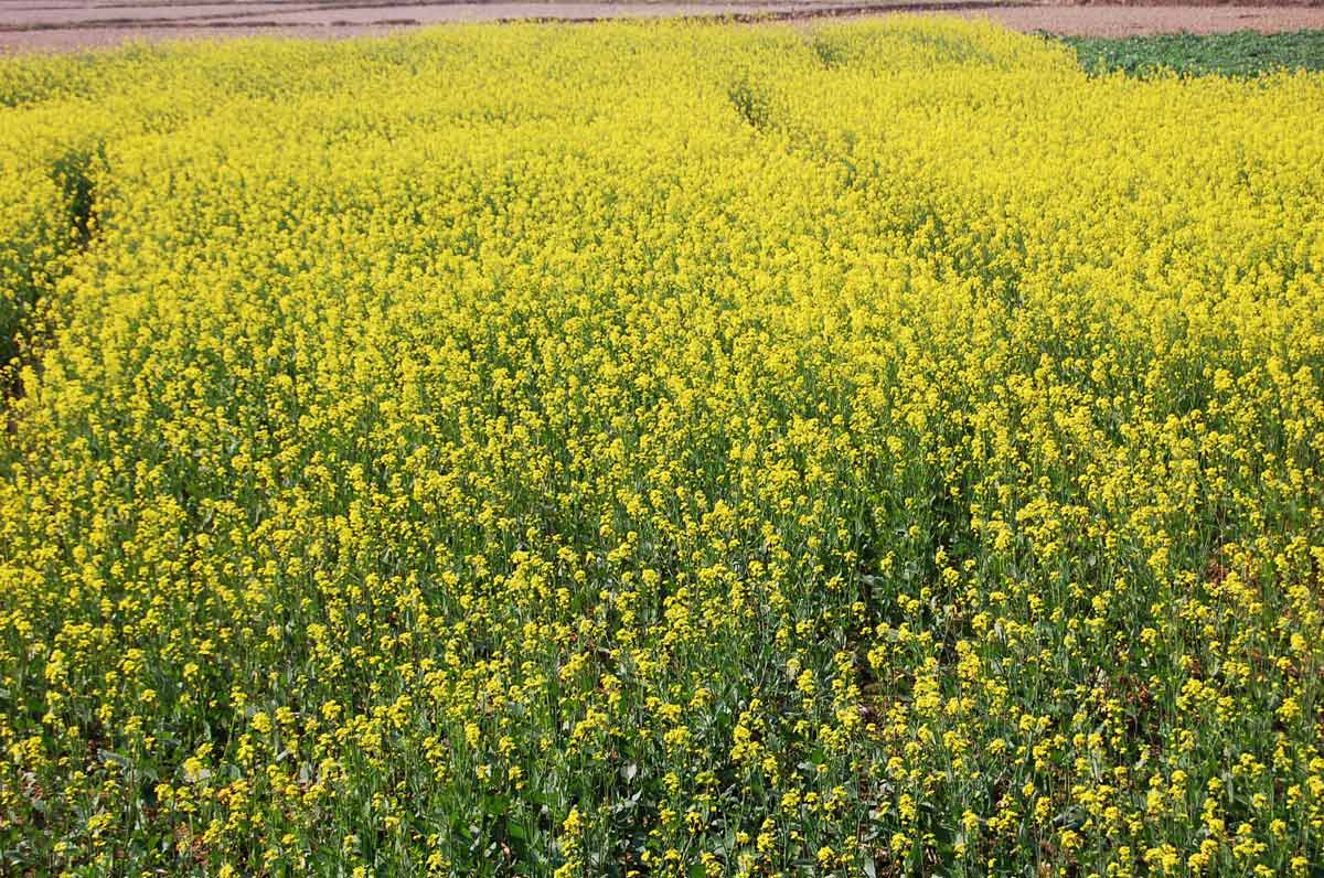 Mustard cultivation
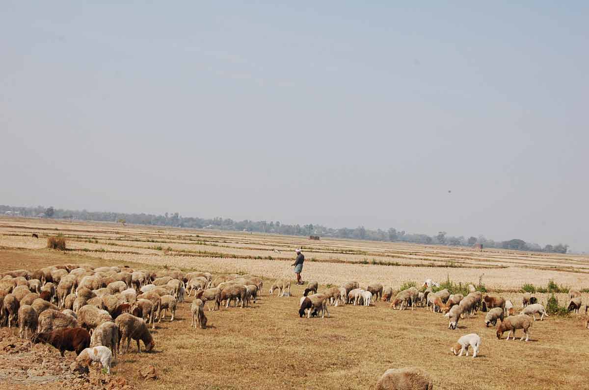 Sheeps
25 January 2015 | West Bengal
- 01:00 PM | Buxa Wildlife Sanctuary, Buxa Forest
-
Buxa Tiger Reserve, at the northeastern edge of West Bengal, borders Bhutan and Assam. This 759.26 sq. km. reserve with a core area of 315 sq. km. is somewhat contiguous with Manas National Park and forms an important elephant migratory corridor. There is tremendous animal and plant biodiversity in the area and 60 per cent of the species found here are endemic to the reserve. The elephant and the tiger are prime species found in the reserve. Unfortunately, this beautiful reserve is severely affected by dolomite mining.
- 01:10 PM | Dalsingpara Tea Garden
-
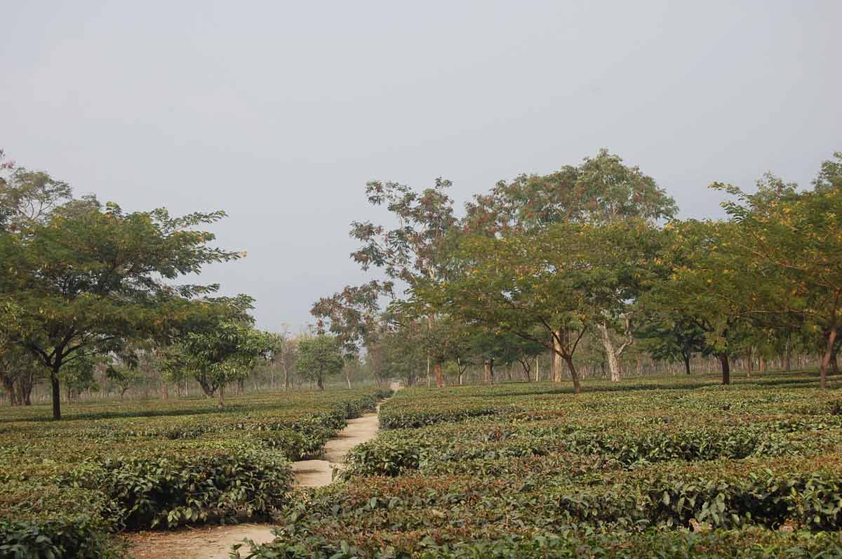 Dalsingpara Tea Garden
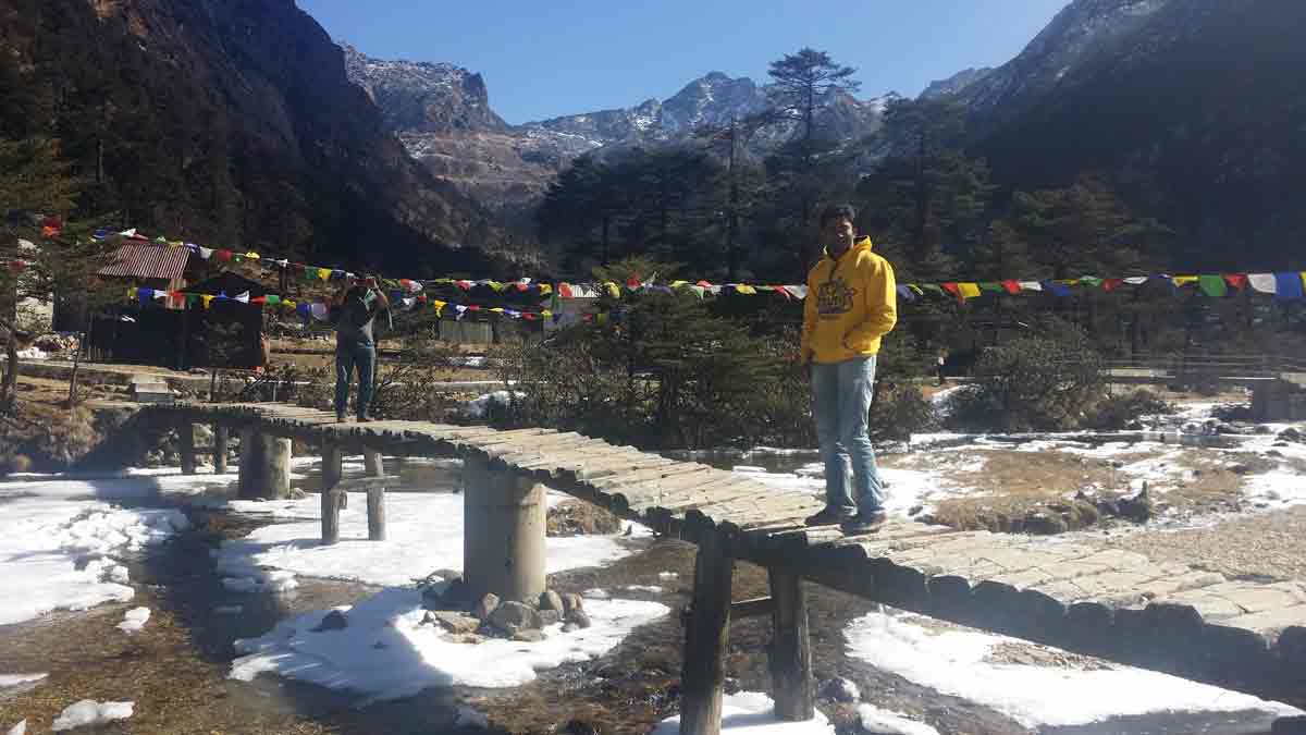
25 January 2015 | Bhutan
- Overview
-
Kingdom of Bhutan is a landlocked country in South Asia at the eastern end of the Himalayas. Bhutan's capital and largest city is Thimphu.
In the early 20th century, Bhutan came into contact with the British Empire and retained strong bilateral relations with India upon its independence. In 2006, based on a global survey, Business Week rated Bhutan the happiest country in Asia and the eighth-happiest in the world. Bhutan's state religion is Vajrayana Buddhism and the population, as of 2015 estimated as 770 thousand people, is predominantly Buddhist.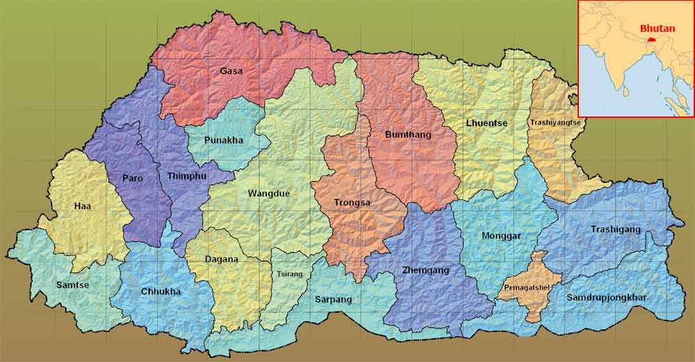 Bhutan - State wise Map
In 2008, Bhutan made the transition from absolute monarchy to constitutional monarchy and held its first general election.
Bhutan's currency is the ngultrum, whose value is fixed to the Indian rupee. The rupee is also accepted as legal tender in the country. In 2007, Bhutan had the second fastest growing economy in the world, with an annual economic growth rate of 22.4 percent. This was mainly due to the commissioning of the gigantic Tala Hydroelectric Power Station (1020 MW installed capacity).
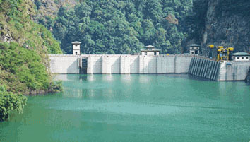 Tala Hydroelectric Power Station
Bhutan's economy is based on agriculture, forestry, tourism and the sale of hydroelectric power to India. Agriculture provides the main livelihood for 55.4 percent of the population.
Bhutanese Dress
The national dress for Bhutanese men is the gho, a knee-length robe tied at the waist by a cloth belt known as the kera. Women wear an ankle-length dress, the kira, which is clipped at the shoulders with two identical broaches called the koma and tied at the waist with kera.
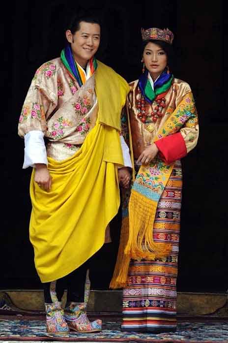
Bhutanese King and Queen in Traditional DressTourism
Bhutan's tourism is mainly in the areas such as their Culture, Spirituality & Wellness, Adventure, Trekking, Festivals and Nature.
Culture
While Bhutan is one of the smallest countries in the world, its cultural diversity and richness are profound. As such, strong emphasis is laid on the promotion and preservation of its unique culture. By protecting and nurturing Bhutan's living culture it is believed that it will help guard the sovereignty of the nation. Read more...
Spirituality & Wellness
Bhutan has many activities available for those visitors seeking a place of solace, rest and recuperation. Whether it's a session of peaceful, contemplative meditation, a relaxing soak in a mineral hot spring bath or the all natural remedies of the traditional medicine Bhutan has just what one need to revive and rejuvenate one's body and spirit. Read more...
Adventure
Bhutan is swiftly developing its reputation as a premier destination for adventure sports. Set amongst the majestic Himalayas Bhutan is the perfect location for all manner of exciting activities including Hiking, Trekking, Kayaking, Mountain Biking and Fishing. Read more...
Trekking
Whether you are looking for a day hike or a gruelling 31 day adventure, Bhutan has it all. Pristine mountain lakes, imposing glaciers and some of the world's most endangered species await you in the mountainous amphitheatre of the Himalayas. Read more...
Festivals
The Tshechu is a religious event celebrated on tenth day of a month of the lunar calendar corresponding to the birthday of Guru Rimpoche (Guru Padmasambhava). However the exact month of the Tshechu varies from place to place and temple to temple.
Tshechus are grand events where entire communities come together to witness religious mask dances, receive blessings and socialize. In addition to the mask dances tshechus also include colorful Bhutanese dances and other forms of entertainment. Read more...
Nature
The terrain is incredibly rugged and there are huge variations in altitude. The northern regions of the country consist mostly of snowy mountains and glaciers but range from subalpine conifer forests to broadleaf forests in the central region and dense subtropical forests in the south. This wide-range of climatic conditions allows for an unparalleled array of vegetation and wildlife to thrive within Bhutan. Read more... - Travel Info
-
Nearly 1.30 PM, we entered Bhutan's Southern border, a Bhutan Town called Phuentsholing. We parked our vehicle beside the Bhutan gate and started applying Entry Permit to visit Paro and Thimphu. Nearly after one hour, we got the entry permit, but for getting vehicle permit, we had to go to Road Safety and Transport Authority Office, which was at Dechhen Lam, Thimphu and driving to that location in office hour was impossible. So we arranged an accommodation at Phuntsholing City, went some places inside that city, returned to our room and had some beer. We had to travel to RSTA office next day morning itself. So we prepared for that and went to bed.
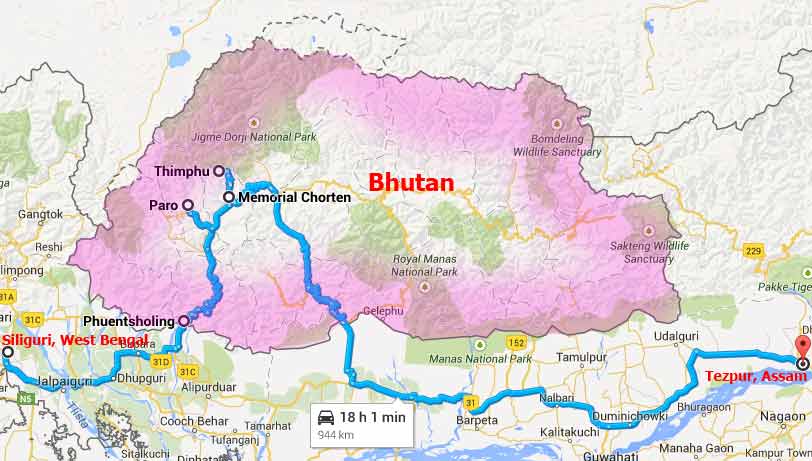
Map of Bhutan and Our Travel Path
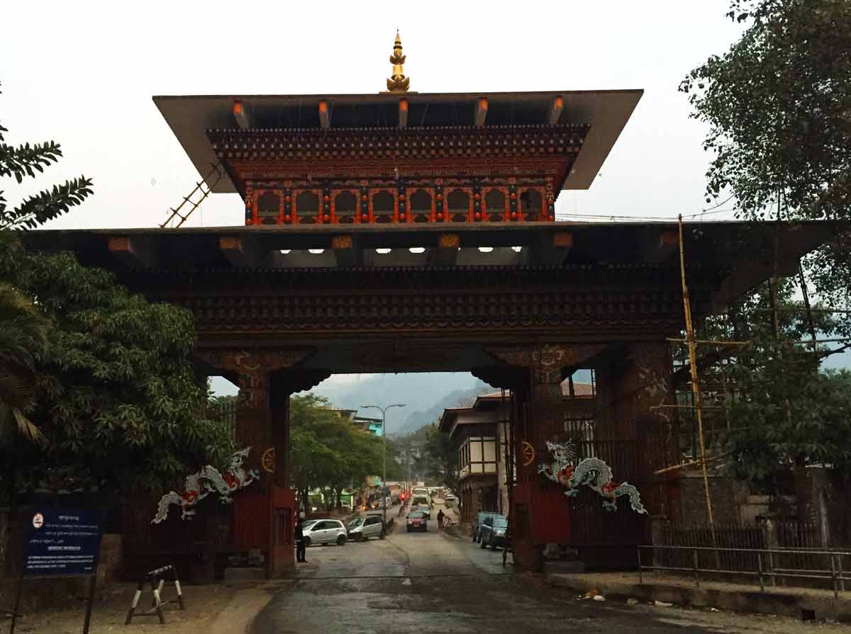
The ornate border gate between Bhutan and India, View from India.
This Gate normally remains open from 6 AM to 8 PM.
Check-in Procedure for Indian Nationals to Bhutan
All tourists (excluding Indian, Bangladeshi and Maldivian passport holders) who wish to travel to Bhutan require a visa and must book their holiday through a Bhutanese tour operator or one of their international partners. So please contact a genuine tour operator and for getting available tour operators, please click here.
No entry permit is required for Indian nationals for entering Phuentsholing City. Indian nationals can directly approach Regional Immigration Office, Royal Govt. of Bhutan, Phuentsholing to obtain entry permits for visiting Thimphu and Paro in Bhutan. No fee is charged by Royal Govt. of Bhutan for issuing entry permits. However, tourists desirous of going beyond Thimphu and Paro need to acquire a 'special area permit' from the Royal Govt. of Bhutan Immigration Office at Thimphu on any working days (Monday to Friday).
Documents required to submit at Immigration Office, Phuentsholing City for Visiting Paro and Thimphu
(a) Original and copy of passport having validity of minimum 6 months (preferable) or Voter Identity Card, issued by the Election Commission of India.
(b) Application written to the Immigration officer requesting a permit (permits are given for one week only).
(c) You need to fill an application form (available at the immigration office) which reveals your identity, purpose of visit and places that you want to travel.
(d) Two Passport Size Photographs (if not available with you, you can take it from the Phuentsholing City, near the Gate itself.)
After verifying your identity, taking your fingerprints and photograph, they will issue it at the same time itself for the requested days (maximum one week). For extending the number of days, you have to apply for it at Royal Govt. of Bhutan Immigration Office at Thimphu.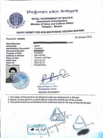
Entry permit issued at Phuntsholing for non Bhutanese visiting to Thimphu and Paro
Procedure to drive your own vehicle in Bhutan
You need to get your permit before applying for the vehicle permit at the RSTA (Road Safety and Transport Authority office). The office timings are from 9 am - 11 am and 1 pm - 3 pm.
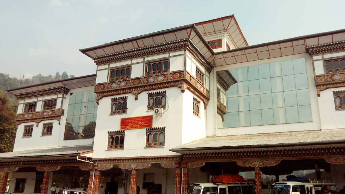
RSTA officeThe documents required for the vehicle permit are:
1. A xerox copy each of vehicle's registration certificate, insurance, driver's license, pollution certificate
2. An application form available at Window No. 04 needs to be filled along with it
3. Xerox copy of the travellers permit
Note : Xerox copy facility is available in the ground floor of the RSTA office.
The process to get vehicle permit is a little tedious. Follow the below diagram.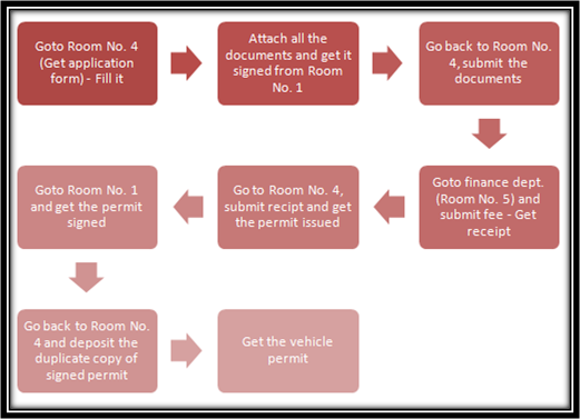
Process to get Vehicle permit from RSTA office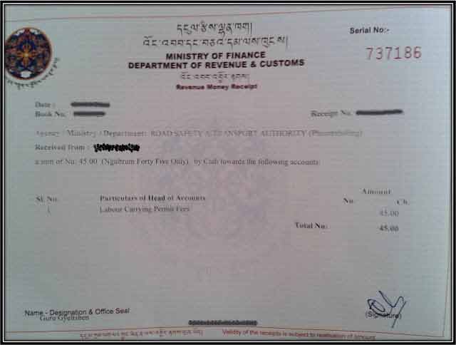
Vehicle Permit, Issued by RSTA office, Bhutan
You will need to show the vehicle and travellers permit at two checkpoints between Phuentsholing and Paro/Thimphu. You have to deposit the permit back at the last checkpoint on your way back.
Even though we have followed all these steps in RSTA office without knowing what to do, later we got these vehicle permit information well documented from the link "The Spunky Traveller". Thanks for the very well documentation.
Note : Indian nationals travelling to Bhutan are advised not to bring Indian currency notes of the denominations of Rs. 500/- and Rs. 1000/- to Bhutan. However, Indian currency notes of Rs. 100/- and below are accepted in Bhutan. - 01:40 PM | Phuntsholing, Bhutan
-
Phuntsholing is a border town in southern Bhutan. Phuentsholing adjoins the Indian town of Jaigaon, and cross-border trade has resulted in a thriving local economy. There is a stark contrast in the culture across the border, which is separated by a long wall with a single Bhutanese gate. Locals can sometimes even cross without being asked for papers, but visitors without an Indian passport will need a visa presented by a hired registered tour guide; even one's Indian Voter ID card will suffice within the town of Phuntsholing. The gate is manned by Bhutanese Army guards. The terrain inclines soon after the gate.
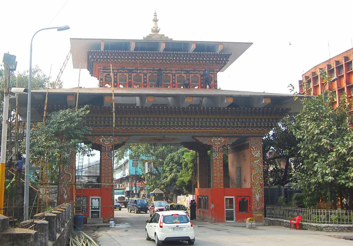
The ornate border gate between Bhutan and India, View from Bhutan.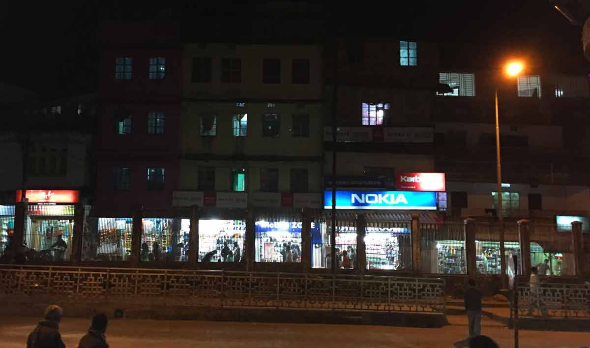
Indian from Bhutan, a night view.
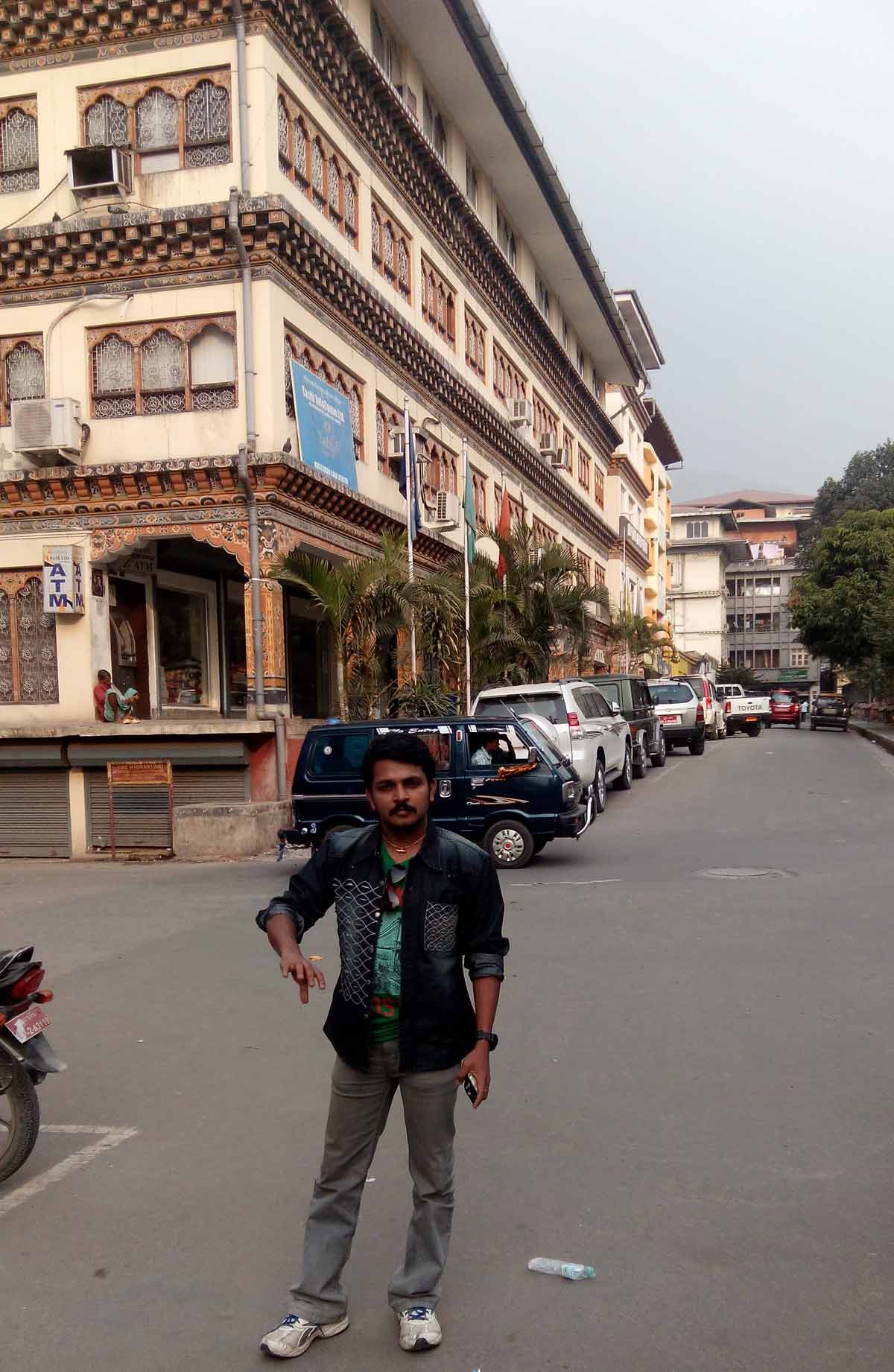
Street View, Phuntsholing City
Street View
26 January 2015 | Bhutan
- Travel Info
-
We vacated our room at Phuntsholing City and started our travel in morning at around 8.30 AM. One has to give parking fees for parking the vehicle beside the road too in Phuntsholing City, which is one of the main income of the Government. Nearly 10.30 AM, we had reached RSTA office. We started our procedure to get the vehicle permit. At around 12.15 PM, we got the permit and started our travel to Paro Taktsang (Tiger's Nest). After that we went to Memorial Chorten at around 8.00 PM. The temperature was getting colder and colder. So we need some hotel to stay. We went to Thimphu. We had our night food there and searched for a location to stay. But we didn't get. The temperature was very cold and cannot stand outside. At last we decided to stay inside our Jeep.
We spend our night inside the Jeep and when we wake up in the morning, we shocked by seeing our vehicle, which was fully covered with Ice. The temperature went below -4�C at that night. - 04:00 PM | Paro Taktsang, Paro
-
Paro Taktsang or Tiger's Nest is a Buddhist sacred site and temple complex, hangs on a cliff and stands above a beautiful forest of blue pine and rhododendrons in Himalaya located in the cliff side of the upper Paro valley, Bhutan. It is first built in 1692. Guru Padmasambhava, popularly known as Guru Rinpoche visited and sanctified Bhutan in the 8th century when evil spirits abounded and harmed people. Legend has it that Guru Rinpoche flew to this site on a tigress' back to subdue a local demon. Thereafter, he meditated here for three years, three months, three weeks, three days and three hours in 8th century.
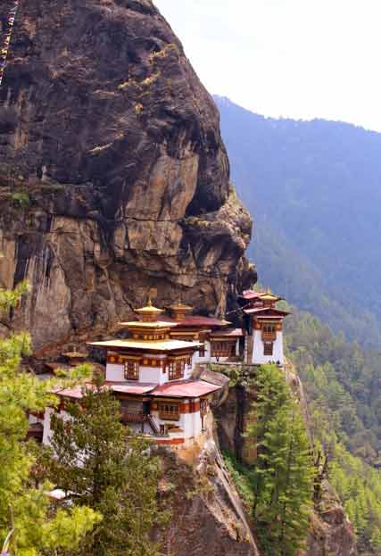
Paro Taktsang or Tiger's Nest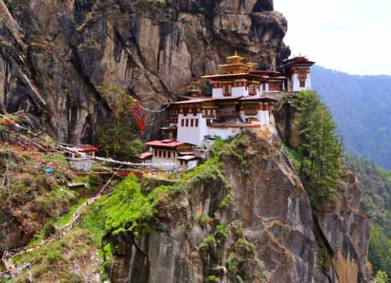
Paro Taktsang or Tiger's NestTiming and Procedures
1) October to March : 8 AM - 1 PM and 2 PM - 5 PM daily
2) April to September : Up to 6 PM
3) Photography is strictly prohibited inside the monastery. So at the entrance, security desk is available and you can register and can keep your camera and bags there.
You can either hike a steeply uphill for 1.5 to 3 hours to get to the top or ride a horse 2/3 of the way. - 08:00 PM | Memorial Chorten, Chhoten Lam
-
This large Tibetan-style chorten is one of the most visible religious structures in Thimphu, and for many Bhutanese it is the focus of their daily worship. Chorten literally means 'Seat of Faith' and Buddhists often call such monuments, the 'Mind of Buddha'. It was built in 1974 as a memorial to the third king, Jigme Dorji Wangchuck (1928 - 72). The chorten is an extraordinary example of Buddhist architecture and artwork with its gorgeous paintings and intricate sculptures.
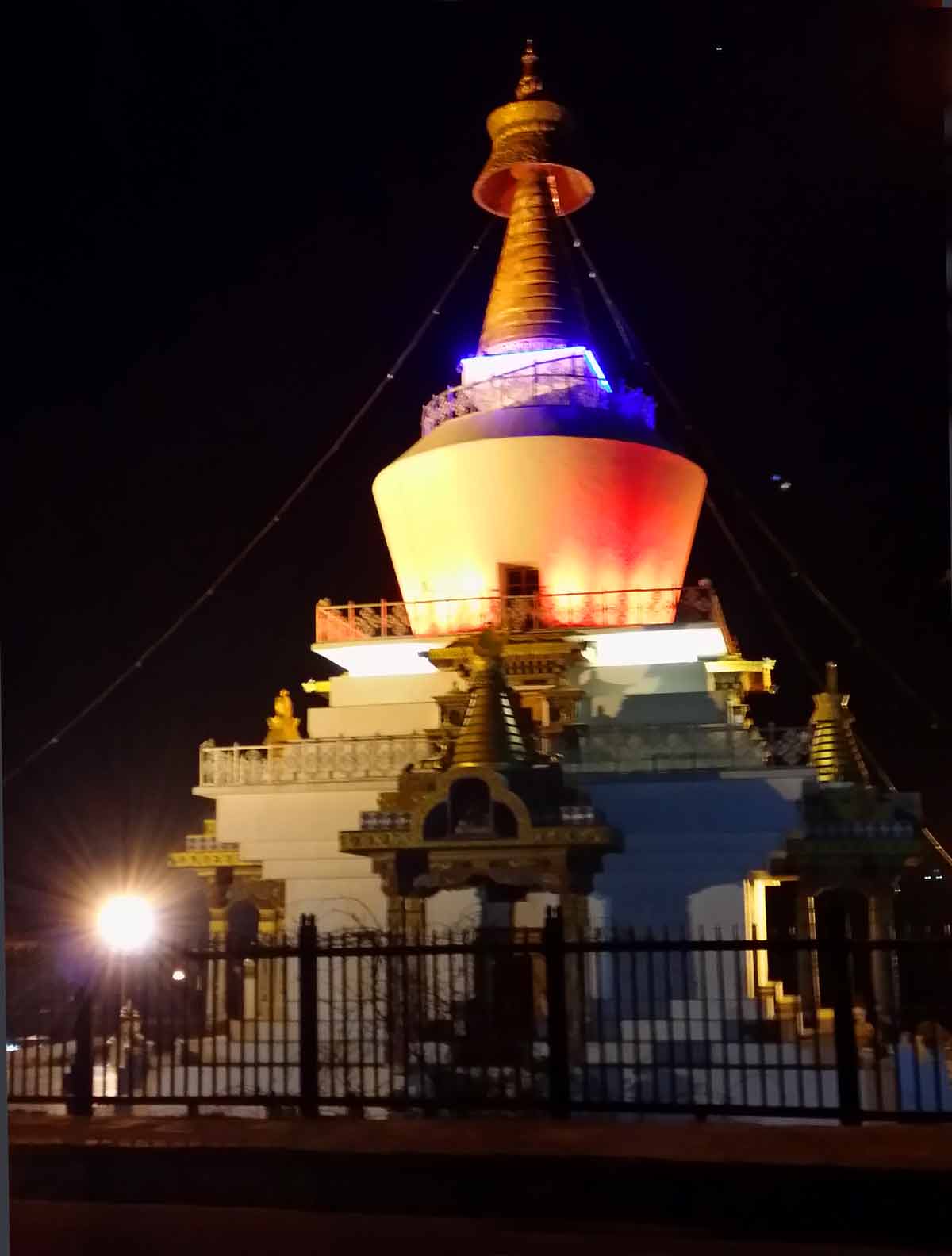
Memorial Chorten, Thimphu - A night view
27 January 2015 | Bhutan
- Travel Info
-
We wake up at around 6.00 AM and started searching for a room and finally we got one. We immediately finished our primary activities and charged all the possible mobile devices. After our breakfast, we started our travel to Buddha Dordenma. At that day, our Entry Permit would expire, so we had to exit Bhutan in the same day itself. At around 5.20 PM we exited from Bhutan.
- 08:00 AM | Thimphu
-
Thimphu, the Kingdom's capital city is home to approximately 100,000 inhabitants including the Royal family. Thimphu is the most modern city in Bhutan with an abundance of restaurants, internet cafes, nightclubs and shopping centers, however it still retains its' cultural identity and values amidst the signs of modernization.Thimphu is one of the few towns in Bhutan that have been equipped with ATM banking facilities and is a good place to stock up on some currency.
One of the most curious features of Thimphu is that it is the only capital city in the world that does not use traffic lights. Instead a few major intersections have policemen standing in elaborately decorated booths (small pavilions), directing traffic with exaggerated hand motions. The juxtaposition of ancient tradition and modernity make Thimphu the ideal location for visitors to break away from their tour itinerary and just immerse themselves in the lifestyle of contemporary Bhutanese.
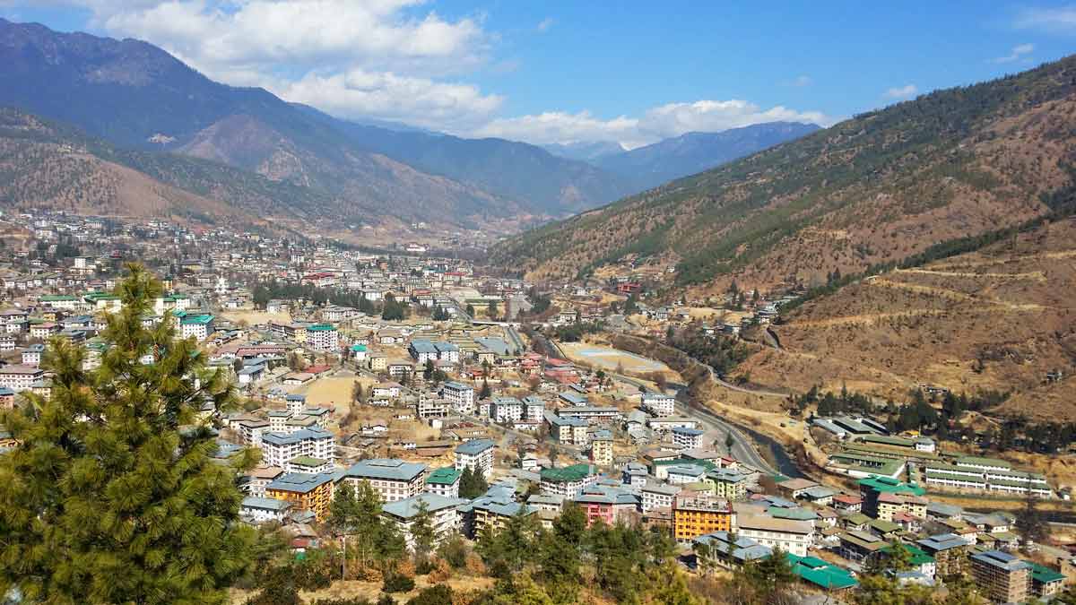
Thimphu City View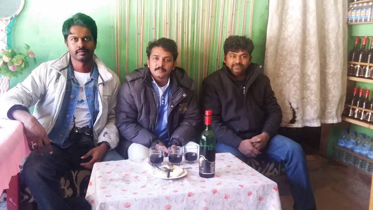
Having some wine, at Thimphu
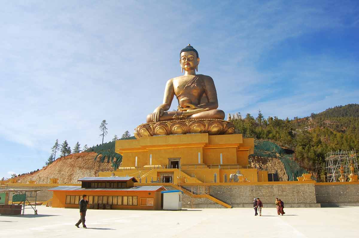
- 10:00 AM | Buddha Dordenma
-
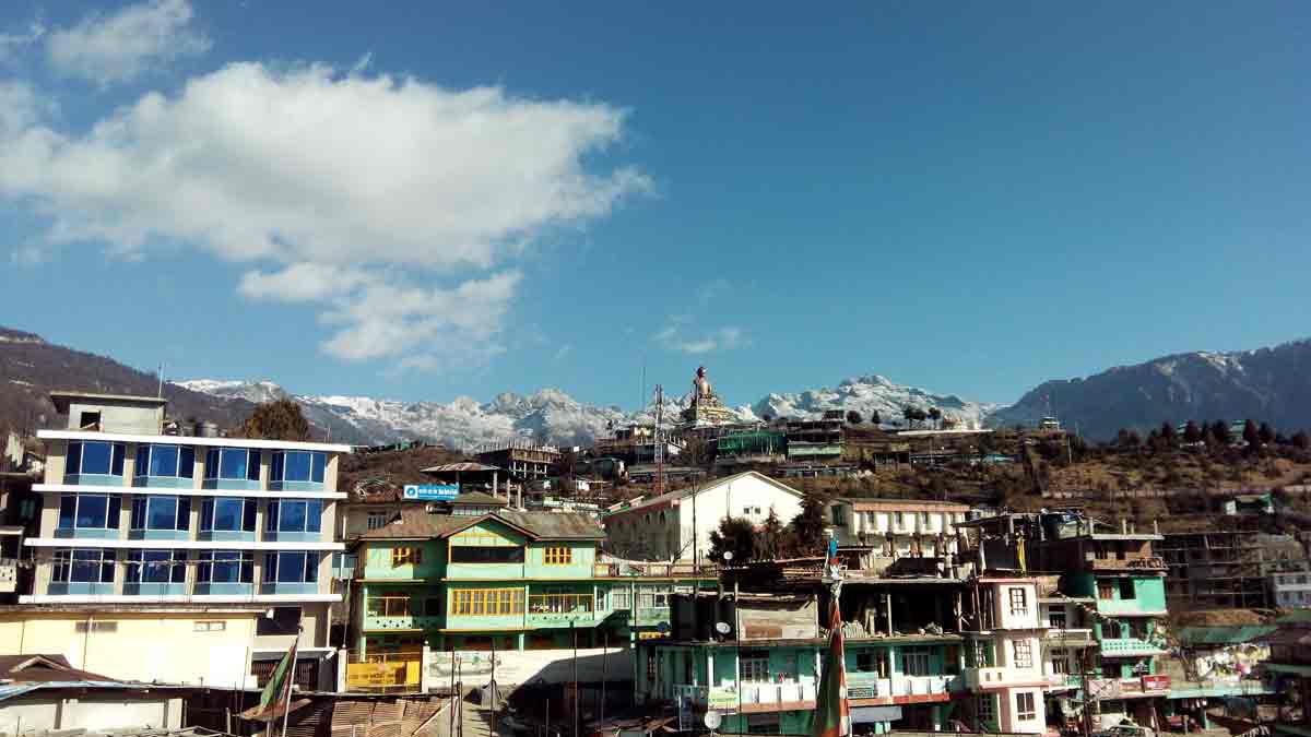
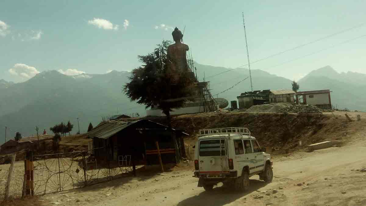
The Buddha Dordenma Project is the construction of a gigantic 42-meter-tall gilded bronze Shakyamuni Buddha statue (inclusive of lotus) seated on a 20-meter-tall throne in the Kingdom of Bhutan. Fulfilling the mission of Buddhas, Buddha Dordenma (meaning Vajra-throned Buddha) symbolizes peerless virility to bestow blessings, peace, and happiness on the world.
As many as 100,000 units of 8-inch-tall Buddha Dordenma will fill up the gigantic 42-meter-tall Buddha's body and lotus; whereas as many as 25,000 units of 12-inch-tall Buddha Dordenma will reside along the walls of meditation halls inside His 20-meter-tall throne. For more information click here.
Buddha Dordenma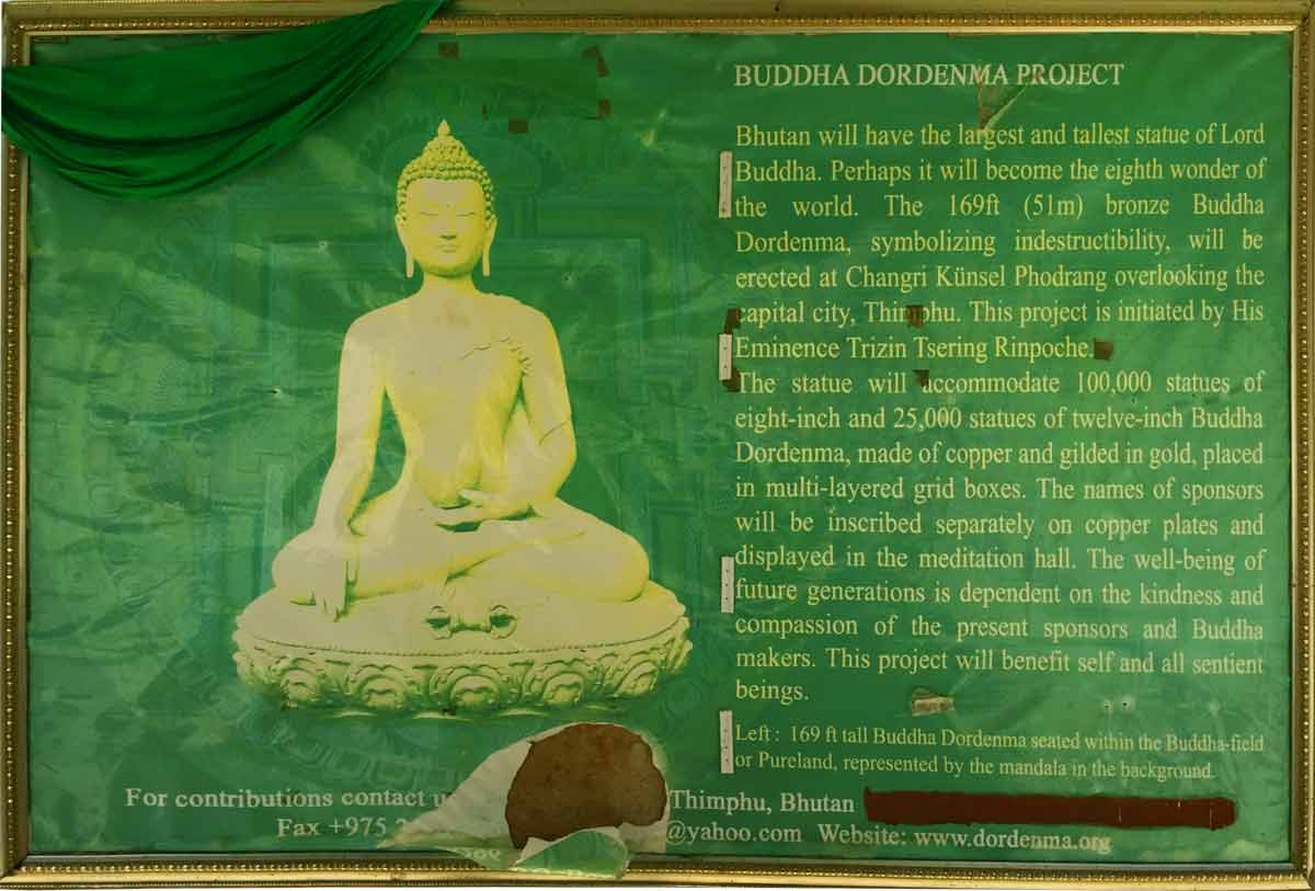
Dordenma Information
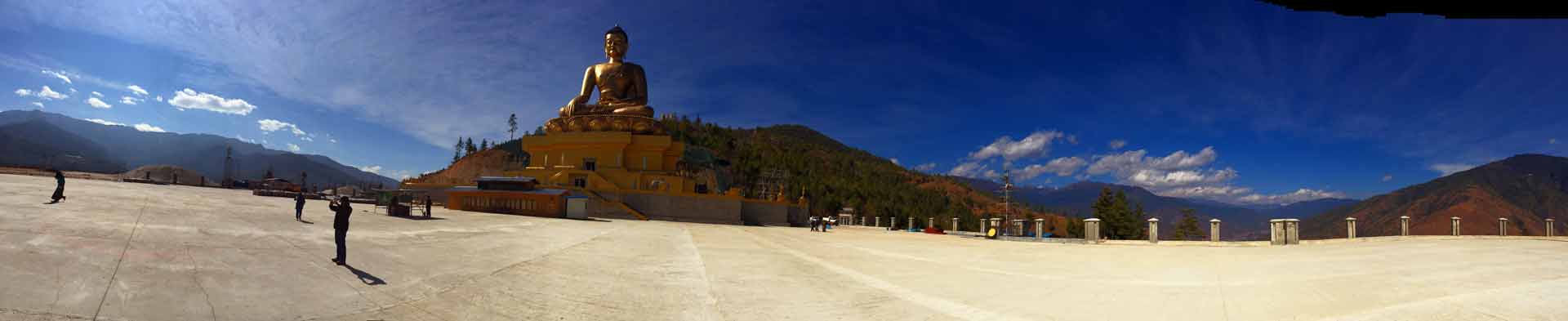
Buddha Dordenma, a panoramic view
27 January 2015 | West Bengal
- Travel Info
-
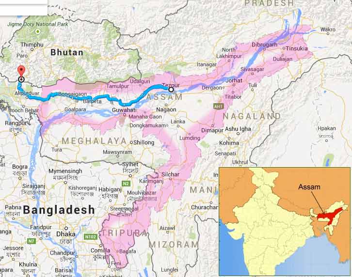
We entered West Bengal, India from Bhutan at around 5.20 PM. Nearly 7.30 PM, we crossed Assam Border.
27 January 2015 | Assam
- Overview
-
Assam is a beautiful and diverse state with an incredible range of cultures and landscapes located in the northeast of India. It shares it's borders in the North and East with the Kingdom of Bhutan and Arunachal Pradesh. The Brahmaputra Valley is an alluvial plain about 724 KMs in length and 81 KMs in breadth. It is enclosed on the north by the mighty Himalayas, south by the Garo, Khasi, Jaintia and Naga Hills. The southern part of Assam is the Barak Valley, which derives its name from the Barak river. This region is a treasure trove of untouched natural beauty. Green is the predominant colour of the state with an impressive 35% forest cover and thousands of hectares under tea cultivation. Assam has five national parks including the World Heritage Sites of Kazirnaga and Manas, and 20 Wildlife sanctuaries. The great Indian one-horned rhinoceros is one of Assam's most famous denizens. Over the centuries, people of various ethnic, religious and linguistic backgrounds have been attracted to the fertile valleys of Assam making it a mixture of various cultures. It is no wonder then that Assam is said to be like a miniature of the whole country itself.
Each tribal groups has its own stock of folk dances which are attractive as much for the flowing movements as for the colouful costumes and the earthy quality of the accompanying music.
Assam is a land of fairs and festivals. Most of the festivals celebrated in Assam have their roots in the diverse faith and belief of her inhabitants, but a spirit of accommodation and togetherness characterizes the celebration of all festivals. The perfect fusion of heritage of her numerous races has made Assam the home of the most colourful festivals which are passionate, compelling and mesmerizing reflecting the true spirit, tradition and life style of the people of Assam.
- Travel Info
-
We entered the State of Assam at around 7.30 PM. Nearly 9.00 PM we passed the City Bongaigaon. Why Bongaigaon has these much importance? We got so many information from different people, who have prior experience, said to us that this place is not good for night travel. They warned us that never travel to Bongaigaon at night and taking stay before that location is good. We enquired some truck drivers regarding this. They said that normally the speed vehicles have no problem as whenever somebody tries to stop your vehicle, never stop. But they have been utilizing lorries and trucks very badly. But the time was 9.00 PM and there was nobody there in the road other than trucks. We were not found any hotels to stay. Also if we planned to stay, time lose was a critical factor. So with full courage, we planned to cross Bongaigaon. It was success. Nothing happened. We continued our travel to Tezpur.
Map of AssamOur thought was we escaped from danger, but our fate was different. When we reached the starting junction of Guwahati bypass and Tezpur road, two police constables run in front of our Vehicle and forcefully stopped the Jeep. Both of them has long stick with them and one of them suddenly put his hand through the driver window and asked to stop the engine. Our window glass was half opened and we never allowed him to touch the key. We were almost centre of the road and we said to him that we would stop after parking the vehicle properly in the side. He roared and ordered us to stop engine immediately at the same place itself. We confused whether these persons were police or locals? Why they behave without any manners? We all decided to go forward without considering those persons. We hold his hand and put it out and turn the Jeep towards left side and immediately went forward. He run and hit the vehicle with force using his hand. But we escaped from them. They actually required money without any reason. For going forward, we had to give money, unless they either never return the RC book or the key. This is the main problem usually happens with any outer registration vehicle.
After this incident, we just confused whether the Police would follow our vehicle and the time was really late. So we went to a safer place, which was Tezpur Railway station, and parked our vehicle. We spent that night in the vehicle.
28 January 2015 | Assam
- Travel Info
-
In the morning, we called our friend, who is a native of Tezpur called Gogoi. He immediately came to Tezpur railway station. We together went to his home and his hospitality was really appreciable. He has been living with his friends and running an office parallelly. At that time our ILP (Inner Line Permit) for visiting Arunachal Pradesh was approved and we took the printouts of it. After lunch, we had gone outside for purchasing yellow fog lamp and snow chains for our travelling in Himalaya. We got the fog lamp, but didn't get the snow chain. We immediately fitted the fog lamp and started our travel to Arunachal Pradesh.
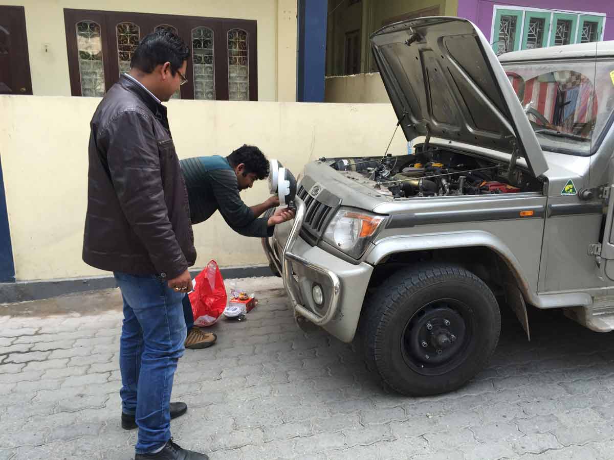
Krishnakumar with Gogoi - fitting fog lamp - 10.30 AM | At Tezpur with Debojith Gogoi
-
Tezpur town is situated on the north bank of the Brahmaputra River and 175 kilometres (109 mi) north east of Guwahati, considered to be the "Cultural Capital of Assam".
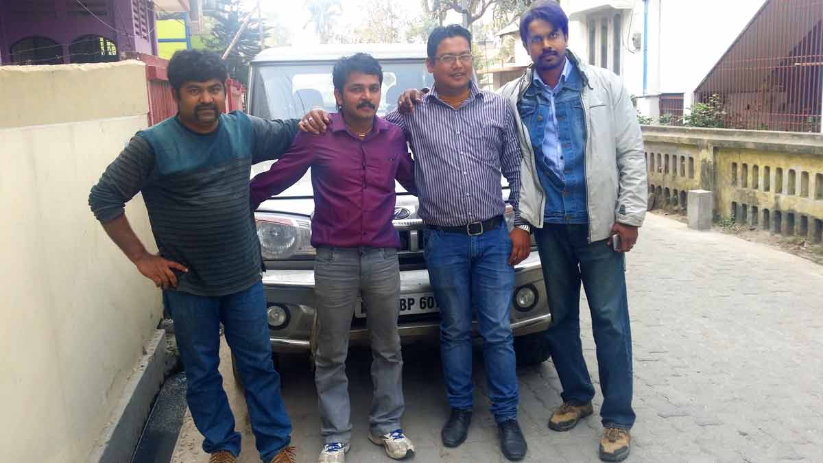
We all with Gogoi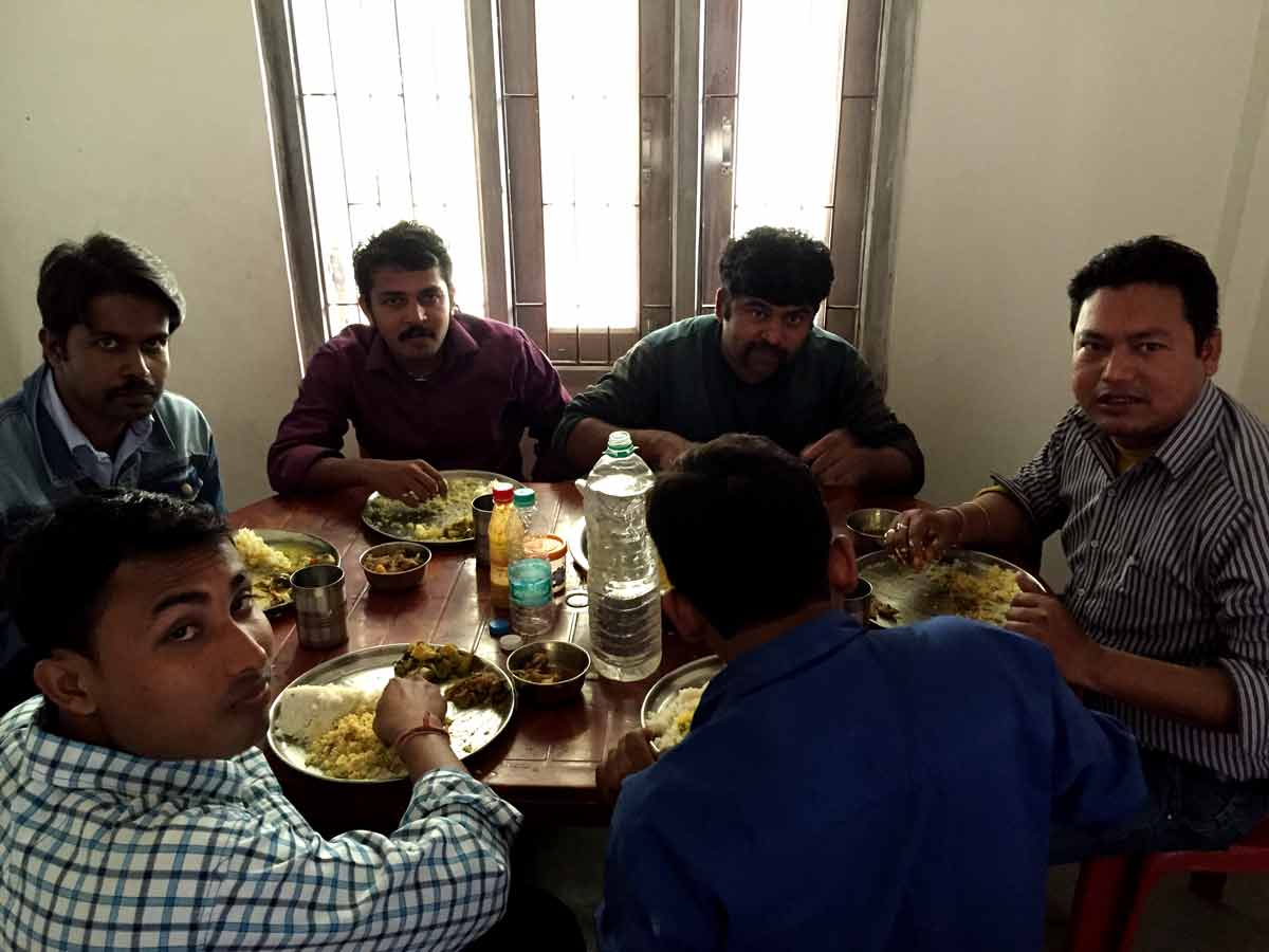
Lunch with Gogoi and friends
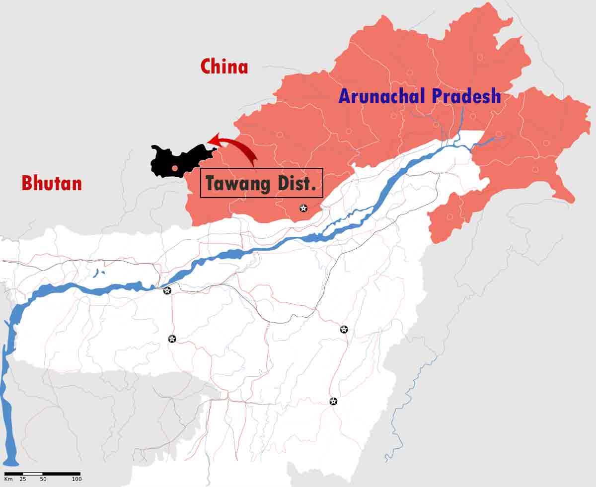
28 January 2015 | Arunachal Pradesh
- Overview
-
Arunachal Pradesh, which translates to "land of the dawn-lit mountains", is also known as the Orchid State of India or the Paradise of the Botanists. It tucked away in the north eastern tip of India, Arunachal Pradesh is home to picturesque mountains, unexplored passes, tranquil lakes and famous monasteries. Encompassing extensive geographical diversity with a variety of rare wildlife, flora and fauna, Arunachal Pradesh is now gaining acclaim worldwide as one of the richest biodiversity and heritage spots. It is the only Indian state that can claim to have four major varieties of the big cats in its jungles- tiger, leopard, clouded leopard and snow leopard. In this incredibly beautiful state, more than 500 species of birds have been recorded, many of which are highly endangered and restricted to this state. One of Asia's largest Orchidarium is in Arunachal Pradesh and almost every district of Arunachal Pradesh has its own exclusive and rare variety of orchids.
- Travel Info
-
Nearly 3.00 PM, we crossed Arunachal Pradesh border, which is a small town named Bhalukpong. Nobody checked our ILP in the border gate, we don't know why. We passed freely. At around 4.15, we arrived in a very beautiful river called Kameng. After spending some time there, we continued our travel and stayed at Bomdila.
Arunachal Pradesh Map with the path we had travelledILP
ILP(Inner Line Permit) is required for Indian citizens to enter Protected Areas - Arunachal Pradesh, Nagaland and Mizoram. ILP is issued under the Bengal Eastern Frontier Regulation, 1873. For getting detailed information about all these states regarding ILP, please click here. ILP for Arunachal Pradesh
It is required for entering Arunachal Pradesh through any of the check gates across the interstate border with Assam or Nagaland. An ILP for temporary visitors is valid for 15 days and can be extended, while one for those taking employment in the state and their immediate family members is valid for a year. The Aruanchal Pradesh government is planning to implement a permit-on-arrival system.
Apply ILP online :
One can apply ILP by online from the Arunachal Pradesh ILP site www.arunachalilp.com. Click here for directly apply ILP for Arunachal Pradesh. A copy of identity proof (Driving License, PAN, Passport, Voter ID Card or Ration Card) and a photograph with dimension 35mm X 45mm and size between 10KB to 40KB needs to be uploaded while filling the ILP. One need to wait for 3 working days for getting the application approved and can check the status using the "Check Online Application Status" option by submitting application id and form number. If the status is approved state, it is possible to make online payment and can print the ILP directly from the site. Take the printout and show it in the check post while entering to Arunachal Pradesh.
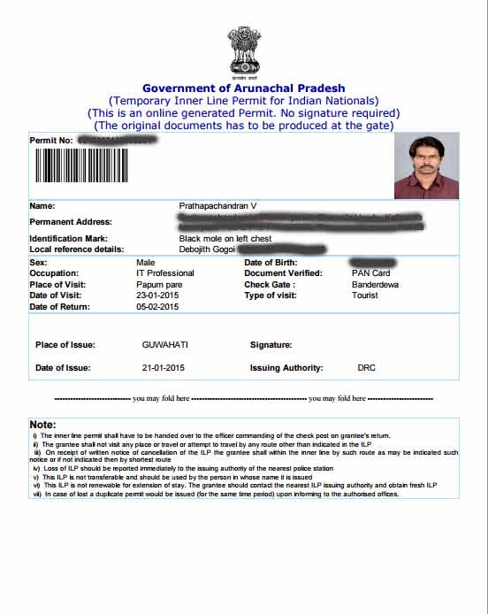
Sample ILP
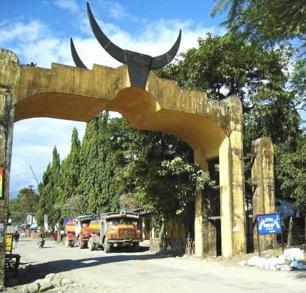
Bhalukpong Check Post in Arunachal Pradesh to show ILP. It is in Assam - Arunachal Pradesh Border. Image Source
- 04:15 PM | Kameng River
-
Kameng River flows in Arunachal Pradesh and Jia Bhoreli in Assam. Earlier it was known as Bhareli River. It is one of the chief tributaries of the Brahmaputra River. It is about 264 kilometers long. The drainage basin of Kameng River is about 11,843 square kilometers large. River rafting and kayaking that takes one through lush rainforests are the attractions of this river. The river originates in the eastern Himalayan Mountains, in Tawang district from the glacial lake below snow capped Gori Chen Mountain at an elevation of 6,300 metres or 20,669 ft on the India-Tibet border in South Tibet. Then it flows through Bhalukpong circle of West Kameng District, Arunachal Pradesh and Sonitpur District of Assam, India.
Kameng River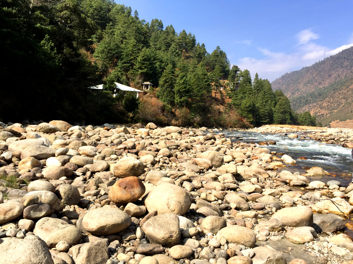
Kameng River
Kameng River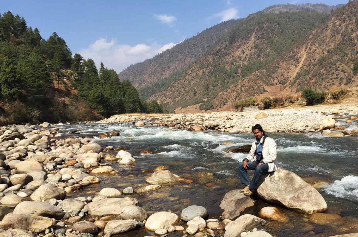
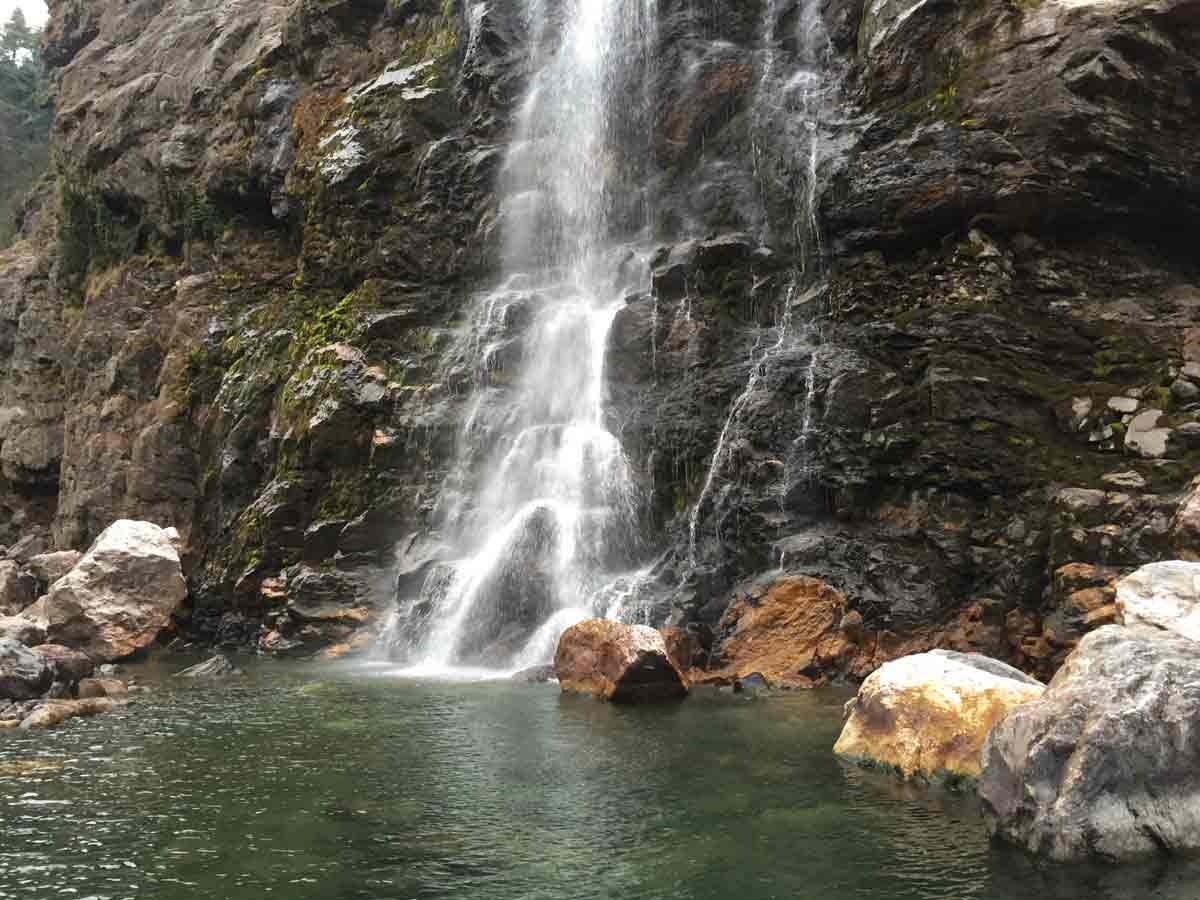
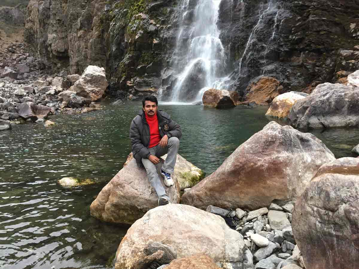
Kameng River - 05:00 PM | Bomdila Water Fall
-
We don't know the exact name of the waterfall, but it is a beautiful waterfall on the way to Bomdila.
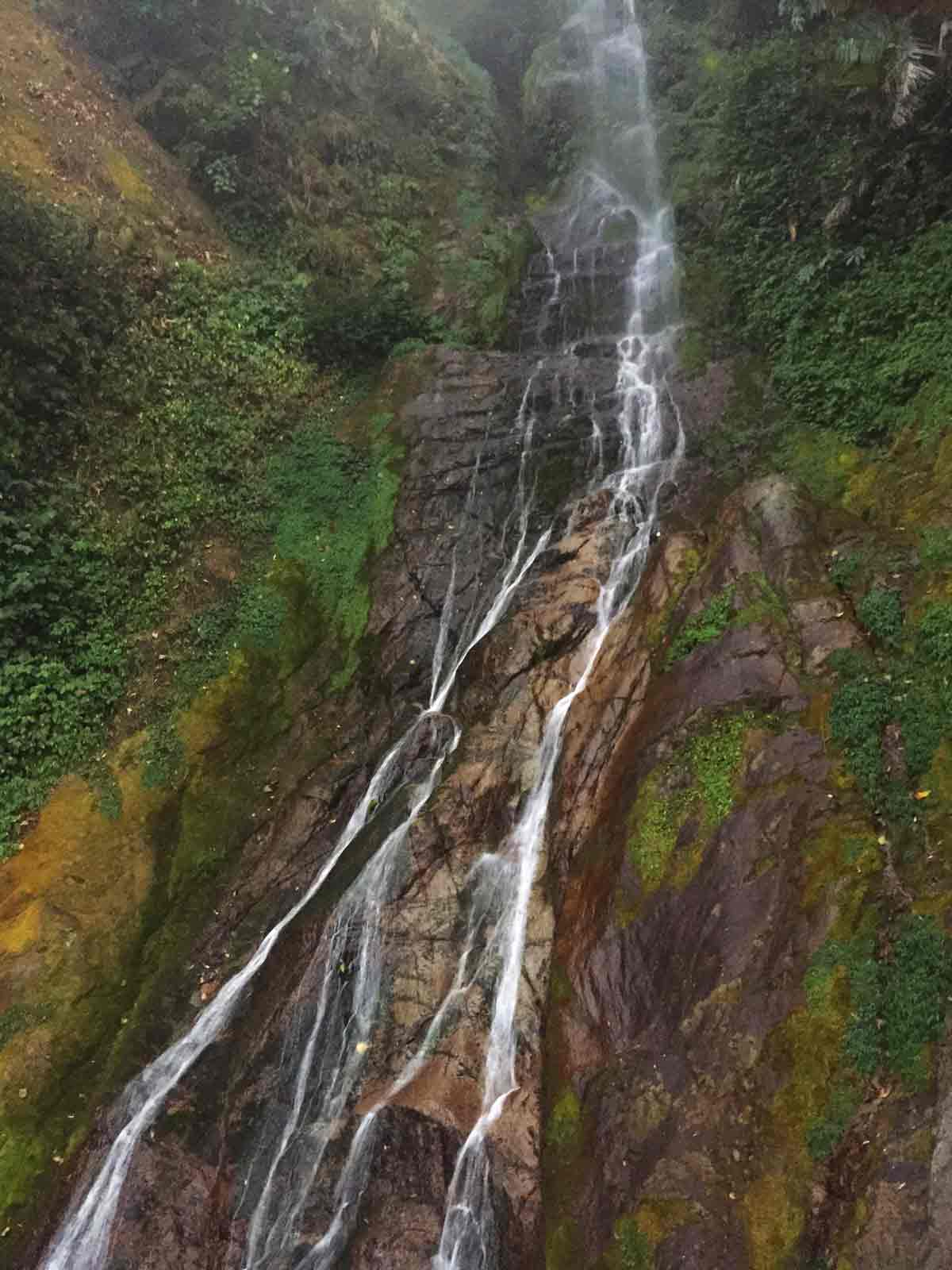
A waterfall - way to Bomdila
29 Jan 2015 | Arunachal Pradesh
- Travel Info
-
In the morning, we started our travel from Bomdila and reached the Hot Water Spring of Dirang at around 10.39 AM. We spent some time there and at around 1.39 PM, we reached Sela Pass and Sela Lake. Jaswantgarh War Memorial is on the way to Tawang. Nearly 4.00 PM, we reached Jang Falls, where one of the scenes of the Bollywood movie "Koyla" starring Shahrukh Khan and Madhuri Dixit were shot. Jang is the valley that lies between Sela and Tawang. Jang Hydro electric power station is near Jang Falls. After that we directly went to Tawang. There was heavy snow falling at that time. We took a room for our stay. The temperature was very cold and strong coat is required to withstand that cold. We had only a heater in that room, but regular power failure was the problem. Sometime electricity come for an hour. So we purchased some candles for making the room warm at night.
Another issue was related to water as it was so cold and one could not be able to use it directly from the tap. The tap should be open always to allow free water flow to the wash basin, otherwise it would freeze. Water heater was available, but of no use because of huge time taken to heat the water and electricity for such duration was not continuously available. - 10:39 AM | Hot water spring
-
A hot water spring is a spring that is produced by the emergence of geothermally heated groundwater from the Earth's crust. Because heated water can hold more dissolved solids, warm and especially hot springs also often have a very high mineral content, containing everything from simple calcium to lithium, and even radium.
Here, this natural hot-water spring flows from atop the nearby hills and drains into Dirang River all throughout the year. The Sulphuric content of the spring water is said to cure various kinds of skin diseases besides rejuvenating the body and giving an aesthetic feeling to bathers. Buddhist believers from far and near throng the site and camp here to bathe and meditate during holy months. Others willing to enjoy a refreshing hot-water sulfuric bath especially during the chilling winters makes it a point to visit this place.
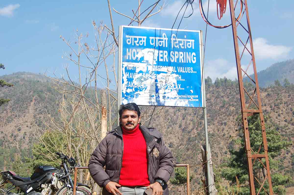
Sign Board of hot water spring at Dirang, Arunachal Pradesh
Way to hot water spring at Dirang, Arunachal Pradesh
Hot water spring at Dirang, Arunachal PradeshThere are lots of other hot water springs are available. Click here to get some info.
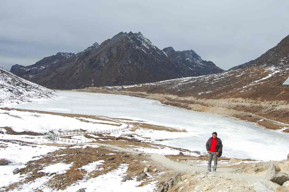
- 01:39 PM | Sela Pass
-
Sela pass is a high altitude pass with an altitude of 13,700 feet and is located between the towns of Bomdila and Jang in Western Arunachal Pradesh that connects the Buddhist city of Tawang with the rest of the country. The only way one can reach Tawang by road is through the Sela pass. If this road gets blocked for whatever reason... enemy trouble, bad weather, heavy snowfall, etc., then commute to the district of Tawang struggles. This place is snowed in most of the year and offers excellent and heavenly views all year round. This part of the Eastern Himalayan range is pretty special for the Buddhists as it is believed that about 101 lakes exist in and around Sela pass and each of these lakes has a huge religious significance for the Buddhist community. Overall, the Sela pass is one magnificent place to visit.
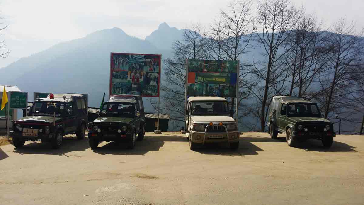
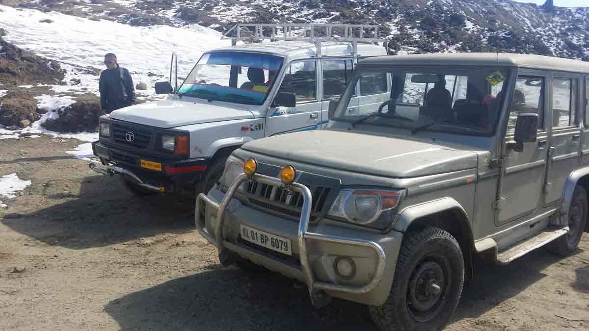
Our Jeep with Army Vehicles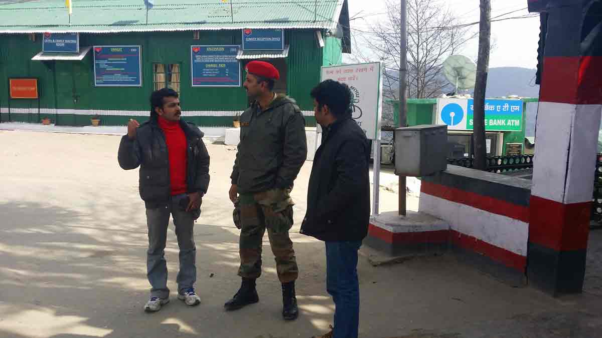
In Army Camp
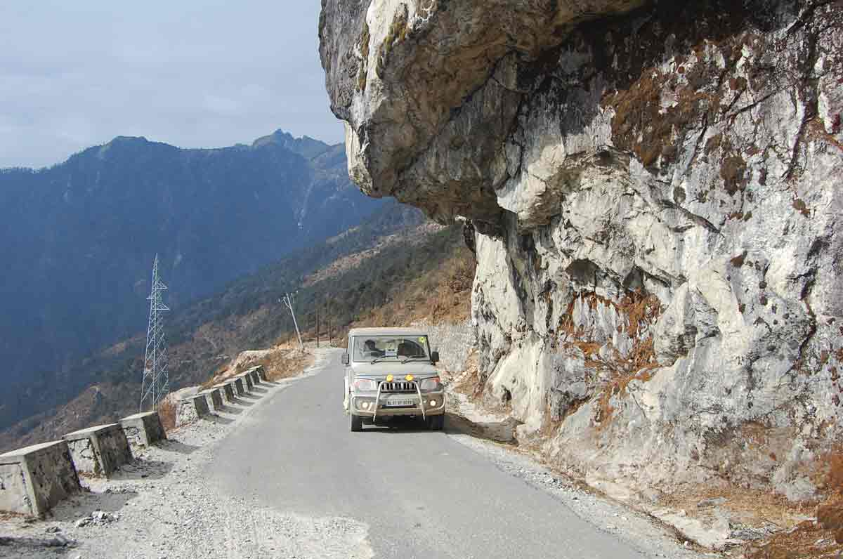
On the way to Sela Pass
On the way to Sela Pass
On the way to Sela Pass
On the way to Sela Pass
On the way to Sela Pass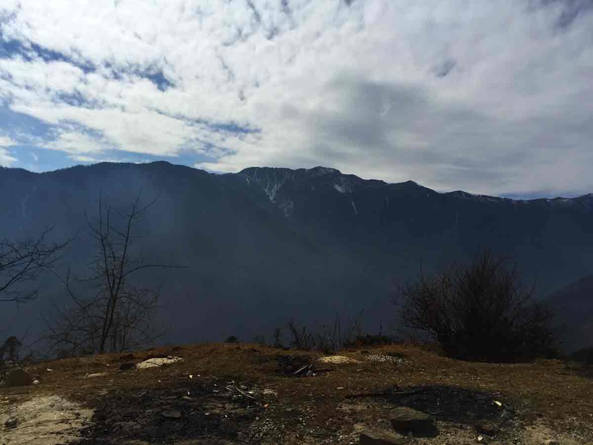
On the way to Sela Pass
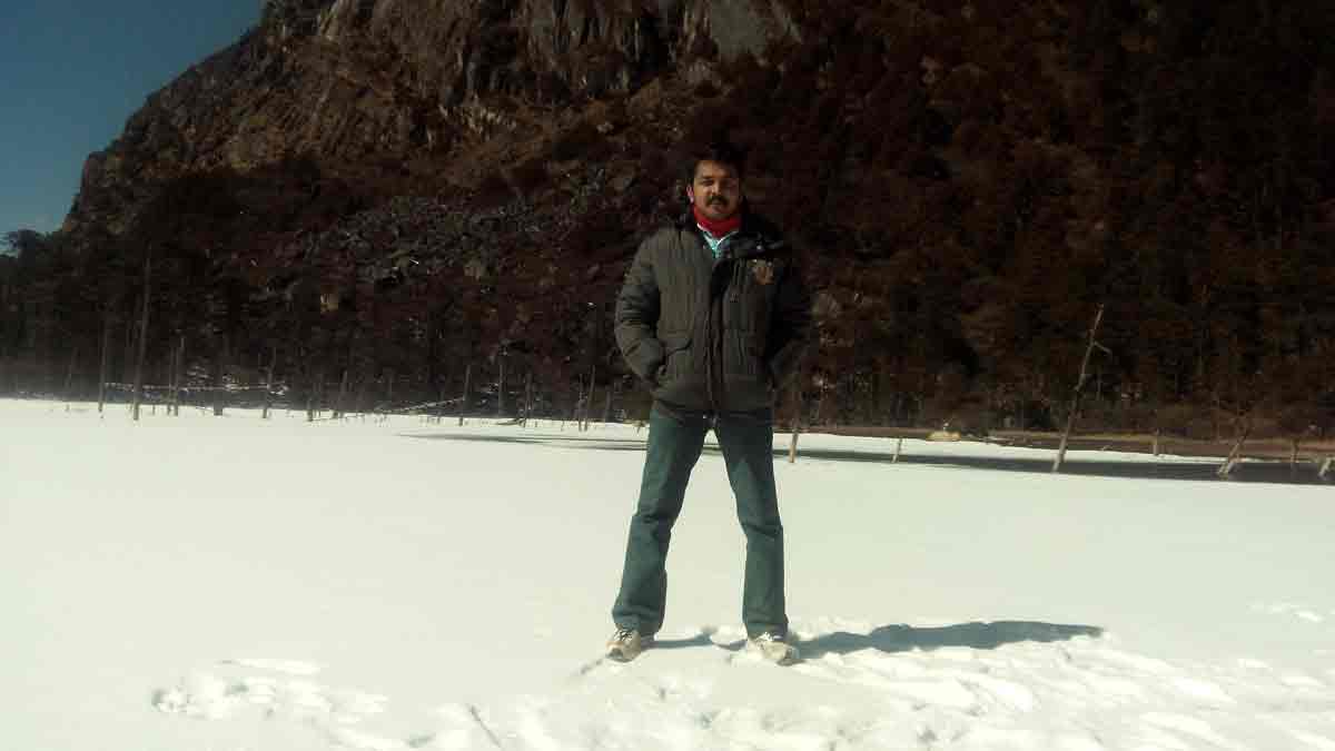
Rathish at Sela Pass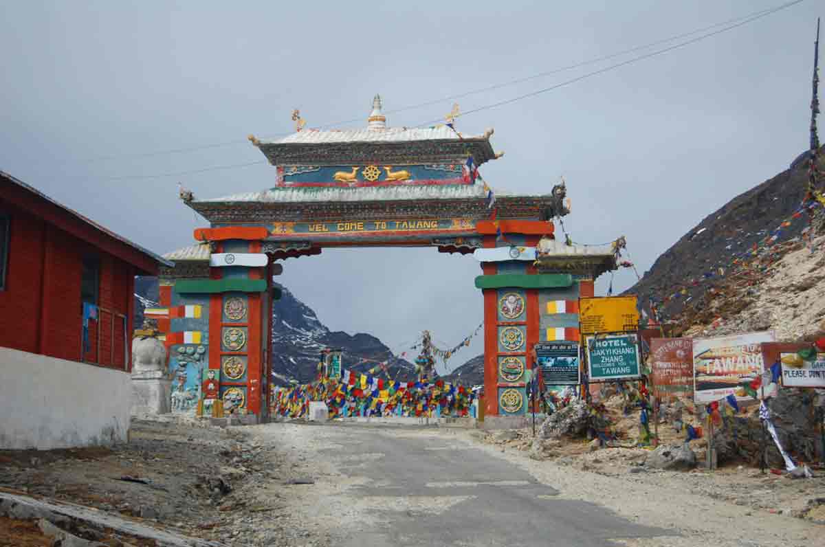
Sela Pass
Prathap at Sela Pass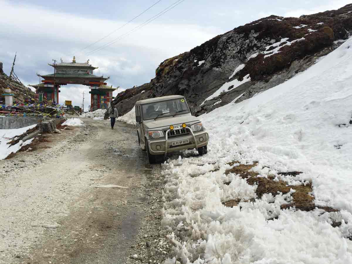
A snow drive of Krishnakumar at Sela Pass
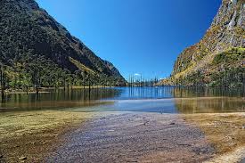
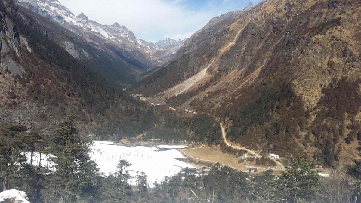
- 01:45 PM | Sela Lake
-
Sela Lake is very close to Sela Pass and sometimes it is called Paradise Lake because of its beauty. Sela Lake will be fully or partially frozen in winter
Sela Lake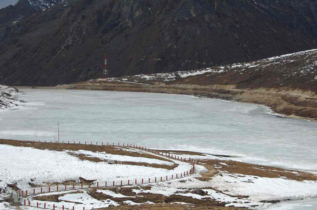
Sela Lake
Sela Lake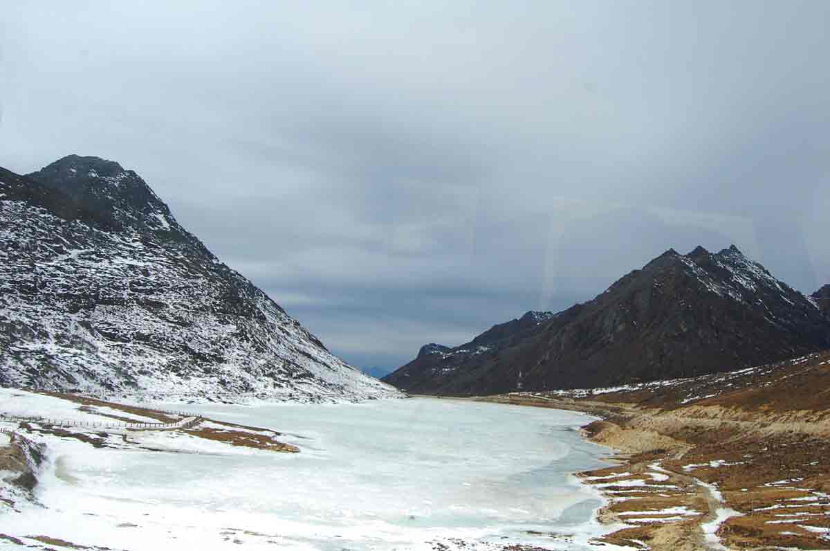
Sela Lake
Sela Lake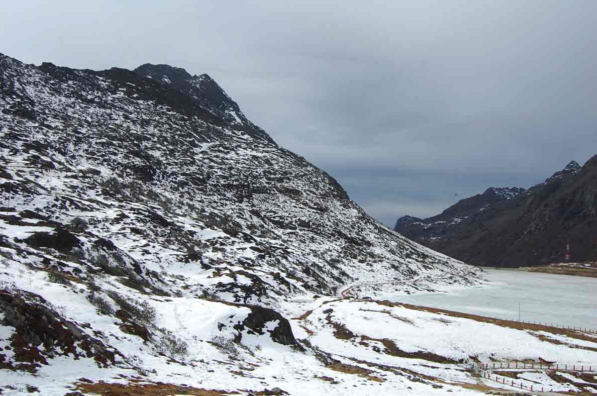
Sela Lake
- 03:00 PM | Jaswantgarh War Memorial
-
A great pit stop enroute to Tawang would be the Jaswantgarh war memorial located at Nuranang, about 25 kms from Tawang. This war memorial, set in scenic terrain just below the Sela pass commemorates the bravery of the martyred Indian soldiers of the 1962 Indo-China war. This war memorial stands in memory of rifleman Jaswant Singh Rawat, Mahavir Chakra Awardee (Posthumous) of the 4th Battalion of Garhwal Rifles Infantry Regiment. Jaswant showed his valor by fighting and holding the invading Chinese back for 72 hours all alone during the 1962 India-China war and remained at his post at an altitude of about 10,000 feet before succumbing to an enemy bullet during that bloody winter war. The post that he held to repulse the Chinese troops has been renamed Jaswant Garh in recognition of his valor and sacrifice.
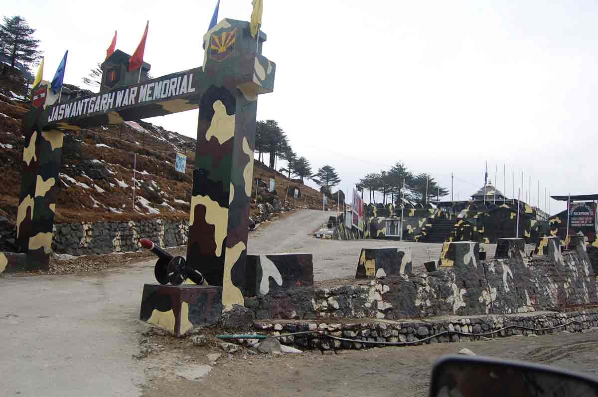
Jaswantgarh War Memorial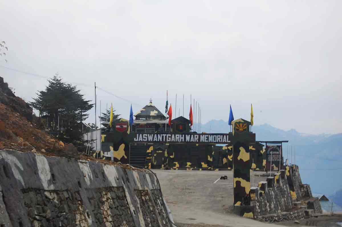
Jaswantgarh War Memorial
- 04:10 PM | Jang Falls
-
Jang Falls or Nuranang Falls is a 100 meter high water fall located in the town of Jang, Tawang District, Arunachal Pradesh. It came to limelight when a song from the movie Koyla featuring Bollywood actress Madhuri Dixit, Tanhai Tanhai Tanhai was shot here and at Sangetser Lake in 1997
Jang Falls and Madhuri lake in Film Koyla
Jang Falls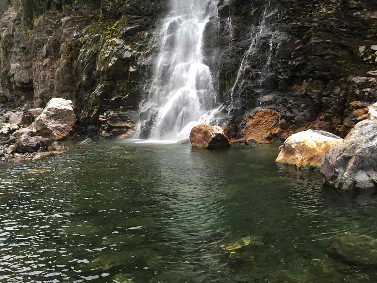
Jang Falls
Rathish @ Jang Falls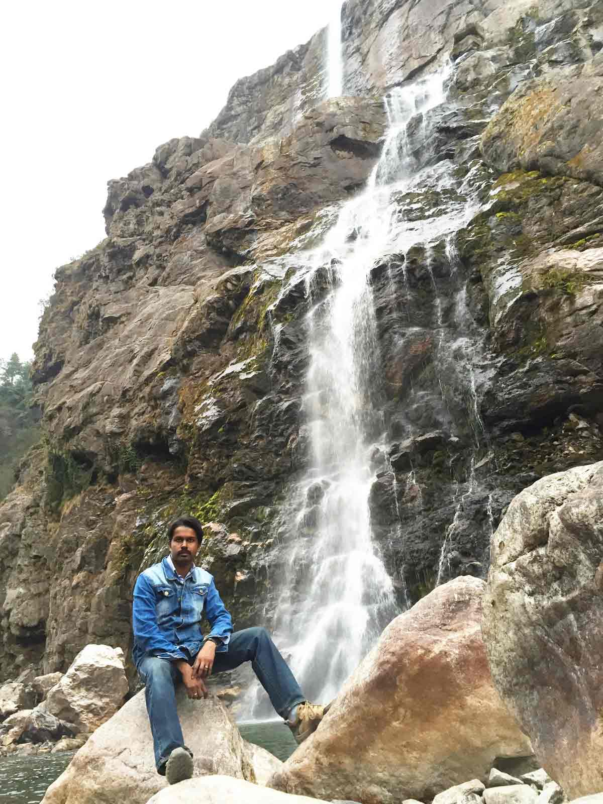
Prathap @ Jang Falls
- 04:10 PM | Jang Hydro Electric Power station
-
It is a small hydro electric power station located near Jang Falls.
- Some Snaps
-

30 January 2015 | Arunachal Pradesh
- Tawang Overview
-
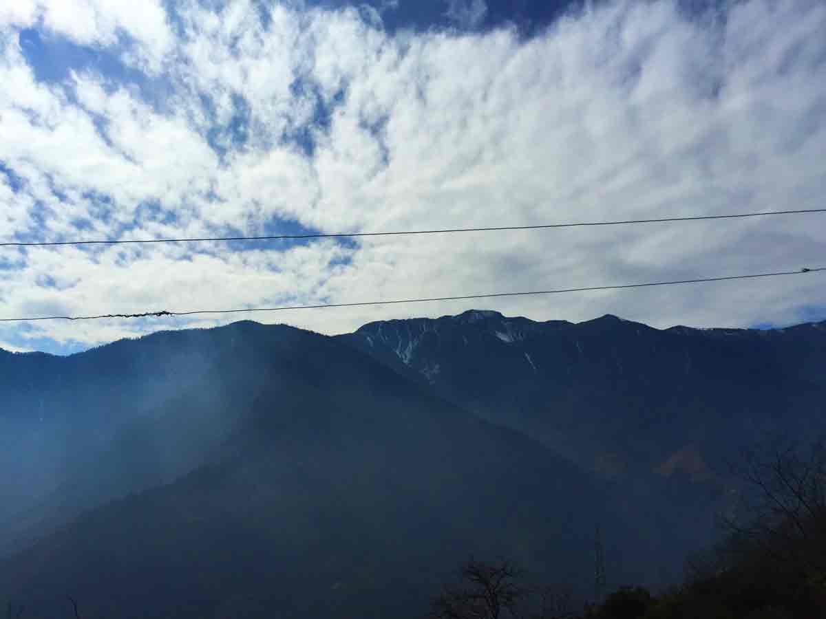
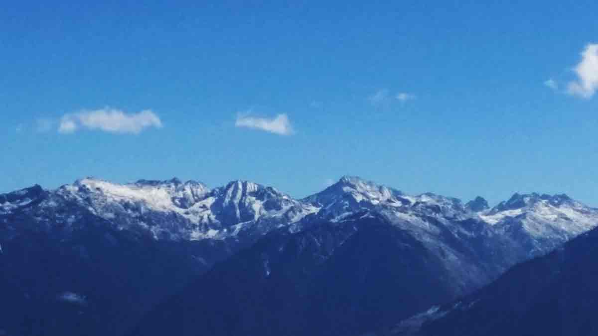
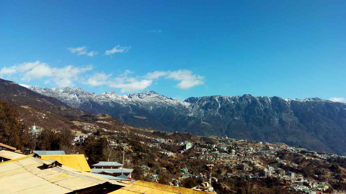
Tawang - The beautiful land of the Monpas is located in Western Arunachal Pradesh on the international borders with China and Bhutan. It is situated at the height of 3500 mtrs from the sea level on the mountainous range of the Northern Himalayas. Its snow capped peaks, pleasant lakes, congenial climate, friendly and hospitable people continue to entice the people who visit. This magical land evokes images of awesome mountain views, remote hamlets, quaint and sleepy villages, magical Gompas, tranquil lakes and mesmerizing mountains. At Tawang, one has a heavenly tryst with nature and there is a heady mixture of ancient history, mishmash religion and glorious legends.
The native people inhabiting Tawang district are known as Monpas. The Monpas have a glorious heritage of arts and crafts. Their craftsmanship is manifested in various trades like weaving, bamboo works and paintings, paper making, incense making, pottery, etc. Monpa artisans are held in esteem and respected in their society as their services are inevitable in their socio-cultural life.
Fairs and festivals have always been an integral part of the tribal people of Arunachal Pradesh so is the Monpas tribe. Dances have been an important part of the life of the people of Tawang.
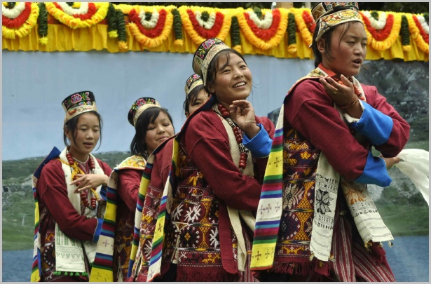
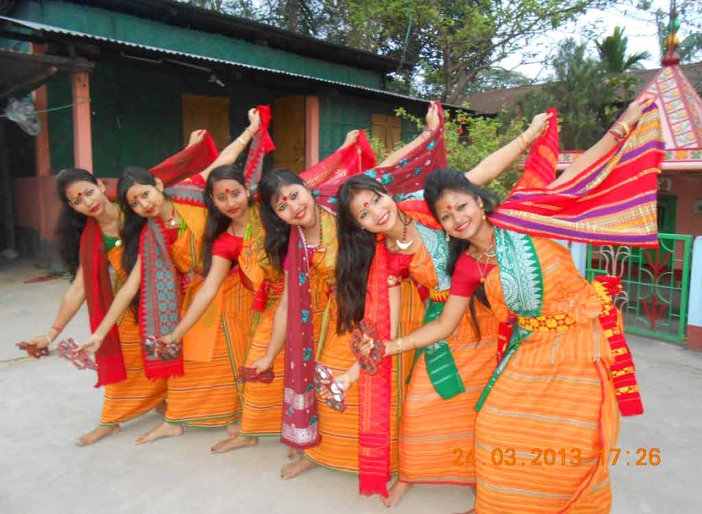
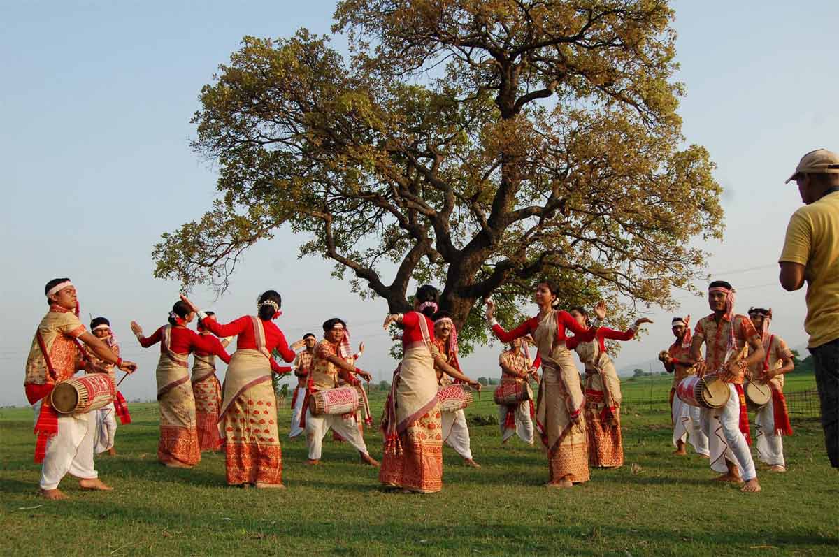
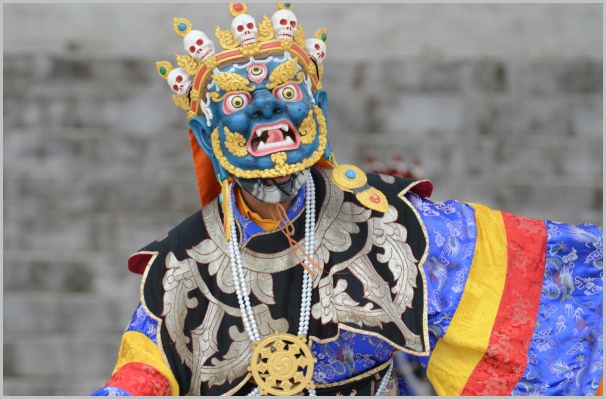 Tawang Traditional Dances. Image Source
 - Travel Info
-
We wake up early and after refresh, we immediately went for our breakfast, which was a hotel just opposite to our room. Our hotel manager gave so many information related to Tawang and procedure for visiting different Himalayan Passes. He told to us that every day, in the war memorial, a military film show would be displayed for tourists and one need to take ticket which costs 10 INR for watching that show. It gives so many valuable information related to Arunachal Pradesh, indo-sino war in 1962 and its military operations. One need to obtain separate permit to visit to Bumla Pass and Madhuri Lake apart from the ILP. He also explained the procedure to take the permit.
Procedure to take Pass for Visiting Bum-La Pass and Madhuri Lake
1) Take Xerox of all member's ILP and photo identity proof - 2 copies
2) Take Xerox of driving license of the driver - 2 copies
3) Go to DC (Deputy Commissioner) office at Tawang District (10.00 AM - 4.30 PM is the office time)
4) Apply for permit in the morning. A small amount needs to pay at DC office for each person as fees.
5) Collect the permit in the evening
6) Go to War Memorial and submit it at the check gate.
7) Collect the signed permit from the gate on/after the time they informed.
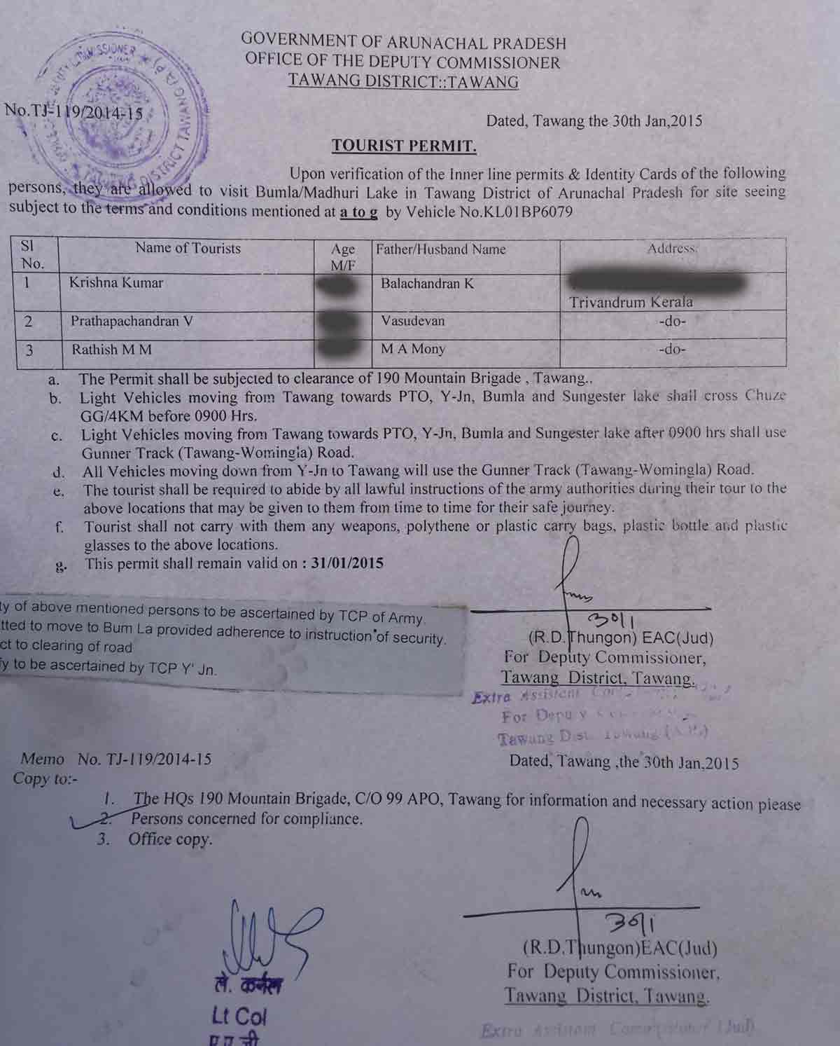
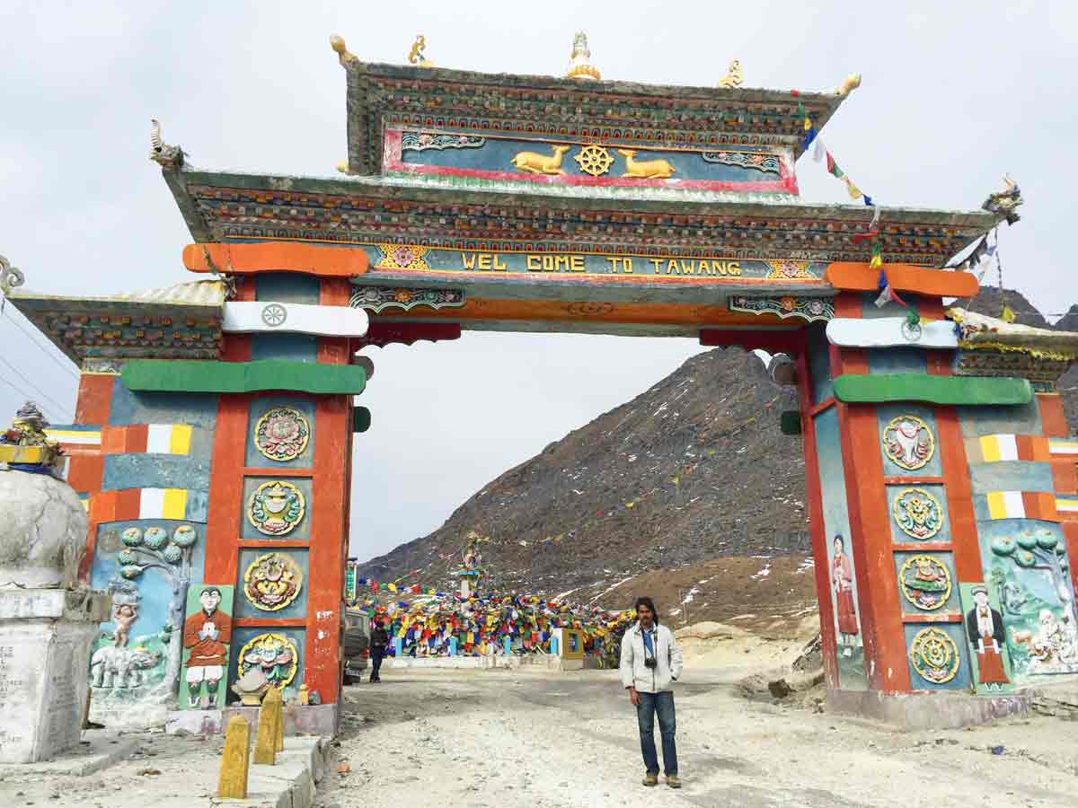
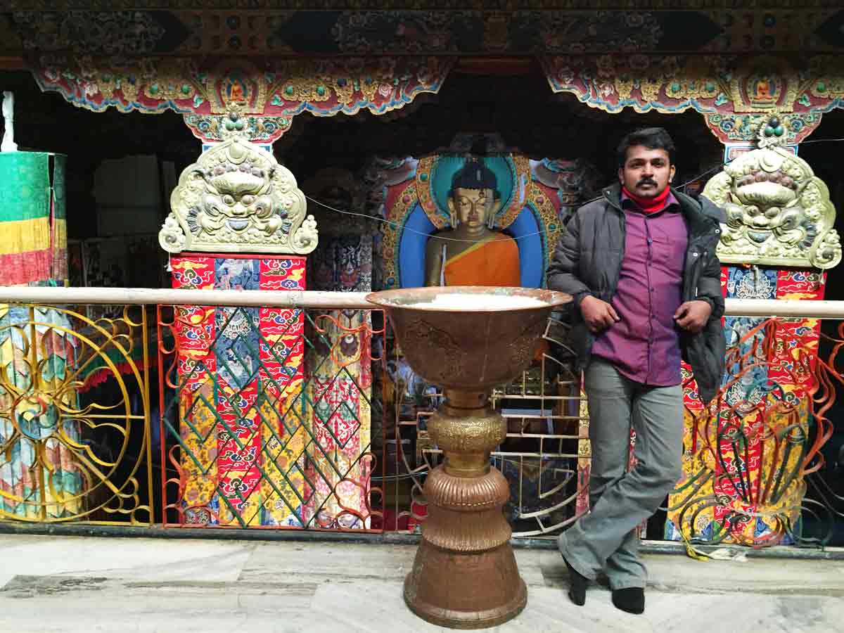
Sample Pass for Visiting Bumla Pass and Madhuri LakeNearly 8.30 AM, we started our travel. Around 9.30 AM, we reached Tawang Monastery, which was really a big monastery with a big library. For visiting Library, one need to take ticket which costs 10 Indian Rupee (INR). Then we immediately went to DC office for applying permit for visiting Bumla pass. They ask us to come at around 2.30 PM for collecting the permit. We went to War memorial, Gyangong Ani Gompa and Hill top Statue. Nearly 1.00 PM, we returned to our room and parked our vehicle and had our lunch. We spent the remaining time in our room and in the evening, we went to War Memorial for watching the military film show. The show was really good. We forgot to collect the Permit from the gate in the same day. But we met two tourist persons named Prathyush Thota and Dinesh Yalagandula at War Memorial whose native place is Andhra Pradesh. We together had our dinner.
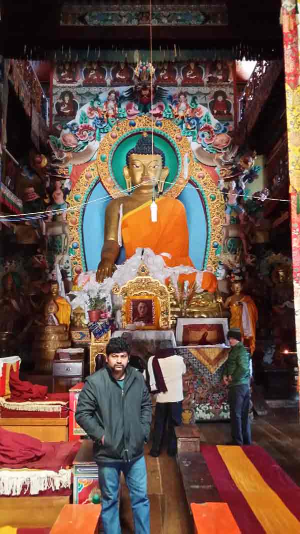
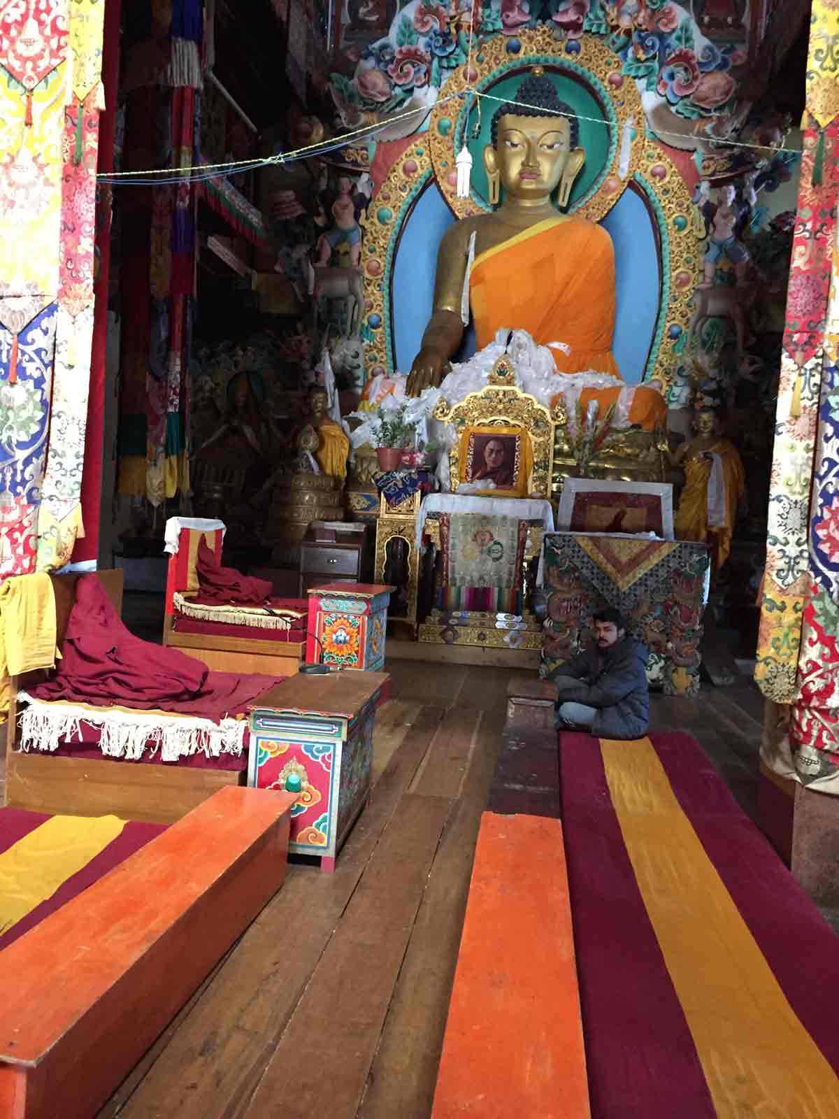
- 09:30 AM | Tawang Monastery, Tawang
-
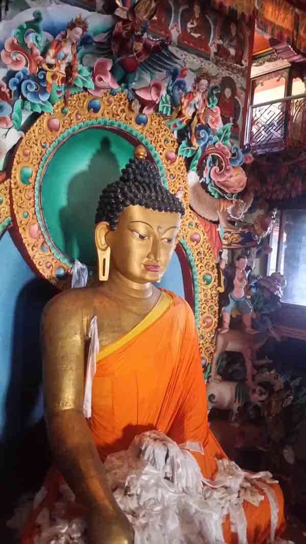
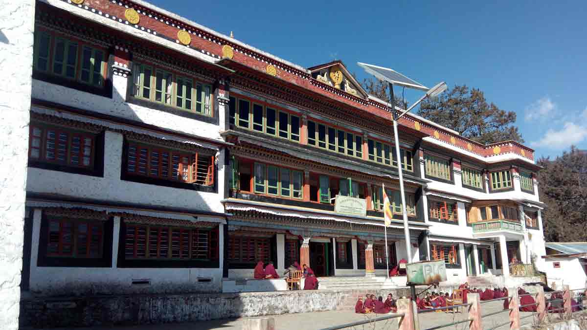
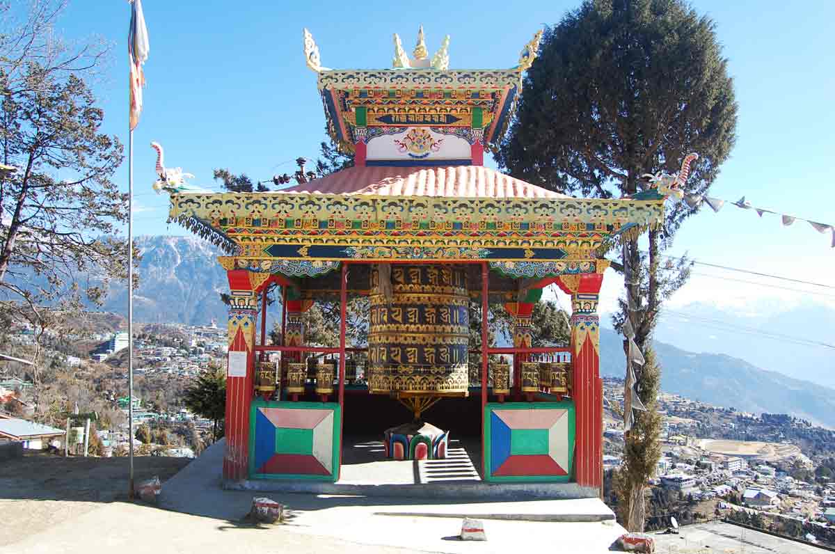
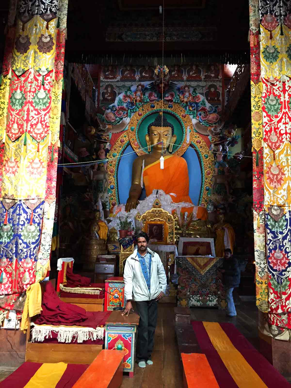
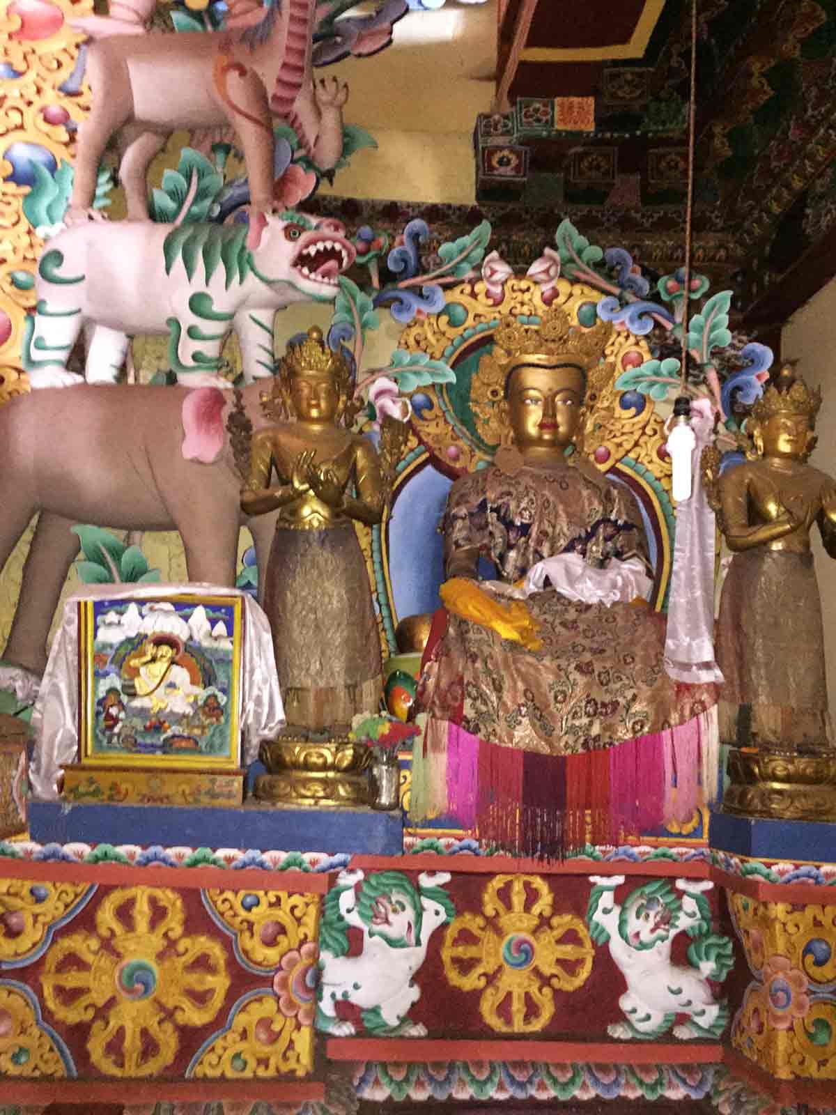
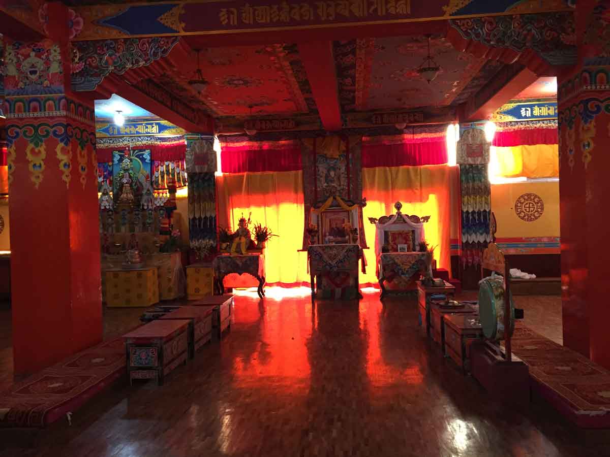
Tawang Monastery which is an important seat of Mahayana Buddhism is located here. This world famous monastery of the Gelukpa was founded during the 17th century by Mera Lama Lodre Gyaltso who is considered as a contemporary of the 5th Dalai Lama.
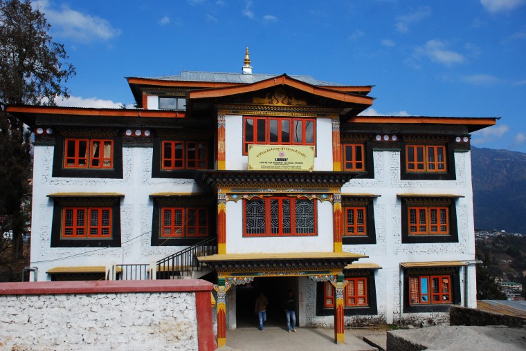
It is Asia's second largest monastery and India's largest which controls 17 Gompas in the region. The highlights of this monastery are the imposing three-storied assembly hall and the 28 ft high golden statue of Lord Buddha. There is also a big library which has an impressive collection of ancient books and manuscripts. The famous Buddhist gold inscribed scriptures Kangyur and Tangyur are preserved here.
Another attraction of Tawang is the Urgyelling Monastery which is considered sacred as it is the birth place of Thangyang Gyatso, the sixth Dalai Lama. Bramadung Chung, Sengsarbu Ani Gompa, Gyanggong Ani Gompa are also well known nunneries and monasteries with the Ani Gompa being one of the oldest in the country.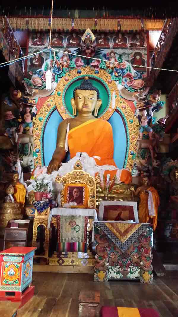
A Gompa associated with Tawang Monastery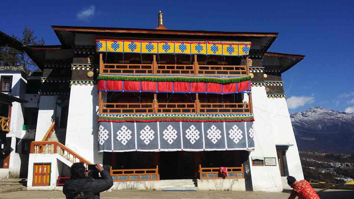
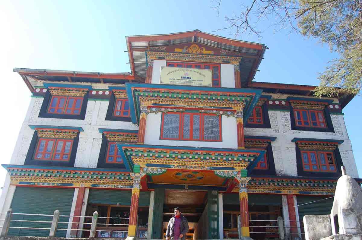
- 09:50 AM | Library
-
It is a 3 storied building also home to a 400 year old Kangyur Scriptures and many other priceless manuscripts and books.
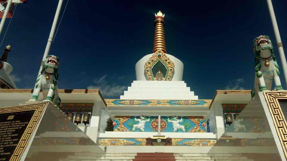
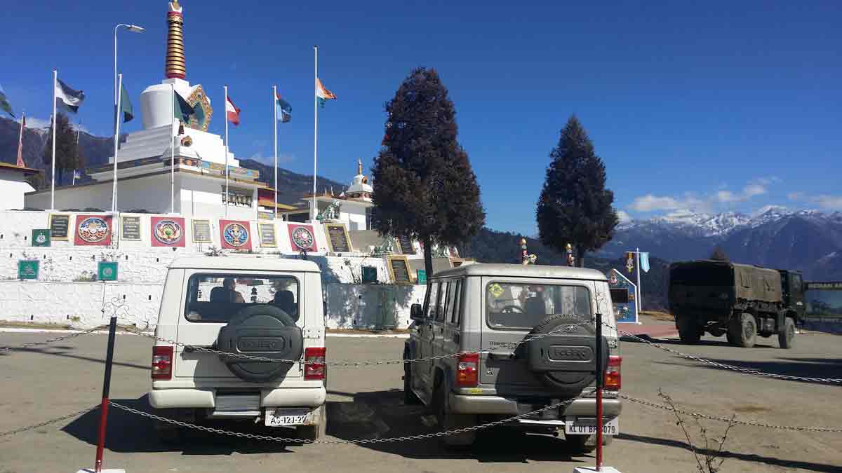
- 12:15 PM | War memorial, Tawang
-
The Tawang War Memorial was built in memory of soldiers of the Indian Army who gave up their life in the 1962 Indo-Sino War. This is a fitting memorial for the greatest sacrifice anyone can offer.
Located on a slope just before reaching the main town, the Tawang War Memorial is open to the public. The 40 ft structure was built by the Indian Army; Rs.15 lakhs were spent on constructing it. This stupa like structure was blessed by the Dalai Lama in 1997 and is called Namgyal Chortan by the locals. Led up by few steps, and surrounding the structure are walls of black granite. The names of the 2420 soldiers who laid down their lives in the Kameng sector during the 1964 war are inscribed on this granite plates. The memorial is surrounded by two rooms on each side; one room houses artifacts, maps, photographs and remains of the war and the other room is used for a sound and light show depicting the heroic deeds of the slain soldiers. The sound and light show room was usually closed, but the museum displays items used by the army during war, such as gun, bullets, helmet, mugs, pots etc. One can also learn more about the war from the newspaper clippings and maps marked with positions of both armies.
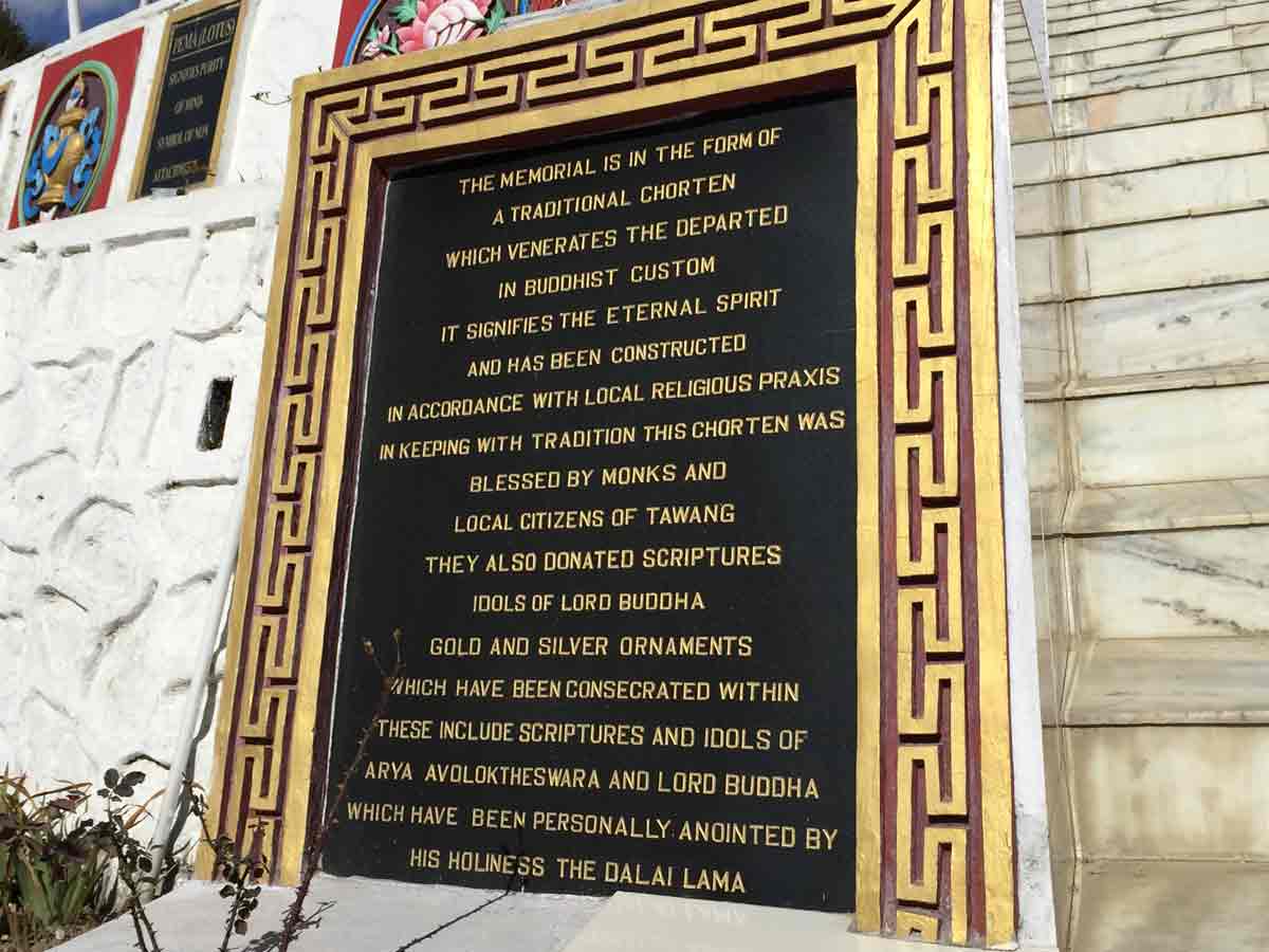
One black marble plaque reads, "In the memory of those brave soldiers who made supreme sacrifice defending the frontier of Mother Land during the 1962 Sino-Indo war." It was dedicated by Lt. General, HRS Kalkat, PVSM, AVSM; GOC IN-C Eastern Command on November 2nd 1999. The structure signifies eternal spirit and was constructed in according with the local religious practices. The grey sky reflects the seriousness of the structure. This lovely memorial is a testimony and a reminder of the ugliness of war. It is here to remind us that in a war no one wins.
Source
- 12:25 PM | Gyangong Ani Gompa
-
Tawang in Arunachal Pradesh has a long tradition of nunneries called the "Ani Gompas". Gyangong Ani Gompa, is under the control of Tawang Monastery, is a beautiful Nunnery, having about 50 Buddhist Nuns. The Nunnery is located on top of a beautiful hillock about 5 km away in the north of Tawang. Founded by Mera Lam Lodre Gyamtso, the Nunnery was subsequently offered by him to his elder sister.
The Tawang monastery provides for the every day needs of the nuns and their monastery. The Location of nunnery and the customs being followed here by the nuns reminds one of a bygone era, when Buddhism was preached in a calm and serene atmosphere under the shades of a tree.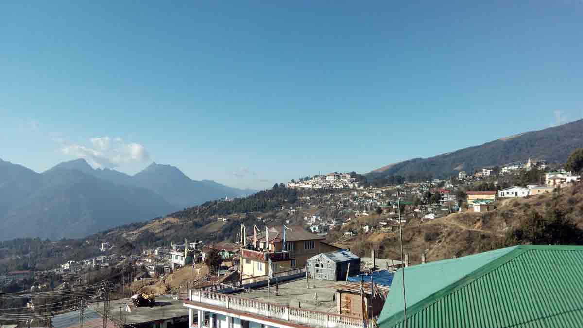
- 12:30 PM | Hill top Statue
-
- 9:30 PM | Dinner with Friends
-
Bar @ Tawang
Rathish and Krishnakumar with Tayama, Arunachal Pradesh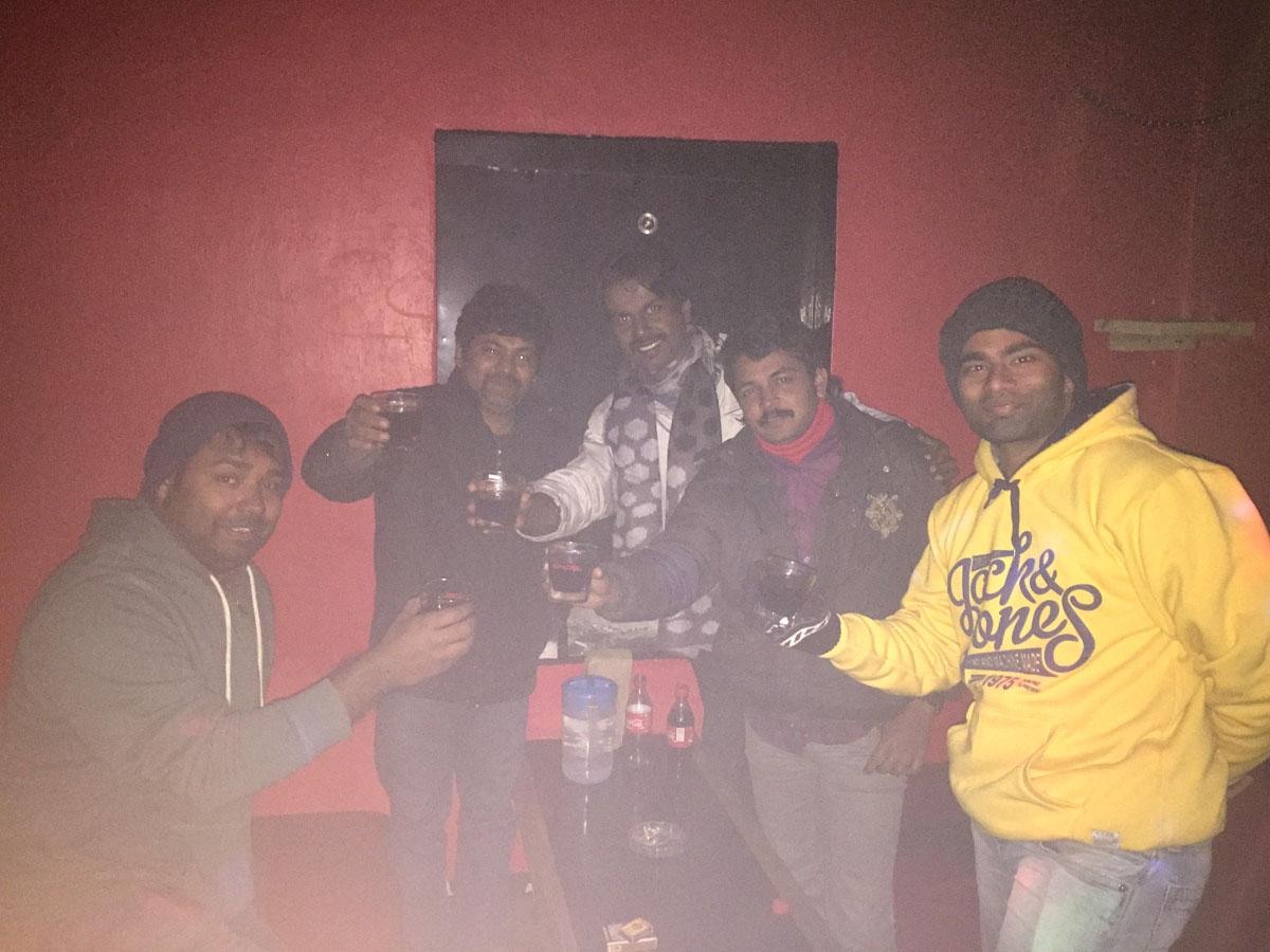
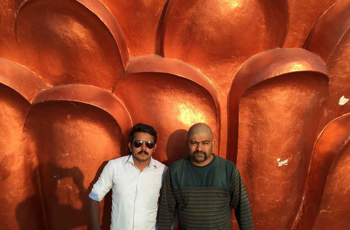
Prathysh, Krishnakumar, Prathap, Rathish and Dinesh
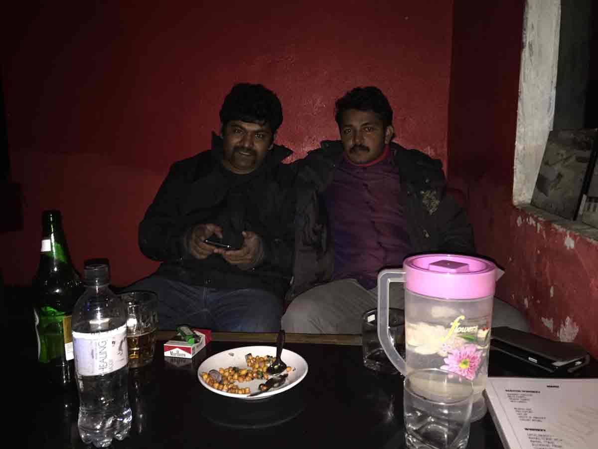
Krishnakumar and Rathish
31 January 2015 | Arunachal Pradesh
- Travel Info
-
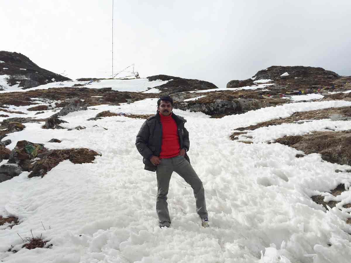
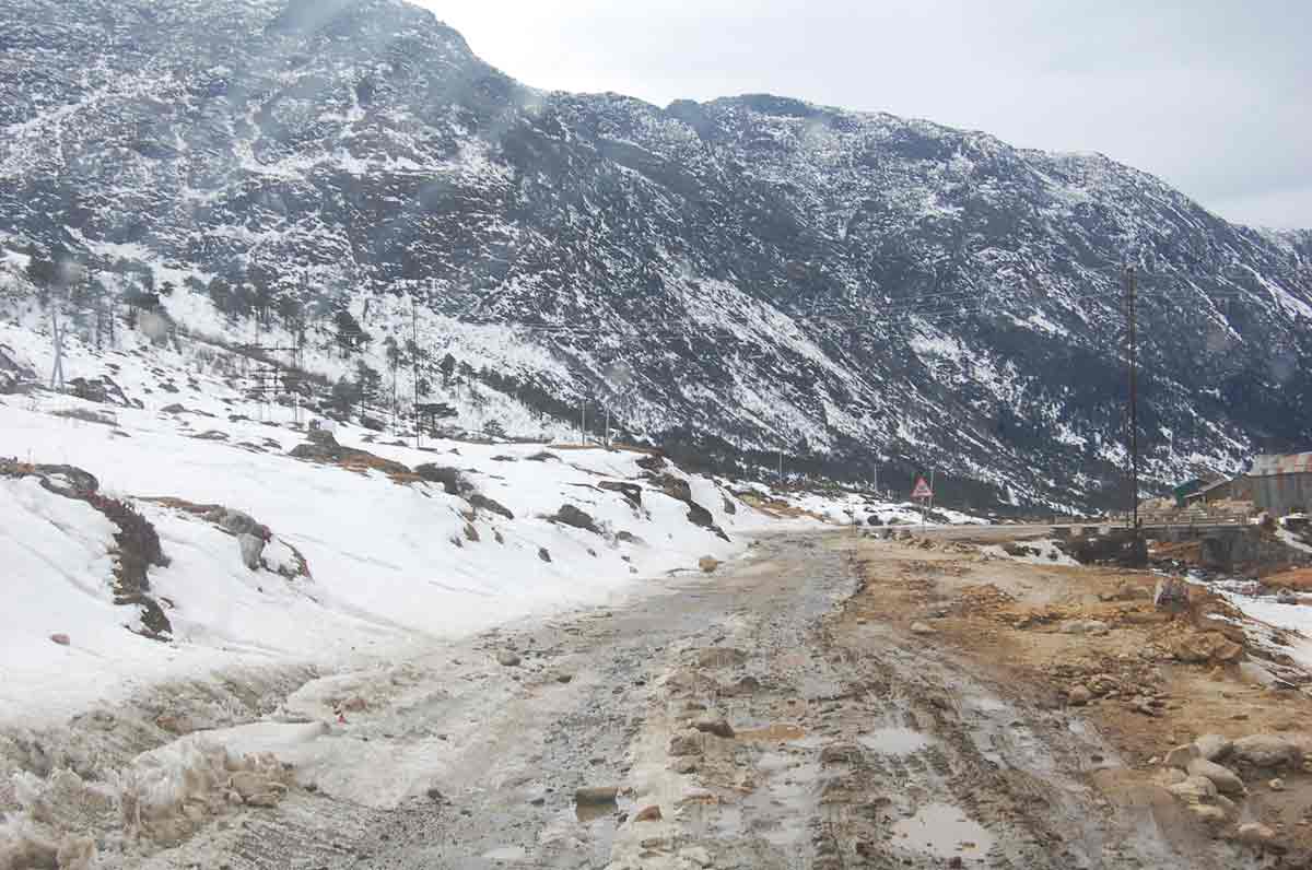
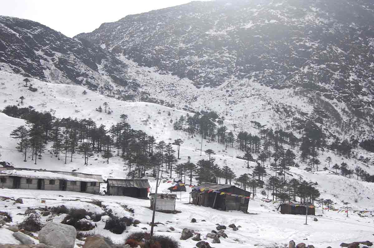
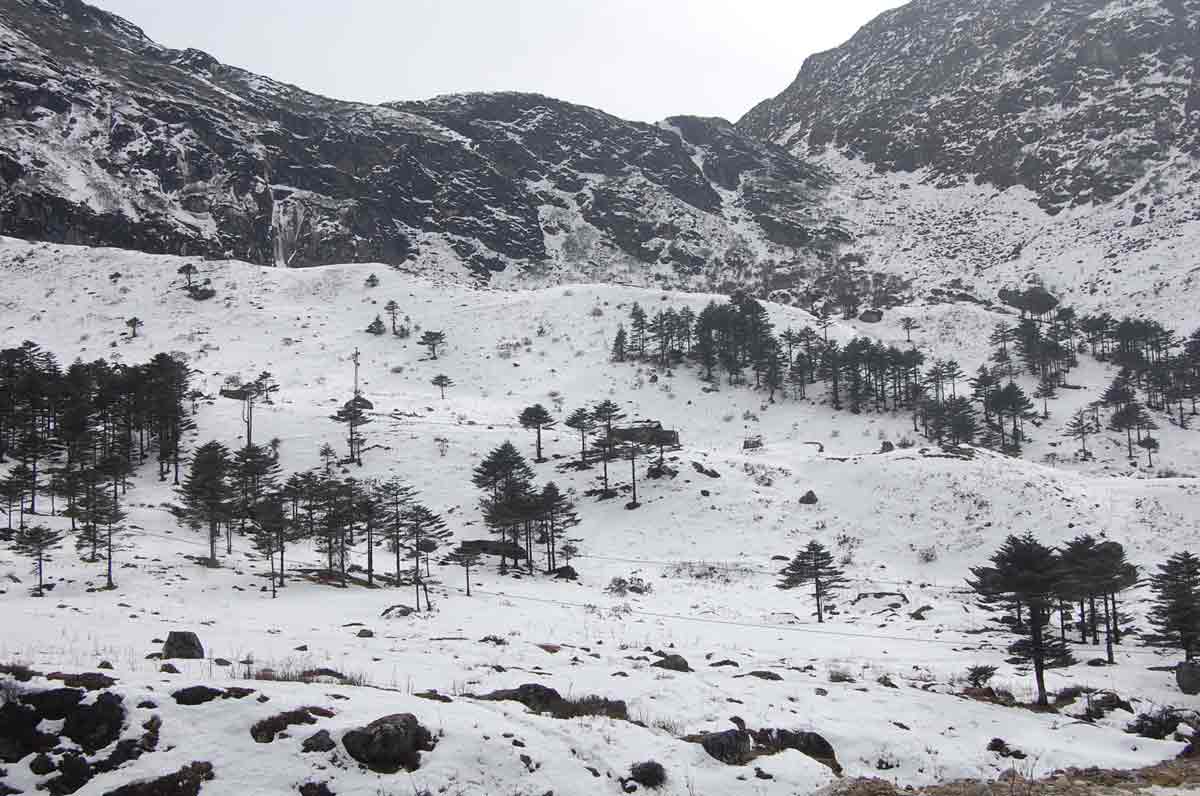
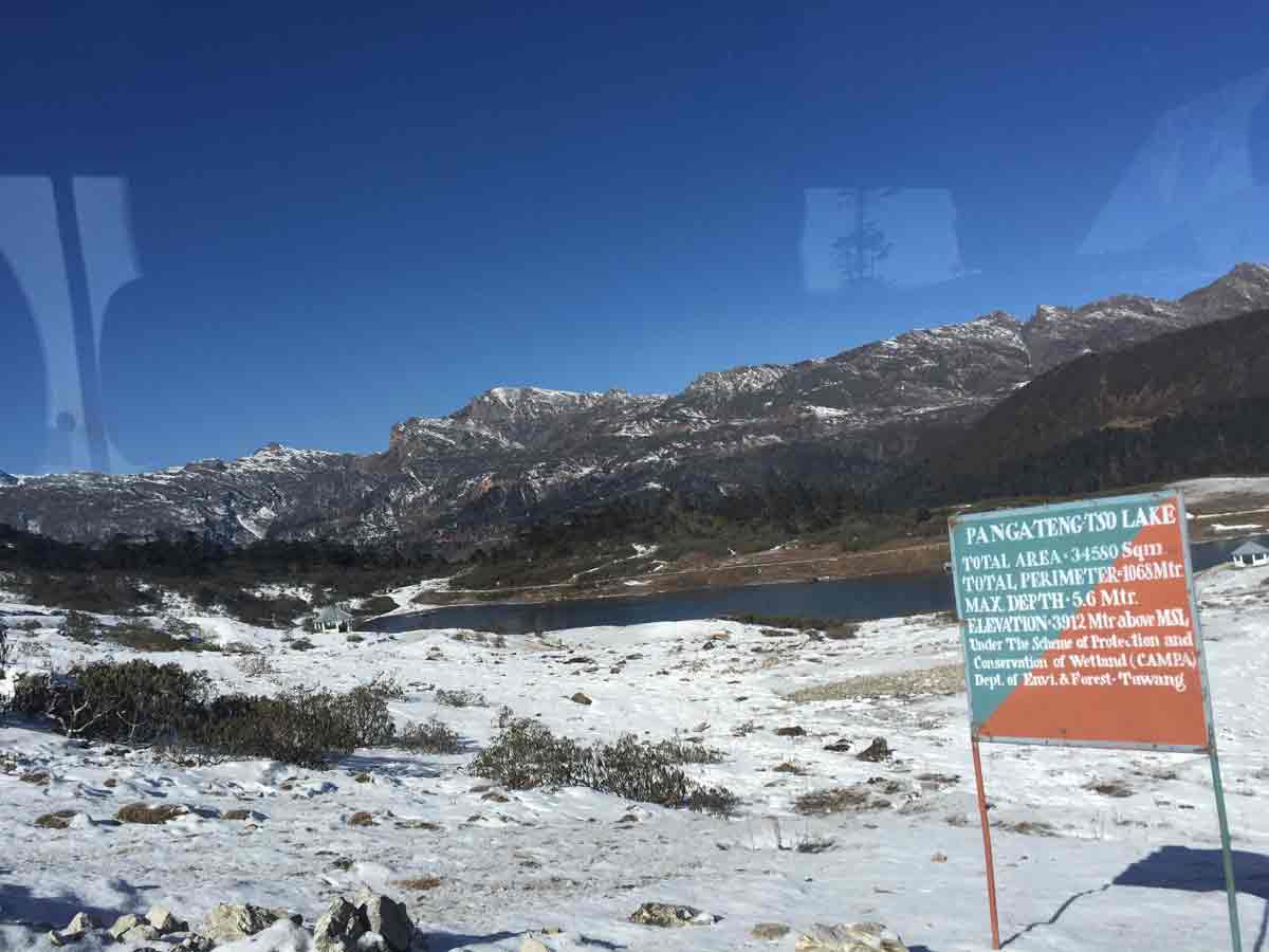
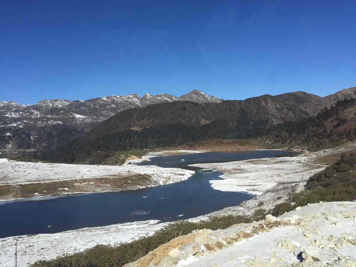
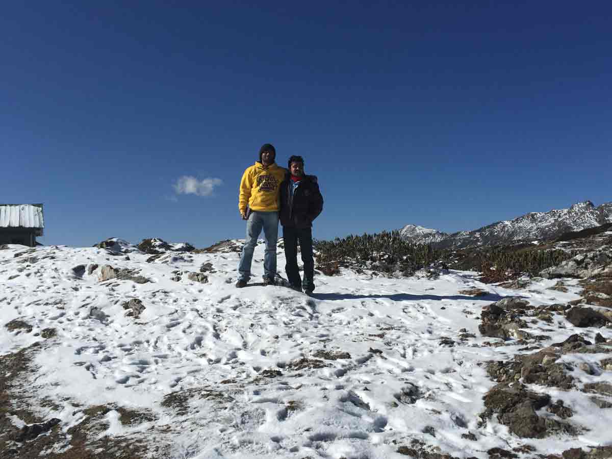
We woke up early in the morning. We had to go to one of our ultimate location - the Boomla Pass. Need to take photographs of India-Sino border. So we had to go very early, otherwise the Army will not allow to go to the border. It was also not the season. We started our travel and initially went to War Memorial for collecting our visiting pass. God grace, the pass is approved. After collecting the pass, we started our journey to Bumla Pass. It is 37 km away from Tawang. Roads were not tarred and very difficult to drive. Completely soil road. Road constructions was in progress in some locations due to land slide. Prathysh and Dinesh already hired a Sumo for travelling to Bumla Pass a day before we met. That driver knew all the ways very well. So we followed that Sumo. We were going higher and higher. After some kilo meters, we could see snow scattered in the mountain and roads. When some distance reached, snow became continuous and hard. We could see so many lakes those were frozen completely. The beautiful Pankang Teng Tso Lake... We passed Y junction and after 15 km, we reached our ultimate destination Boomla Pass. Nearly 9.20 AM, we came back to Y junction for taking another deviation to Madhuri lake. Nearly 10.20 AM, we reached Madhuri Lake. There was a military canteen and we got some noodles and hot coffee. Then we immediately came to our room at Tawang. We started our packing and after completed our room payment, we all including Prathush and Dinesh, started travel to Assam.
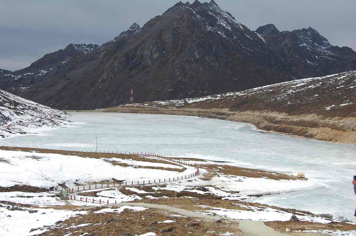
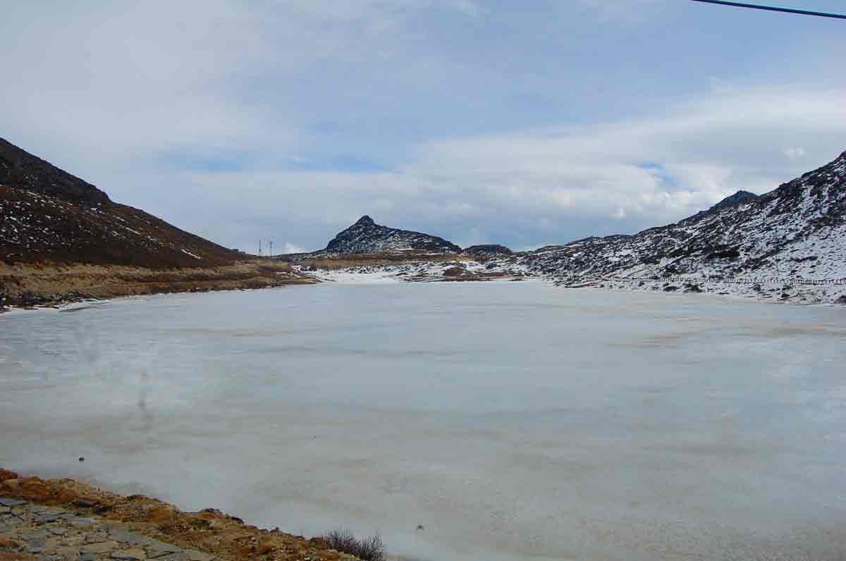
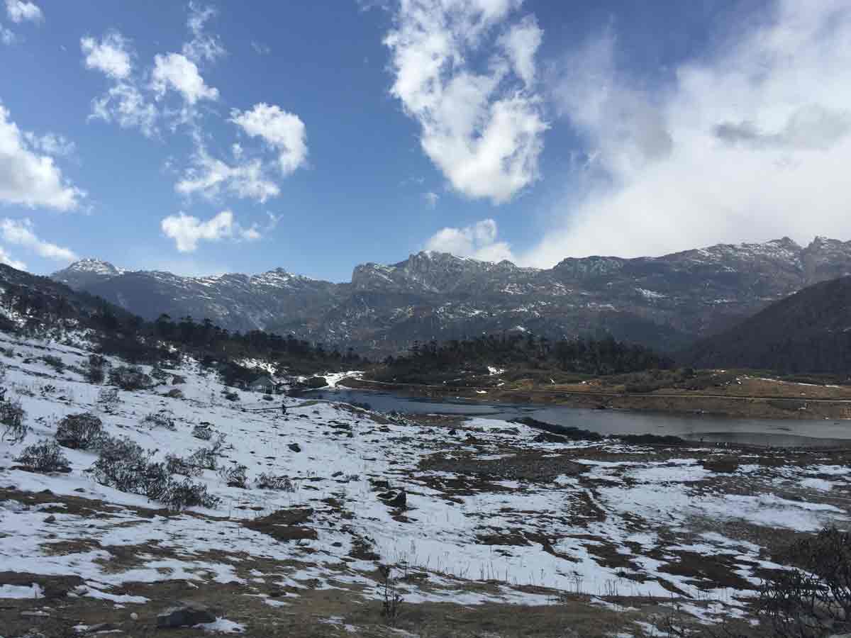
- 06:20 AM | Pankang Teng Tso Lake
-
The calm water, silently moving clouds, earth with its wetness, chirping of birds and warmth is all that one gets while visiting Pankang Teng Tso Lake. The lake is well maintained by the Indian Army and offers a soothing and tranquil atmosphere to its visitors. The lake remains frozen in winter and is ideal to visit only in summers. The path towards the lake is laden by bright rhododendron flowers that add to the exquisiteness of the place. One can also find colourful birds while on the lake and engage in some wonderful nature photography.
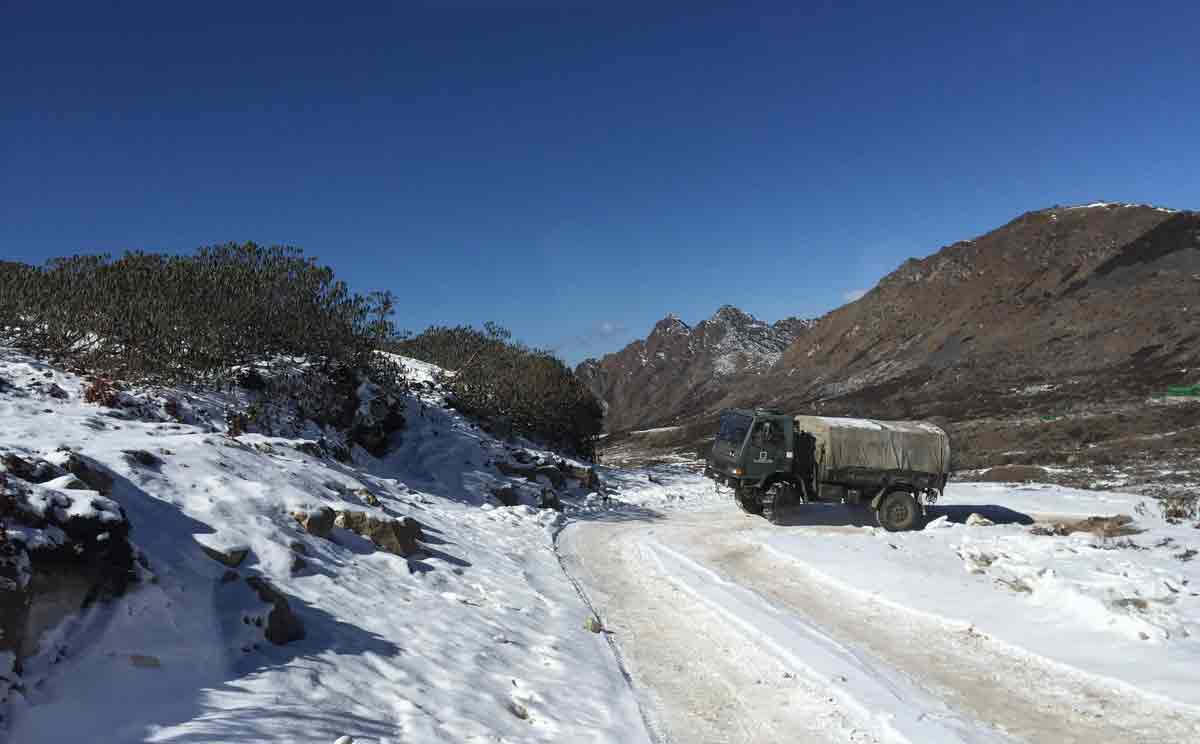
- 07:30 AM | Bumla Pass
-
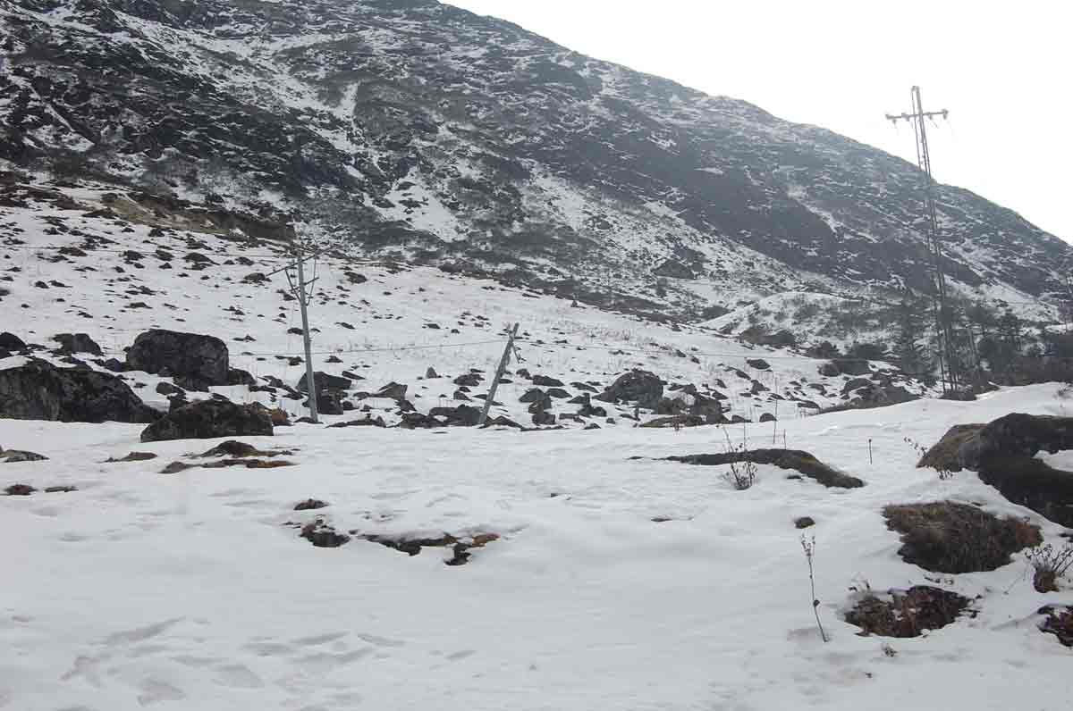
Bumla Pass is located about 37 kms away from Tawang, at the Indo-China border above 16,500 ft above sea level and often covered with heavy snow through out the year. It is one of the most off-beat passes in the world and is also referred to as the pass from where Dalai Lama entered India escaping from Tibet.
The road to Bumla is also a historical route, the Chinese army marched into India during the 1962 Sino-Indian war. In 2006, Bumla pass was re-opened to traders for the first time in 44 years. Traders from both sides of the pass were permitted to enter each other's territories, in addition to postal workers from each country.
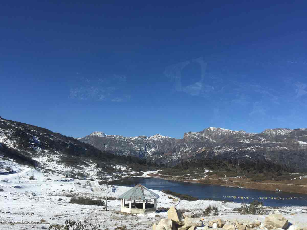
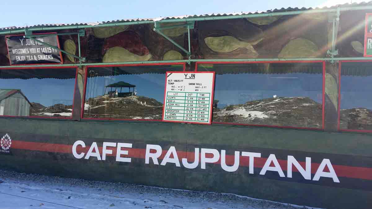
- 09:20 AM | Y Junction
-
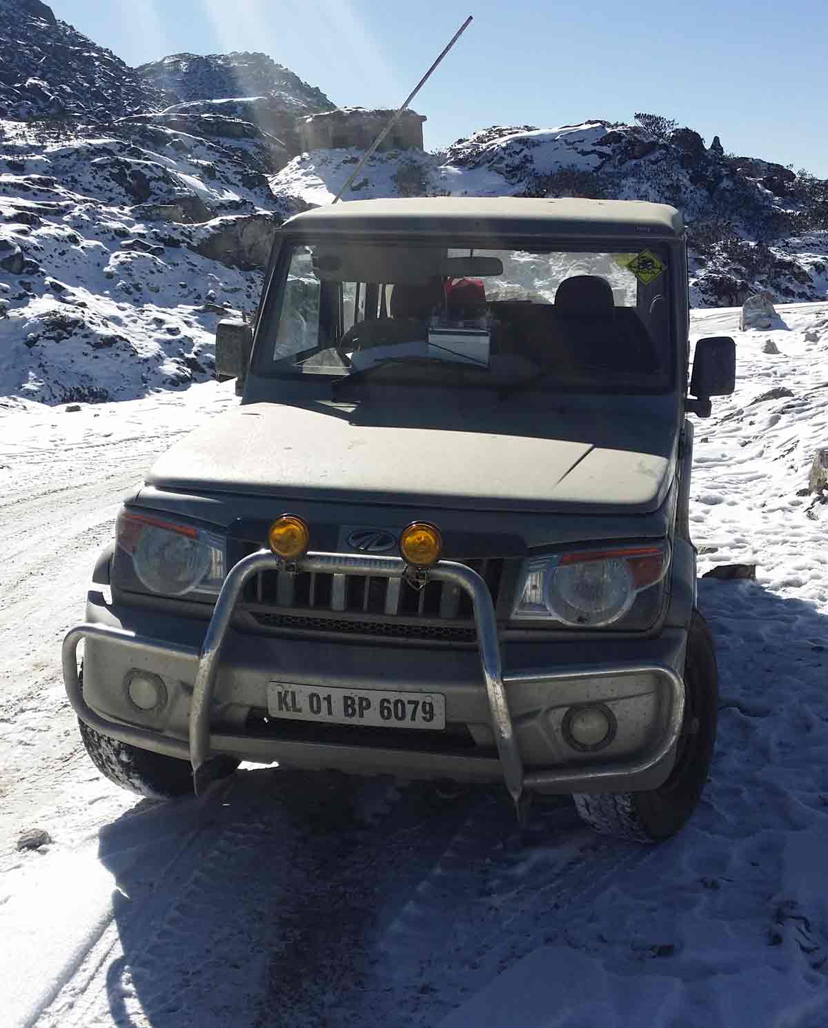
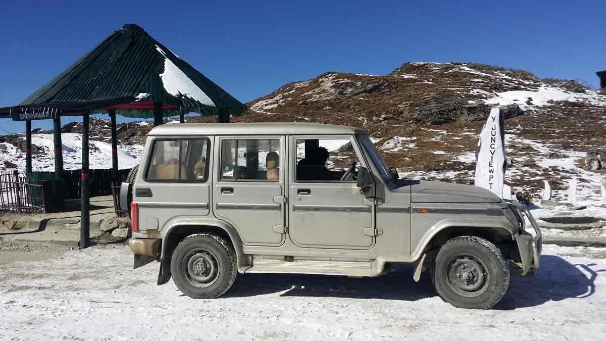
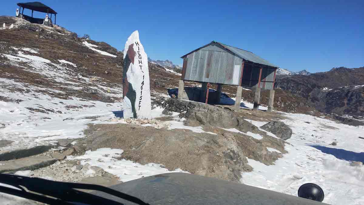
It is a junction from where a major split of the road - road to Bumla pass towards right and road to Shongatser Lake (Madhuri lake) towards left. From Tawang to Y-junction is 22 Kms which is metalled and the rest 15 Kms is graveled which opens for 5-6 months in a year, i.e. June to October and from November to May the road communication is cut off due to heavy snowfall. This road is one of the shortest connectivity points to china from Tawang (India).
Y junction has an altitude of 14615 feet, temperature maximum +10 oC and minimum -14 oC. Maximum snowfall is 6 feet height.
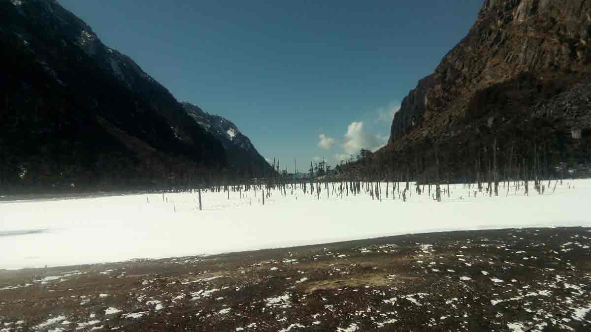
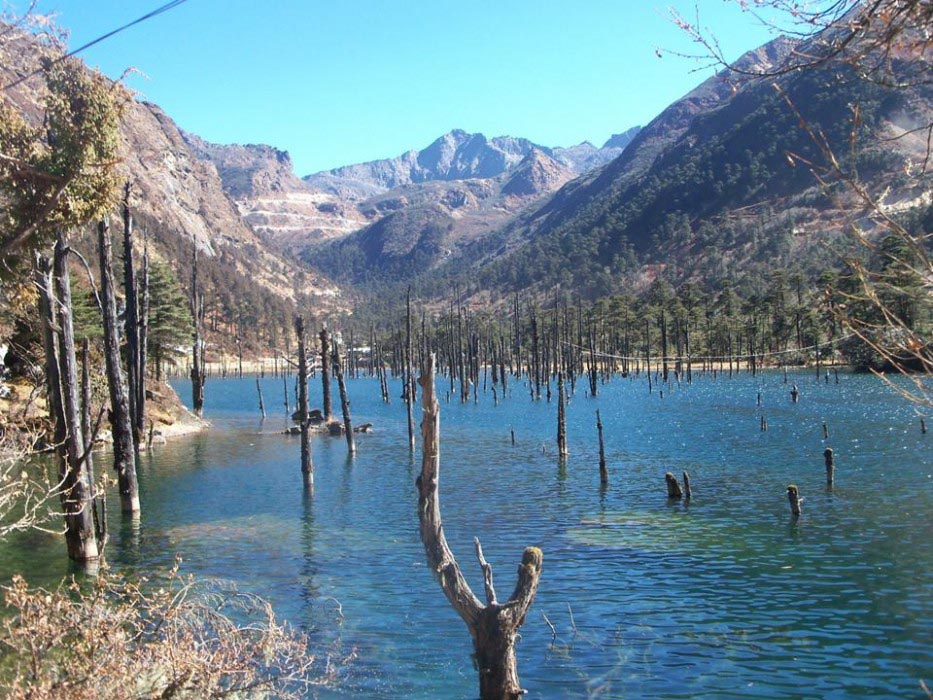
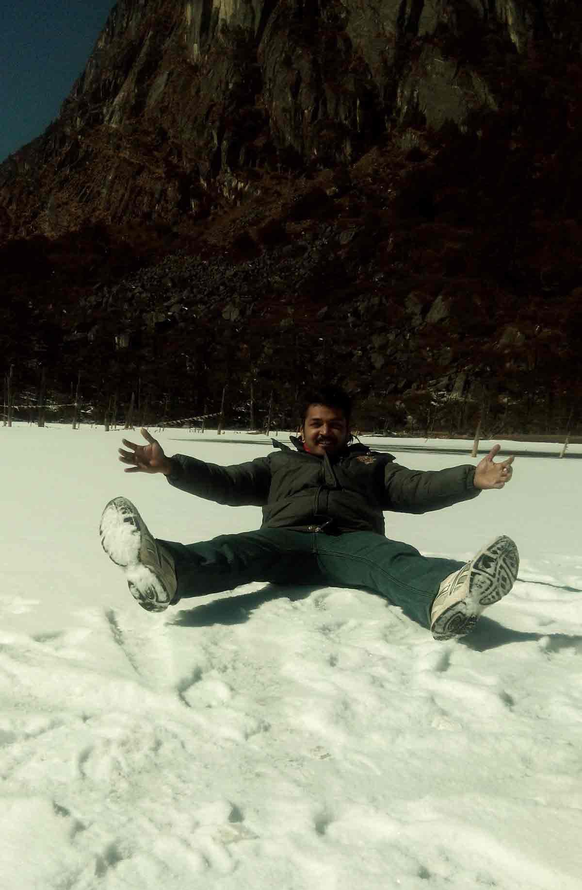
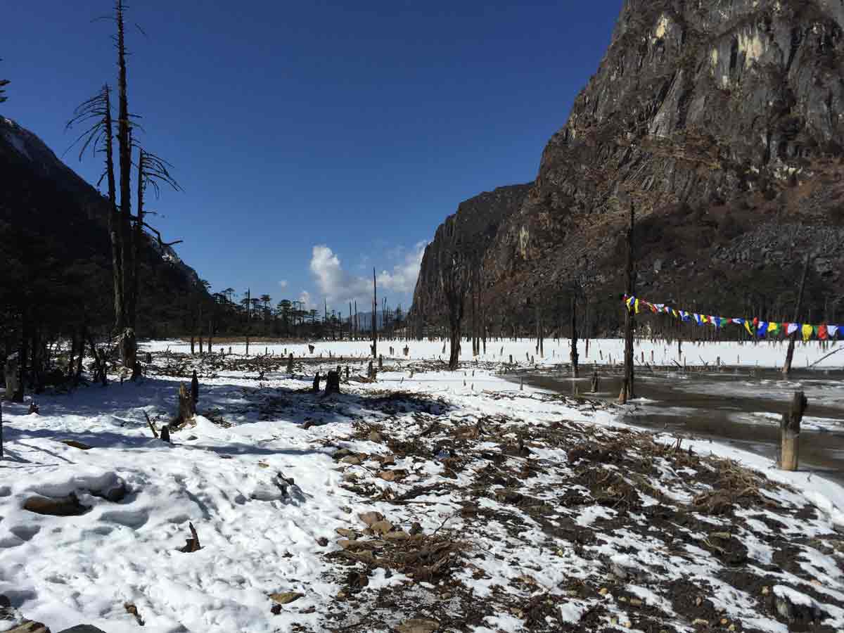
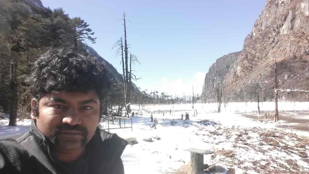
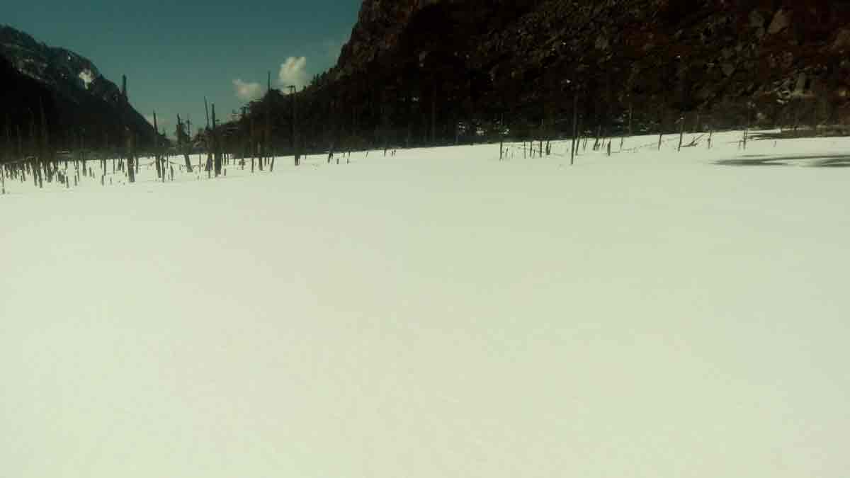
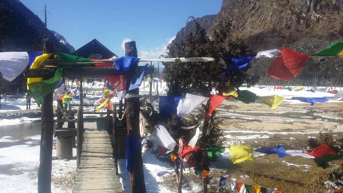
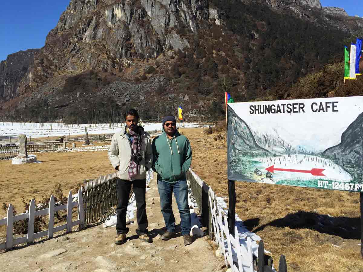
- 10:20 AM | Shongatser Lake (Madhuri lake)
-
When travel further North from Tawang, on the way one will be passing by several lakes each offering its own attraction.The Sangetsar (Shongatser) lake is the last destination. The lake was originally a grazing ground. During 1973 an earthquake occurred which resulted in landslide blocking a stream nearby. As a result the lake was formed. The trees that once stood in the land are all dead but their black trunks coming out of the lake water create a special effect for the beholder. The Sangetsar lake was the sight where Bollywood movie Koyla was shot with famous heroine Madhuri Dixit dancing around the lake. This gave the lake its popular name Madhuri Lake. Source
01 February 2015 | Assam
- Travel Info
-
Our next location was Sikkim, one of the loveliest destination in India. So from Tawang, we drove continuously in the whole night and reached Assam in the morning. Prathush and Dinesh had a different tourist destination - Shillong, Meghalaya. We had our Breakfast from Assam. After a group photo, we said bye bye to Prathush and Dinesh. We resumed our travel to Sikkim.
Prathysh, Rathish, Dinesh, Krishnakumar and Prathap
01 February 2015 | West Bengal
- Some West Bengal Snaps
-
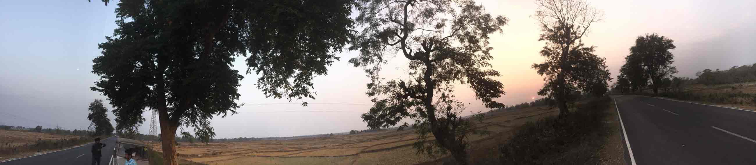
Moon and Sun together - An evening panoramic view from West Bengal
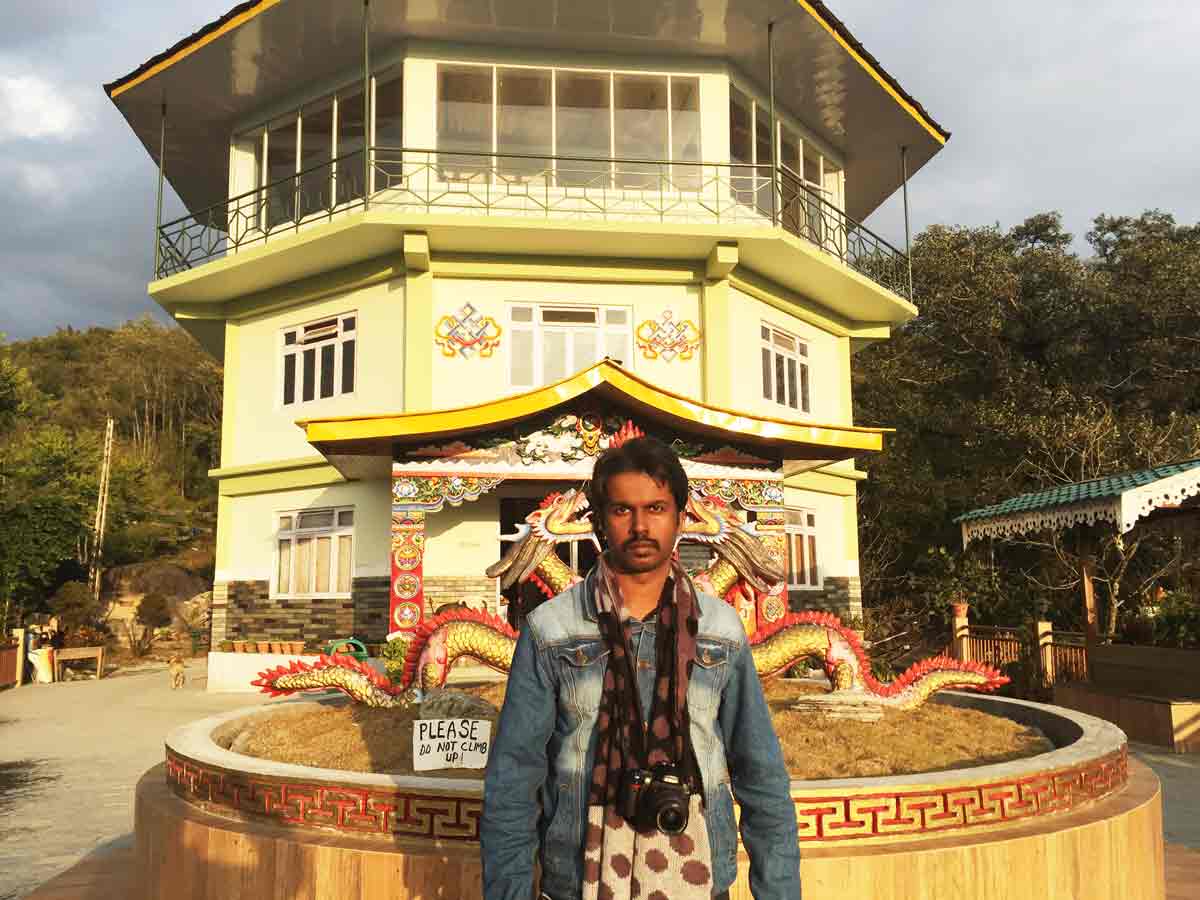
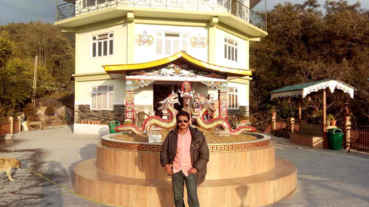
01 February 2015 | Sikkim
- Overview
-
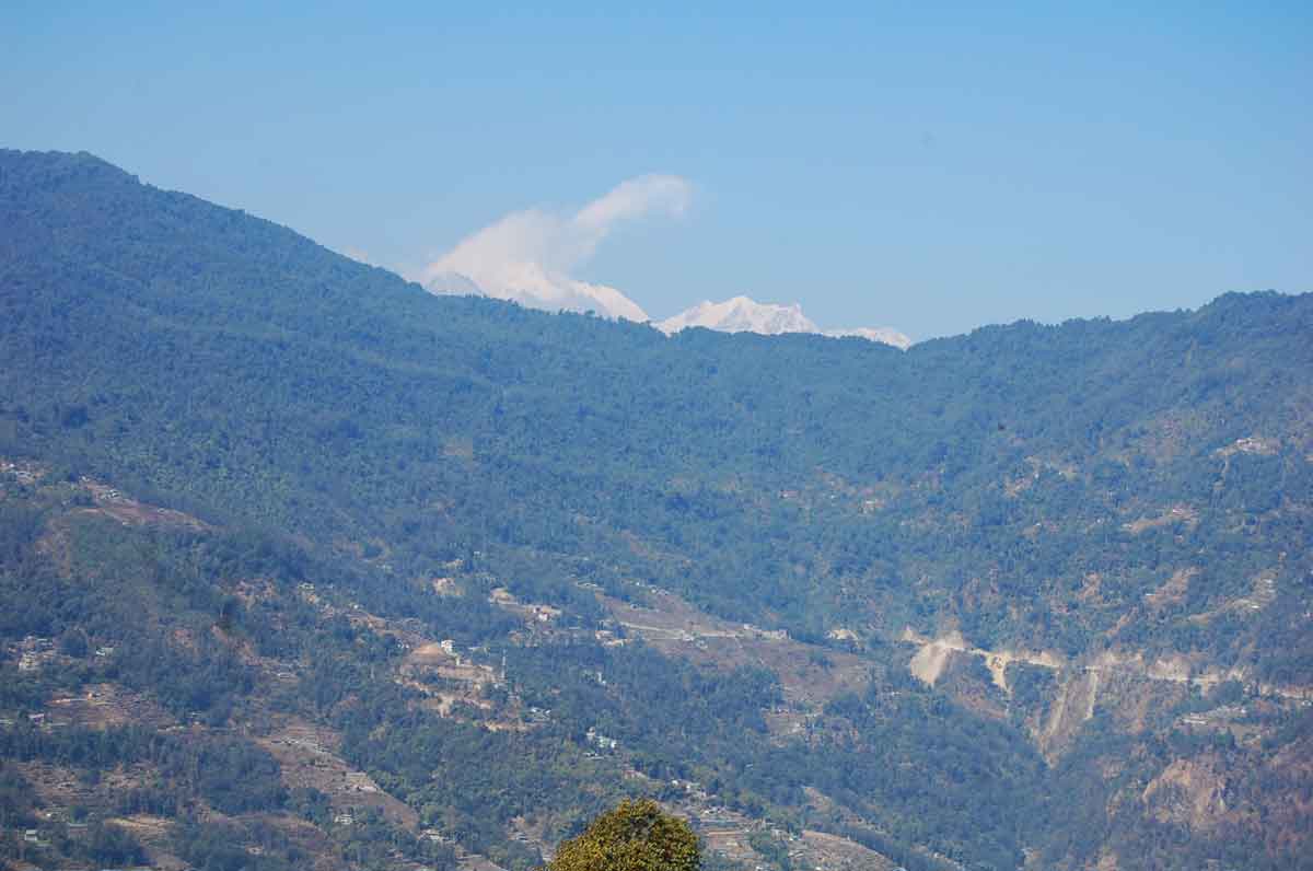
Hailed as one of the world's last utopias by legendary Buddhist guru Padmasambhava, Sikkim is arguably among the loveliest destinations in India. And what variety in such a small state: plunging rhododendron-clad mountain valleys in the north, West Sikkim's atmospheric Buddhist monasteries, monumental religious statues in South Sikkim, and friendly and cheerful urban centres in the east. Then there are stunning views of Khangchendzonga, the world's third-highest mountain (8598m), visible from almost any viewpoint in the state. Little wonder that this tiny former Himalayan kingdom is such a haven for travellers.
A strong preserve of Tibetan Buddhism, Sikkim's public aesthetics are executed in shades of ritualistic vermilion, gold, blue and green, which make striking photo-ops. Throw in yummy local food, exotic Himalayan wildlife, picture-postcard landscapes and some great hikes in the mountains, and have a superb mountain escape on the cards. Read more... - Travel Info
-
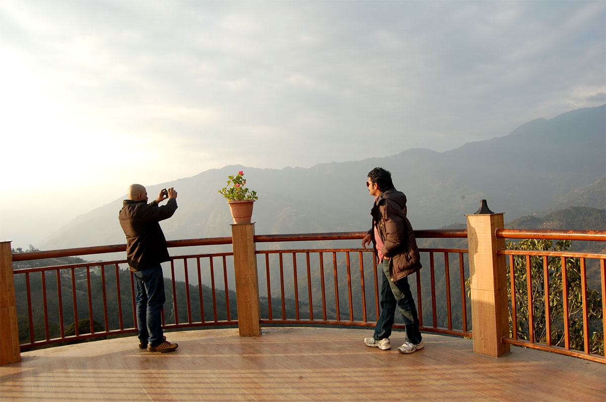
We crossed Sikkim border at around 5.00 PM and for reaching Gangtok, we had to drive nearly 70 KM and it took nearly 2.5 hours to reach Gangtok. The roads where narrow and had good slope, but it was crazy to drive. The river Teesta, which is the lifeline of Sikkim, was a major attraction which flows parallel to the roads in some places. We couldn't get the correct view of the river as it was a night drive. We took a room at Gangtok near M.G Marg and parked our vehicle near Sikkim Legislative Assembly building. A good viewpoint of Kanchenjunga was available at that location in day time. The Gangtok Rope Way was one side of the Assembly Building.
Map of Sikkim and the path we travelled
02 February 2015 | Sikkim
- Travel Info
-
We had to arrange entry permit to visit Changu Lake and Nathula pass. Nathula is open for Indian nationals on Wednesday, Thursday, Friday, Saturday and Sundays. The visitors have to get the permit to visit the place by applying to the Tourism and Civil Aviation Department through a registered Travel Agency. But we got the permit without the help of a Registered Travel Agency.
Steps to get Nathu La Pass Permit
1) Reach Sikkim Tourist Office at M.G Marg, Gangtok (Lat : 27.330039N, Long: 88.612400E), which is the extreme end of MG Marg.
2) From M.G Marg, Step down towards NH 31A using stairs available in the outer right side of the Tourist Office.
3) There you can see police office with a counter.
4) Fill the application and take its Xerox.
5) Pin each member's photograph one by one in the top of both form.
6) With ID proof of each member, give it to the counter and pay the fees.
7) The Permit is ready!!Our Jeep already run more than 5000KM. So periodical service was necessary. We went to a Mahindra servicing Centre at Gangtok. Nearly 3.00 PM, we got the vehicle serviced. We reduced our travel destination to two places at that day - Tashi View Point and MG Marg.
- 04:30 PM | Tashi View Point
-
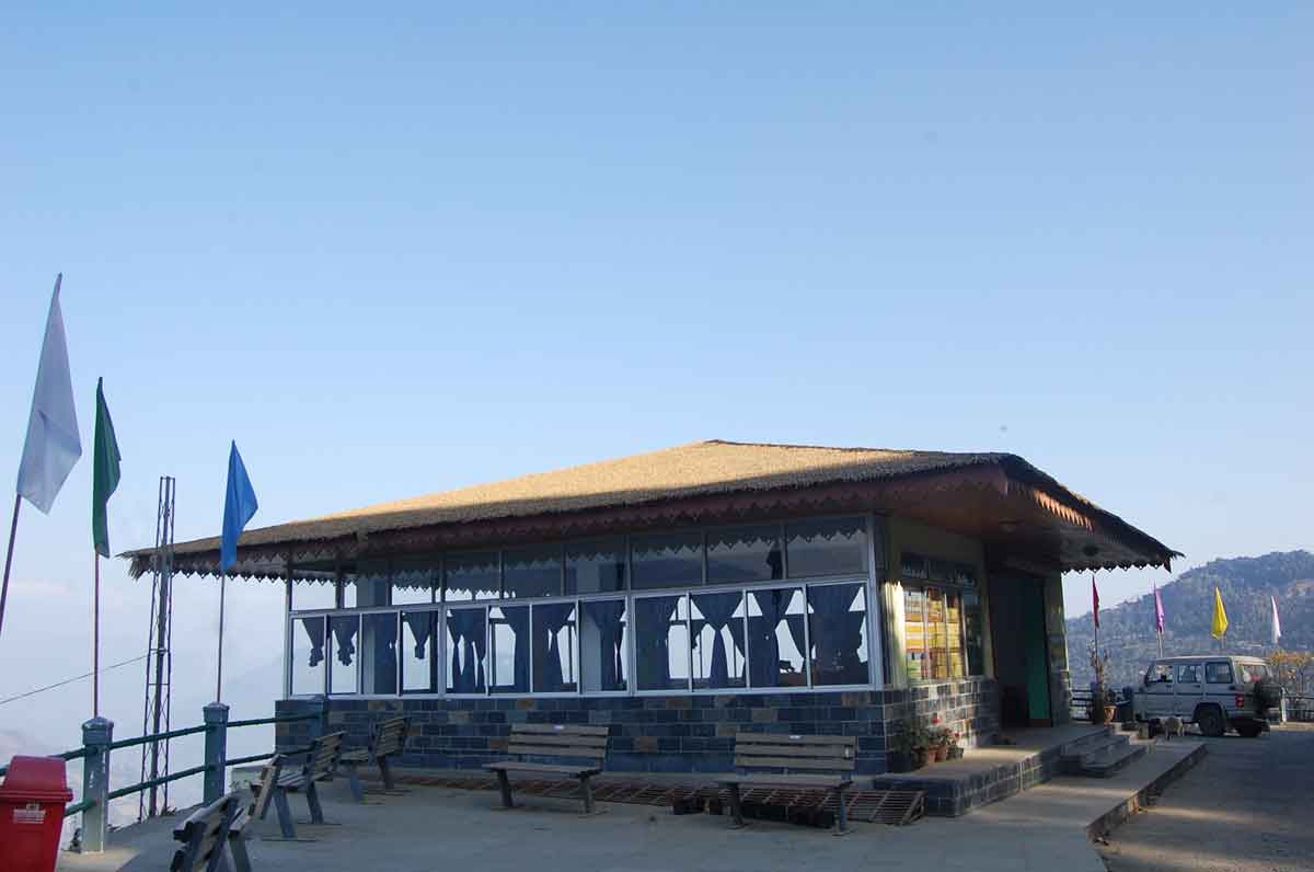
It's located in Tashi and about 8 KMs from Gangtok town. It offers a sweeping view of Kanchenjunga snow peaks on a clear day. In fact the view of sunrise from here is unforgettable and can see the peaks dazzling with changing colors. But for that one must reach the point before 5 AM. In the opposite mountains, one can see the Phodong and Labrang monasteries. From the road level, need to climb steep flights of stairs to reach up to the circular viewing area. It can easily accommodate about 15-20 persons. There is no admission fee. However one can pay INR 10 to get closer view of the peaks through a binocular and telescope mounted here. The forests in the opposite mountains look so close. There is a resting shed here as well as a shop offering tea, coffee, snacks as well as gift & souvenir items. Prices are reasonable.
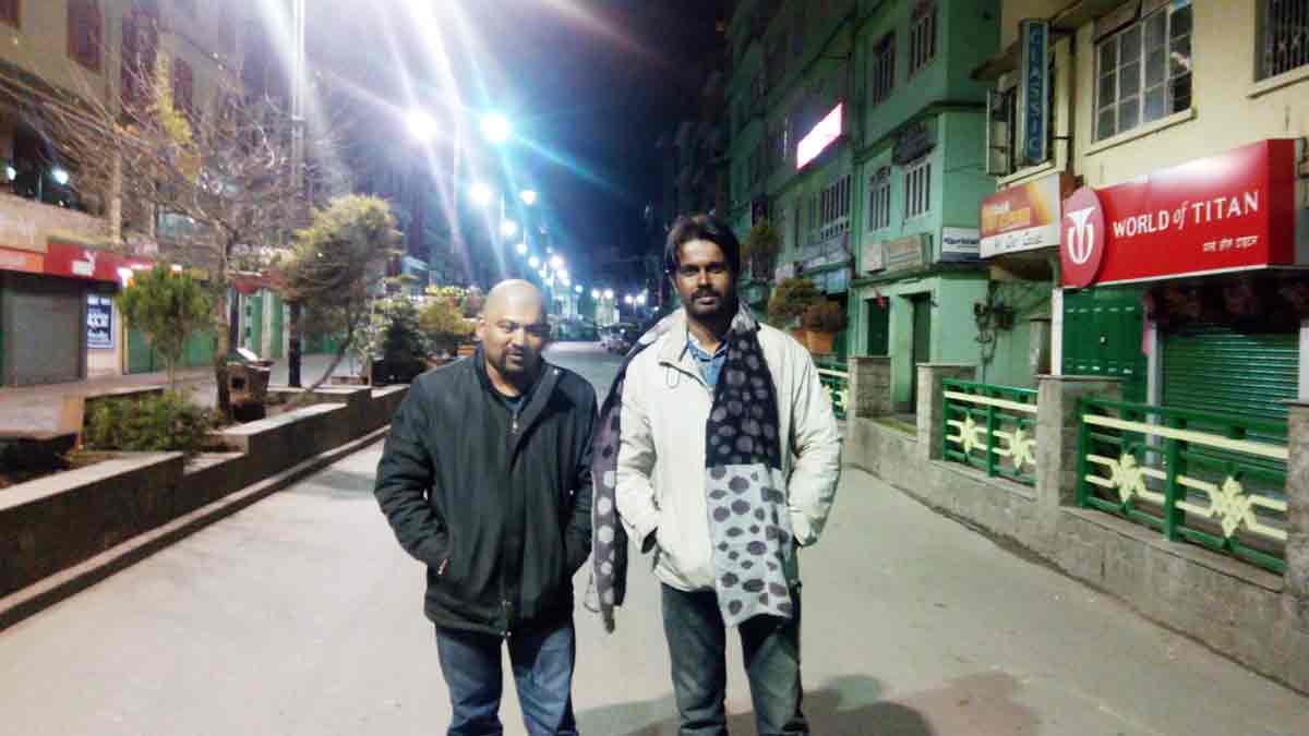
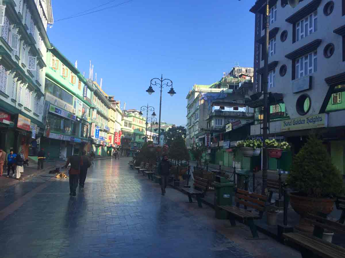
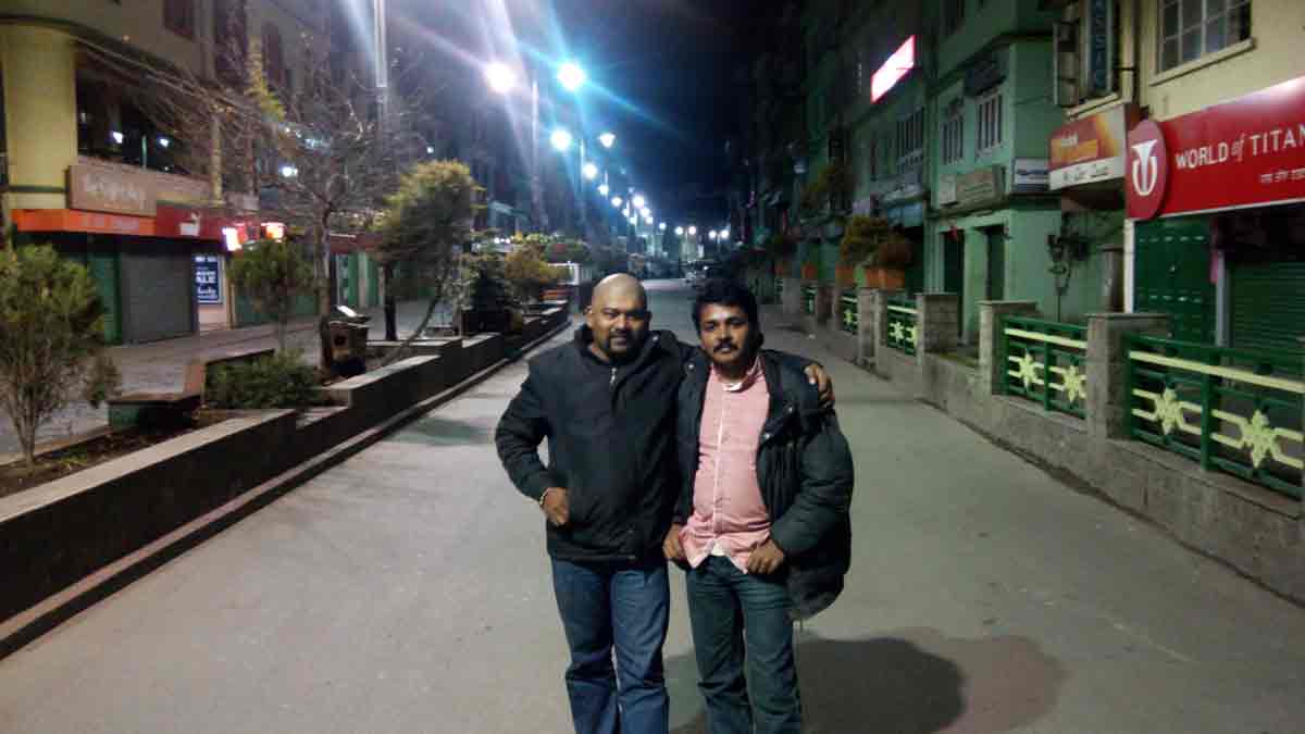
- 09:00 PM | MG Marg
-
M.G. Marg (Mahatma Gandhi Marg or Road), the main street of Gangtok town is a great place to chill out in the evenings. The country's first litter and spit free zone, no vehicular traffic is allowed into the Marg. You can sit at the Titanic Park and listen to the piped in music played for the listening pleasure of visitors or just walk down the Mall and take in the carnival like atmosphere, especially during the tourist season.
The Mall is lined with shops on both sides of the road so shopping becomes an added pleasure. M.G. Marg is also the venue for the annual Gangtok Food and Culture festival held in December each year when Sikkim's multi-cultural cuisines, along with music and dance performances are showcased. This event attracts a large number of locals and tourists each year.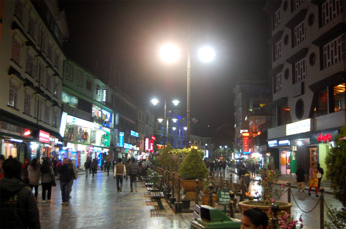
- Some Snaps
-
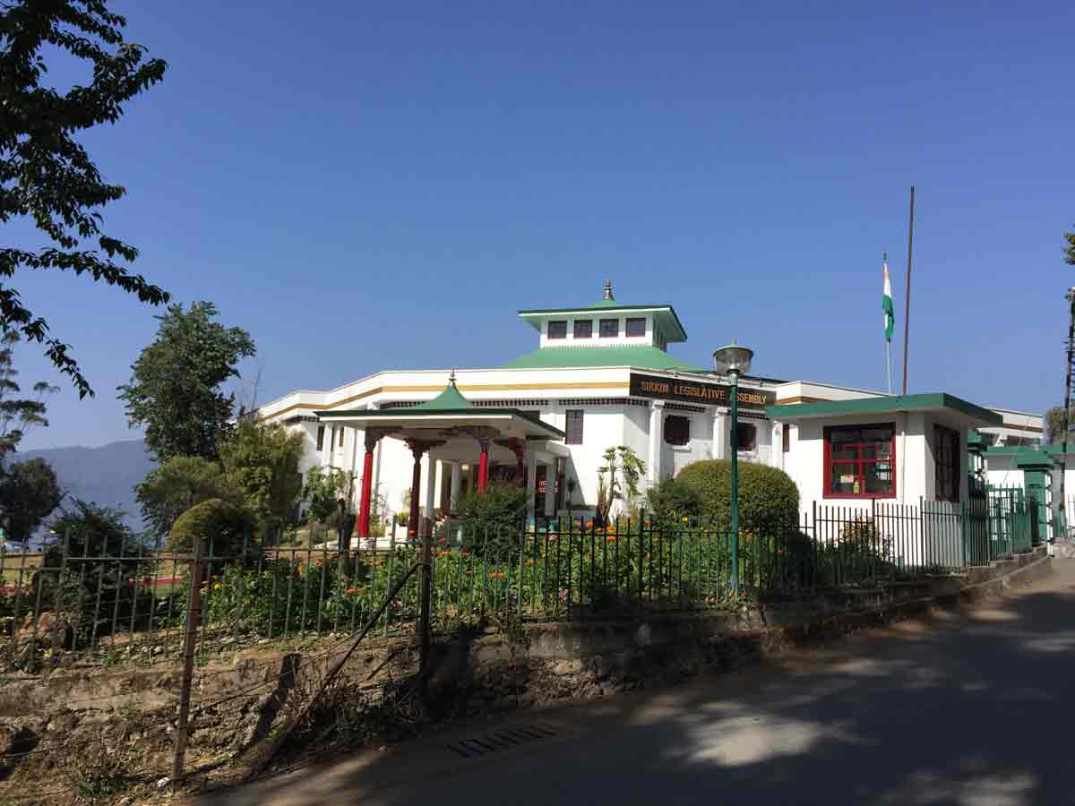
Sikkim Legislative Assembly
Kanchenjunga View - From Sikkim Legislative Assembly
03 February 2015 | Sikkim
- Travel Info
-
We started our travel early in the morning after vacating the room. The day was so important as two important destination we had to cover - Changu Lake and Nathula Pass. Nathula is on Gangtok-Nathula Highway. Only Jeep or SUV type vehicles (like Bolero, Scorpio etc) should be taken to approach Nathula. The paths were snow covered.
Check post to Nathula Pass - 08:20 PM | Changu Lake or Tsomgo Lake
-
This is a beautiful glacial lake perched within mountains at an altitude of 12,400 feet located at Gangtok - Nathula Highway, only 37 KMs from Gangtok, the Changu Lake is one of the most spectacular landscapes of Sikkim. The lake is highly revered by the local Buddhists and Hindus as a sacred lake. With a depth of around 48 feet and spreading over 1 kilometre, the magnificent Changu Lake romances with its picturesque surrounding. The water of the lake comes from the melting of the snow of its surrounding mountains, which is why, this lake never dries up. In fact, Changu Lake is also the place of origin of Lungtse Chu River. This azure blue lake remains completely frozen during winter.
- 09:00 PM | Nathu La pass
-
Located at an altitude of 14,140 feet and 52KMs from Gangtok, Nathula Pass was the place through which the famous Silk Route used to operate until 1962. This used to be a trade route between India and Tibet. Lines of mules used to carry silk, gold and many other items from Tibet to India and take daily essentials back to Tibet. The route in Tibet goes down the Chumbi Valley to Yathung, a place about 30kms away which used to be once a major trading township (no longer so). In fact on a clear day you can see this route winding down the valley. If you look at the eastern horizon, you can see the magnificent peak of Chomolhari of Bhutan.
The fenced Indo-China border is also few meters away and you can see both Indian and Chinese soldiers guarding the border. The guards are friendly. A stairway leads to the border. There is no 'no mans land' here. Even today, mails are delivered across the border on certain days of the week. There is an engraved stone here called Nehru Stone which marks the visit of former Prime Minister of India Jawaharlal Nehru who visited in 1958. Read more...
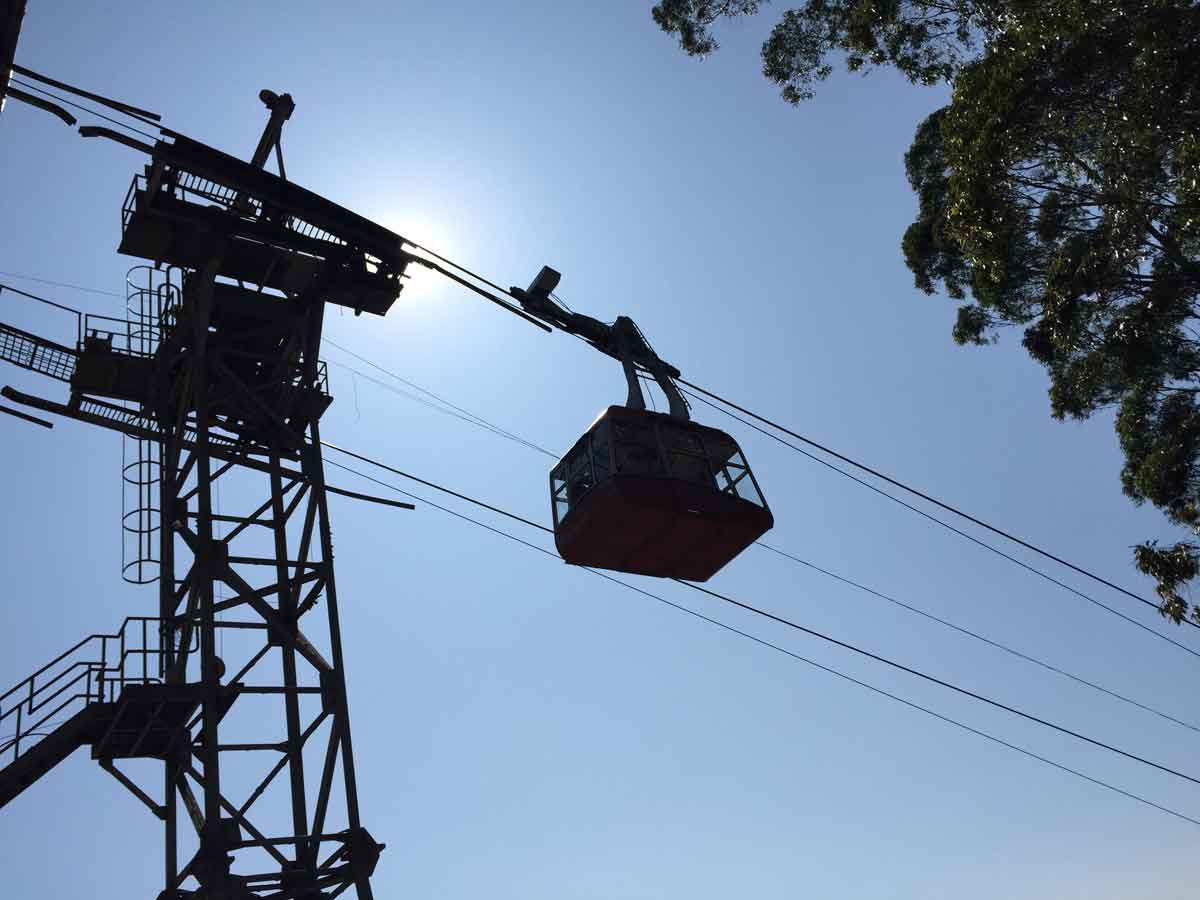
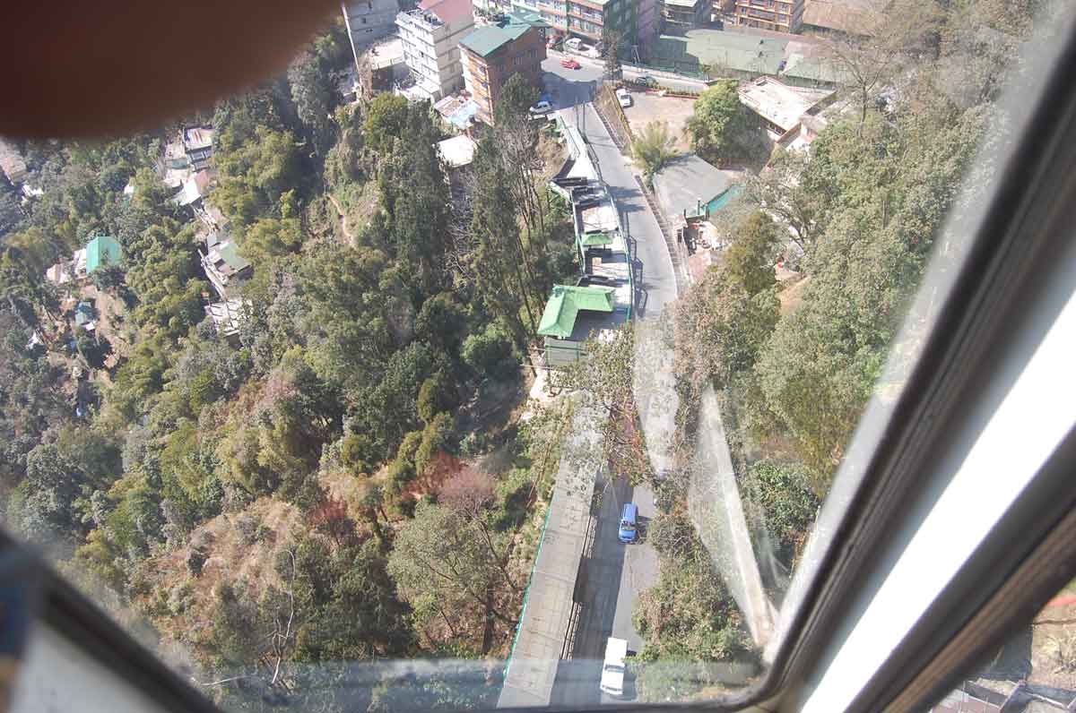
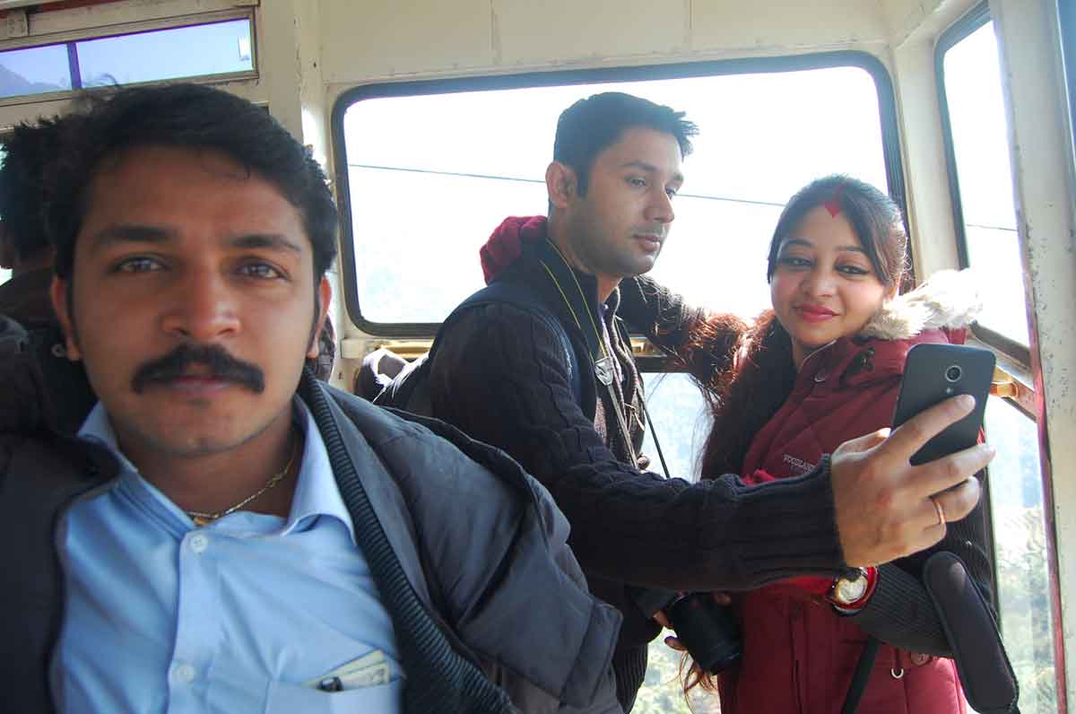
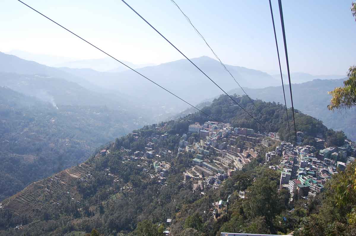
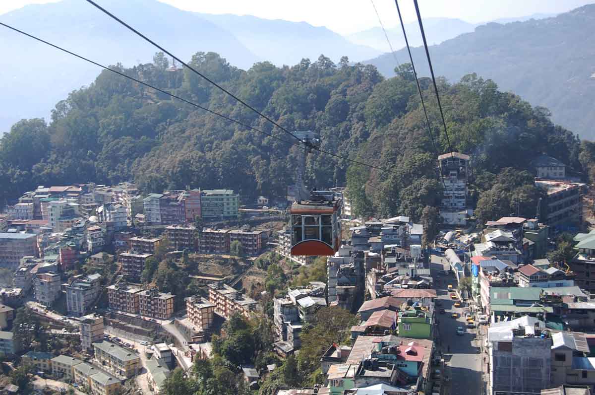
- 11:20 PM | Gangtok Ropeway
-
This is one of the greatest attractions in Gangtok and should not be missed. It's a double-cable zig back ropeway which is operational since December 2003. Each cable car can carry up to 24 passengers. They do not always wait until the cable car is full. But during high tourist season, there are usually long queues and each ride gets full before it starts. And if it gets full, it is struggle to get a vantage point inside the cable car unless you are one of the first to get in.
There are no seats in the cable car, so all persons need to stand. The next station is Namnang and the top most station is in Tashiling next to the Secretariat. The ticket price includes two-way ride and will get awesome views both ways. One way ride takes about 10 minutes. Read more...
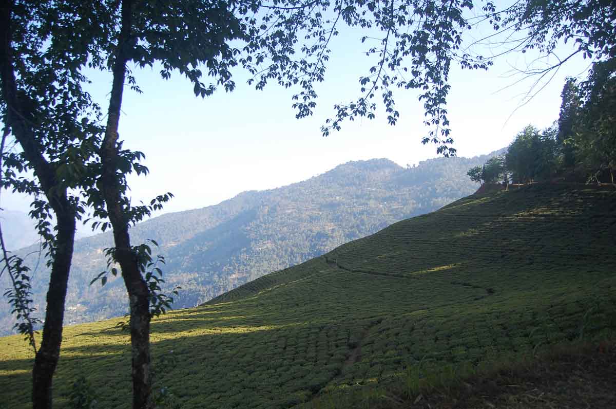
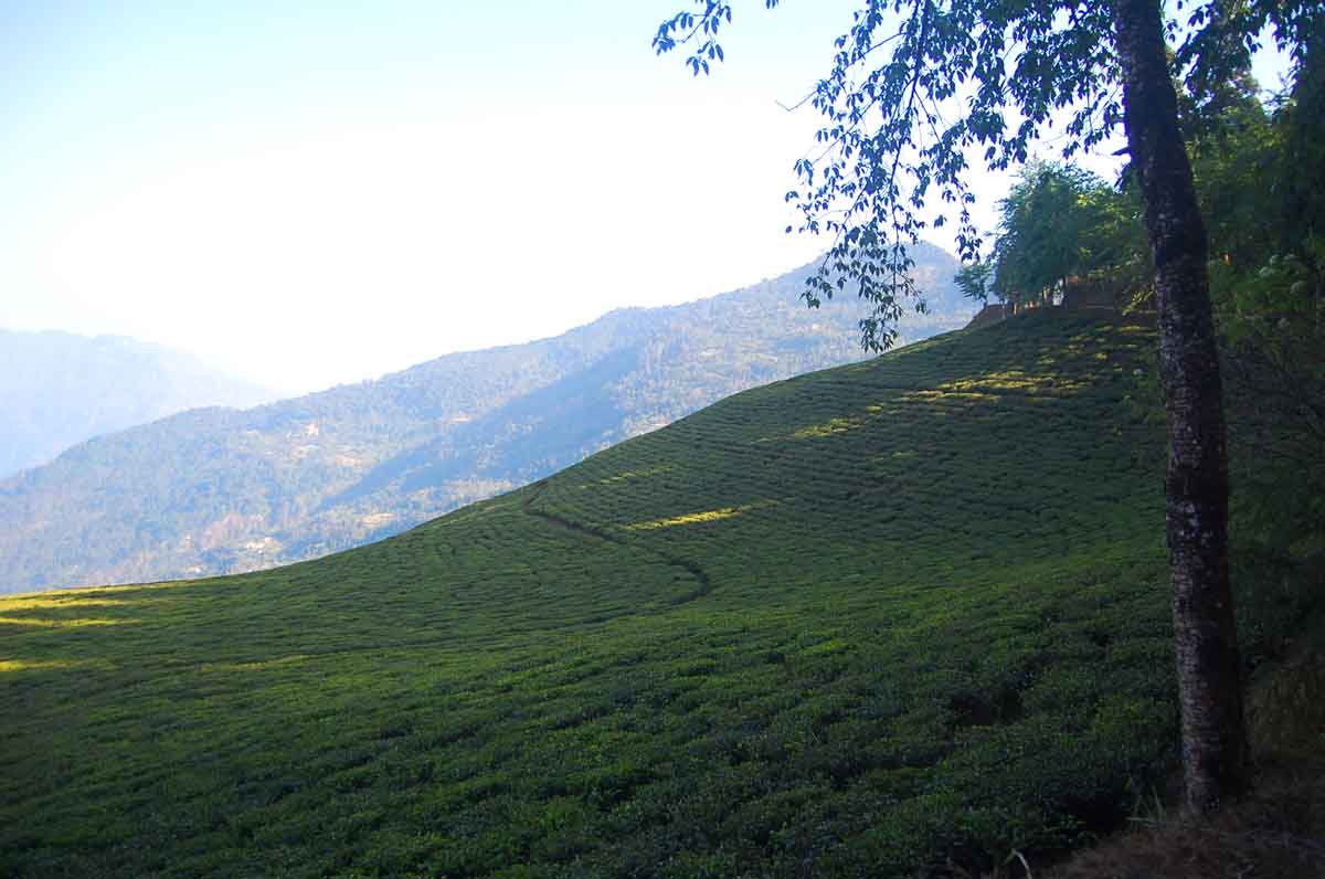
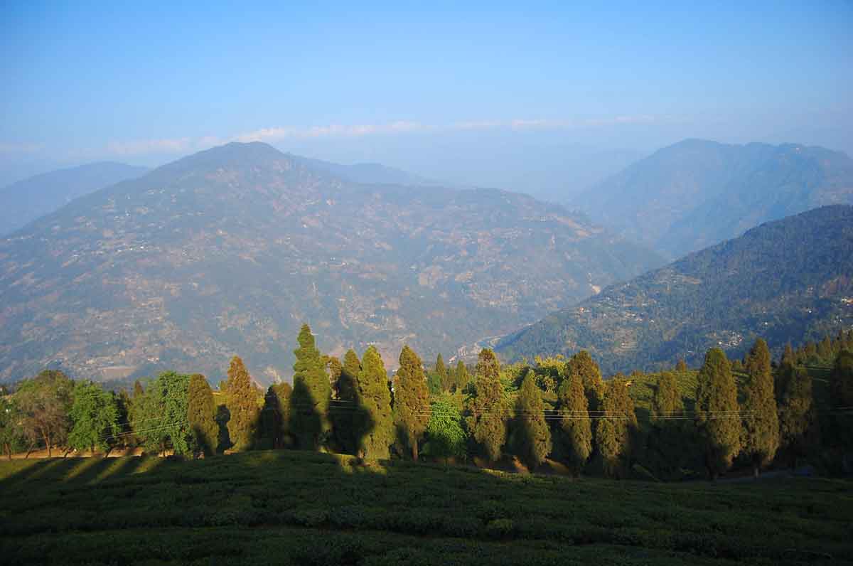
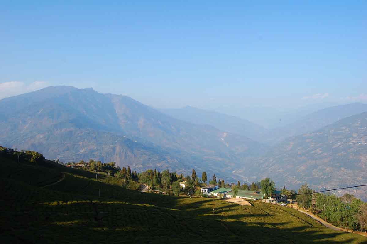
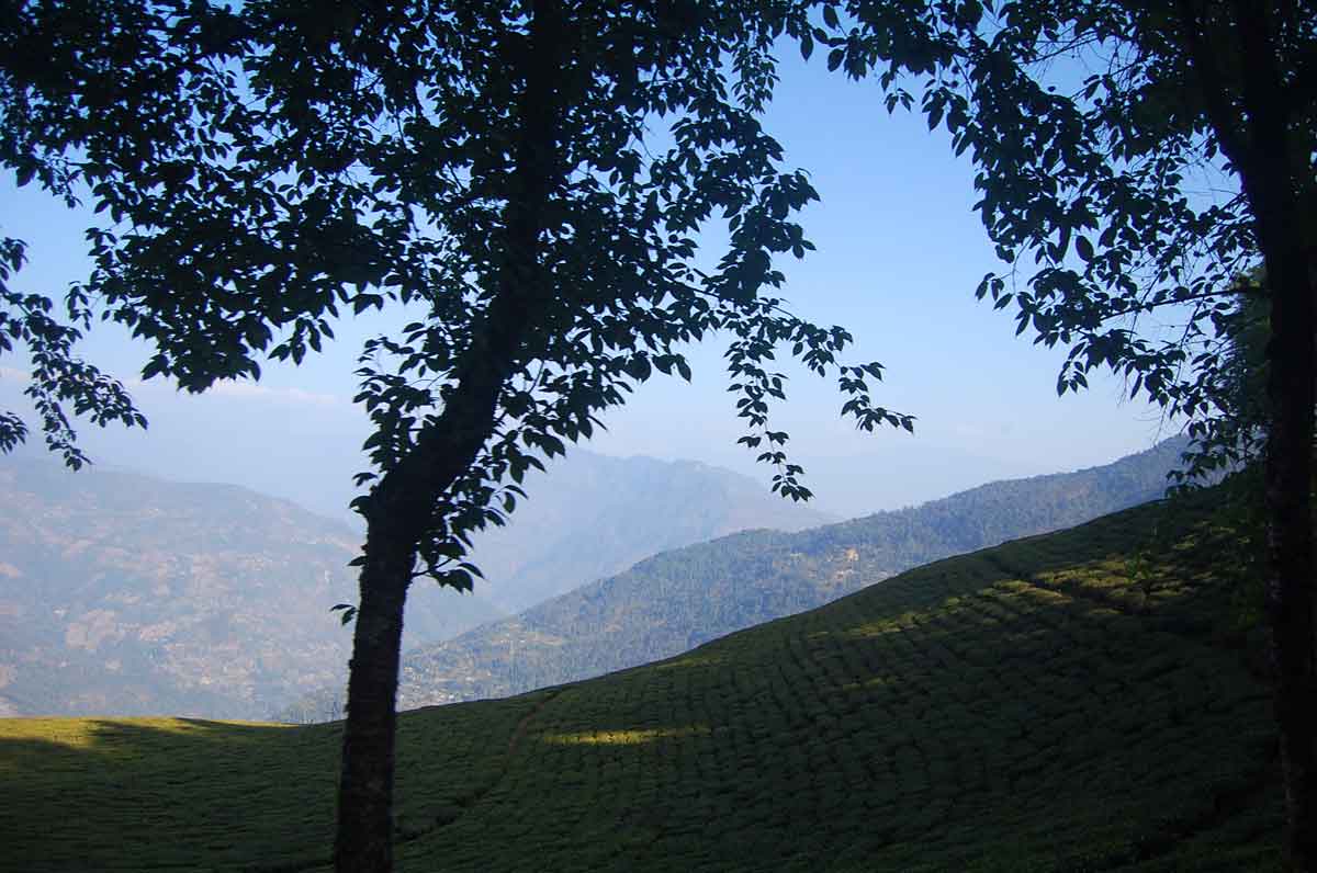
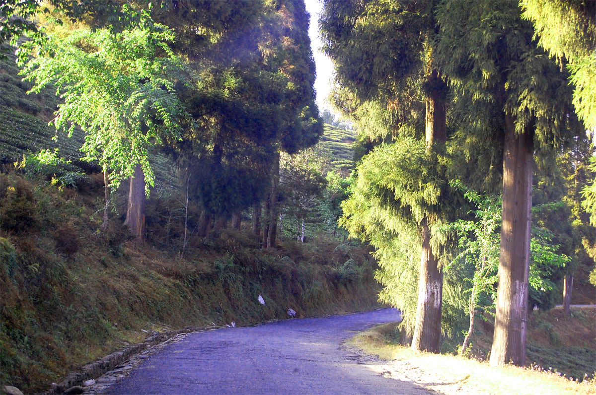
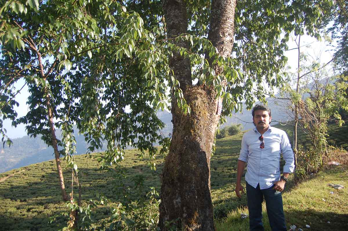
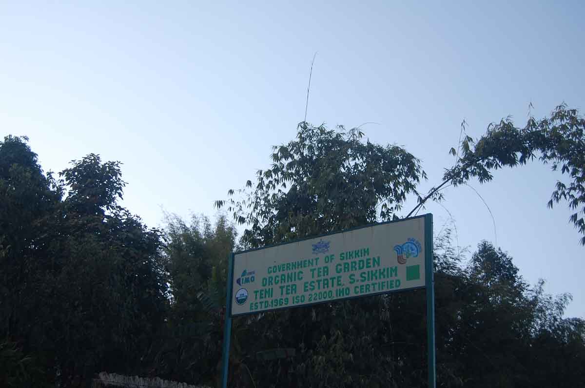
- 03:30 PM | Temi Organic Tea Garden
-
Amidst the backdrop of picturesque and mighty Mt. Khanchan Dzonga refreshed by the gentle breeze of river Teesta brews the morning sip of Sikkim -the Temi tea. Spread over 180 hectares of gentle slope with altitude ranging from 4500 to 6316 feet, the Temi tea garden produces one of the finest orthodox tea that promises the appreciation of tea connoisseur.
The Temi Tea estate was established in 1969 during the erstwhile regime of Chogyal and the commercial production started in the year 1977. In the year 1974 Tea board was formed to govern the day to day functioning of the estate and later it went on to become the subsidiary of Industries Department under Sikkim government. Temi Tea which apart from providing direct employment to over four hundred labors and thirty personnel, also is a major employer in the Government sector.
The gentle slopes that originate from the Tendong hill range has loamy soils condition with slope of 30-50% that suits best for tea plantation and produces nearly 100 tons of tea annually. Although the quantity of produce may seem insignificant in terms of major tea producing estates, the quality and the flavor it produces has been able to win the heart of tea aficionados within India and the world. Read more...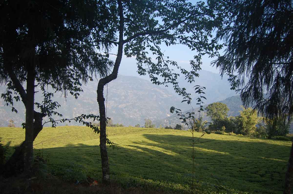
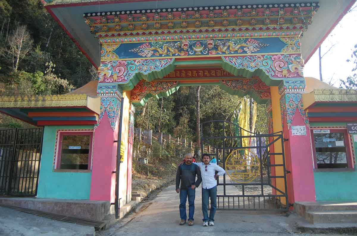
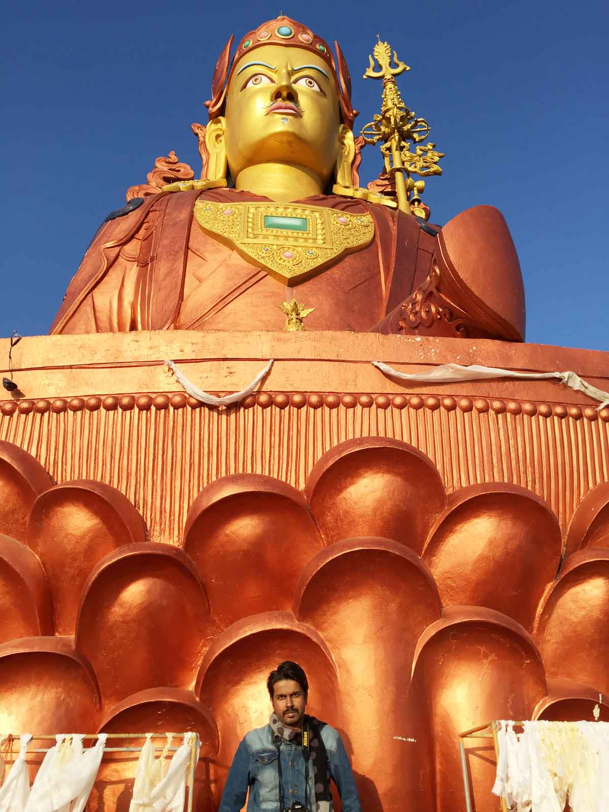
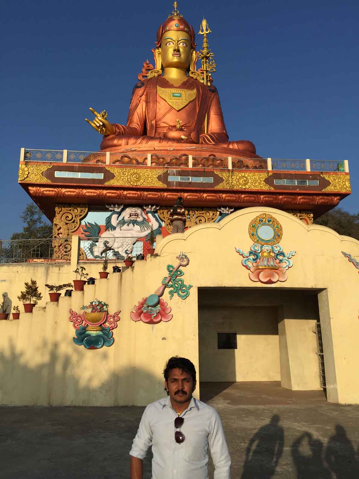
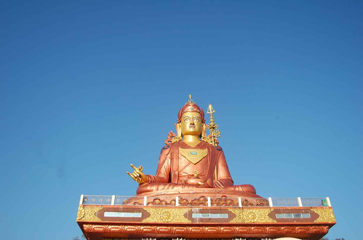
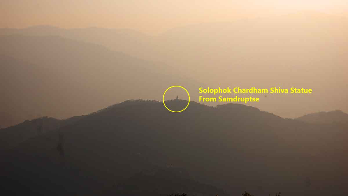
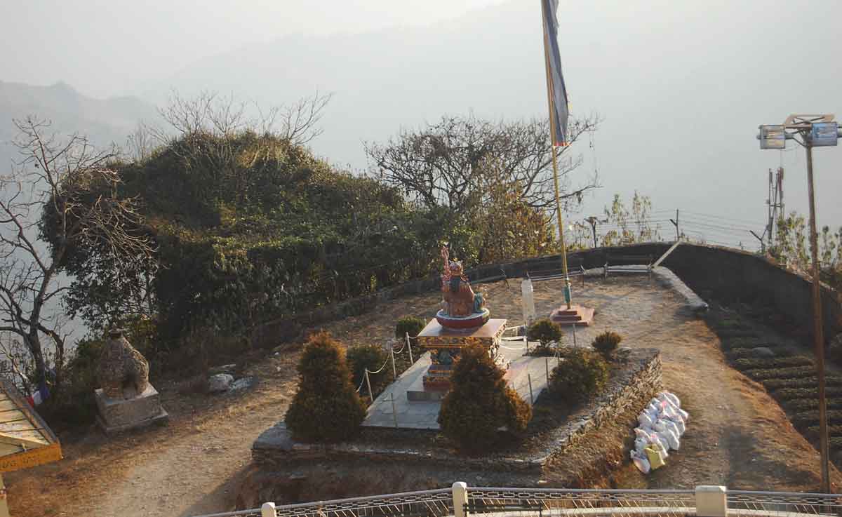
- 04:18 PM | Samdruptse
-
Painted in shimmering copper, pink and bronze, the 45m-high statue of Guru Padmasambhava lords over the forested Samdruptse ridge and is visible for miles around. Completed in 2004 on a foundation stone laid by the Dalai Lama, the statue of the hallowed Buddhist leader sits atop a giant lotus plinth and makes for a striking photo-op. Within the complex, there's a permanent photo exhibition of archival images documenting Sikkim's cultural, natural and artistic history.
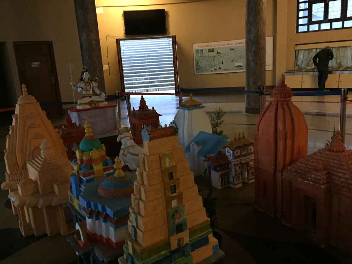
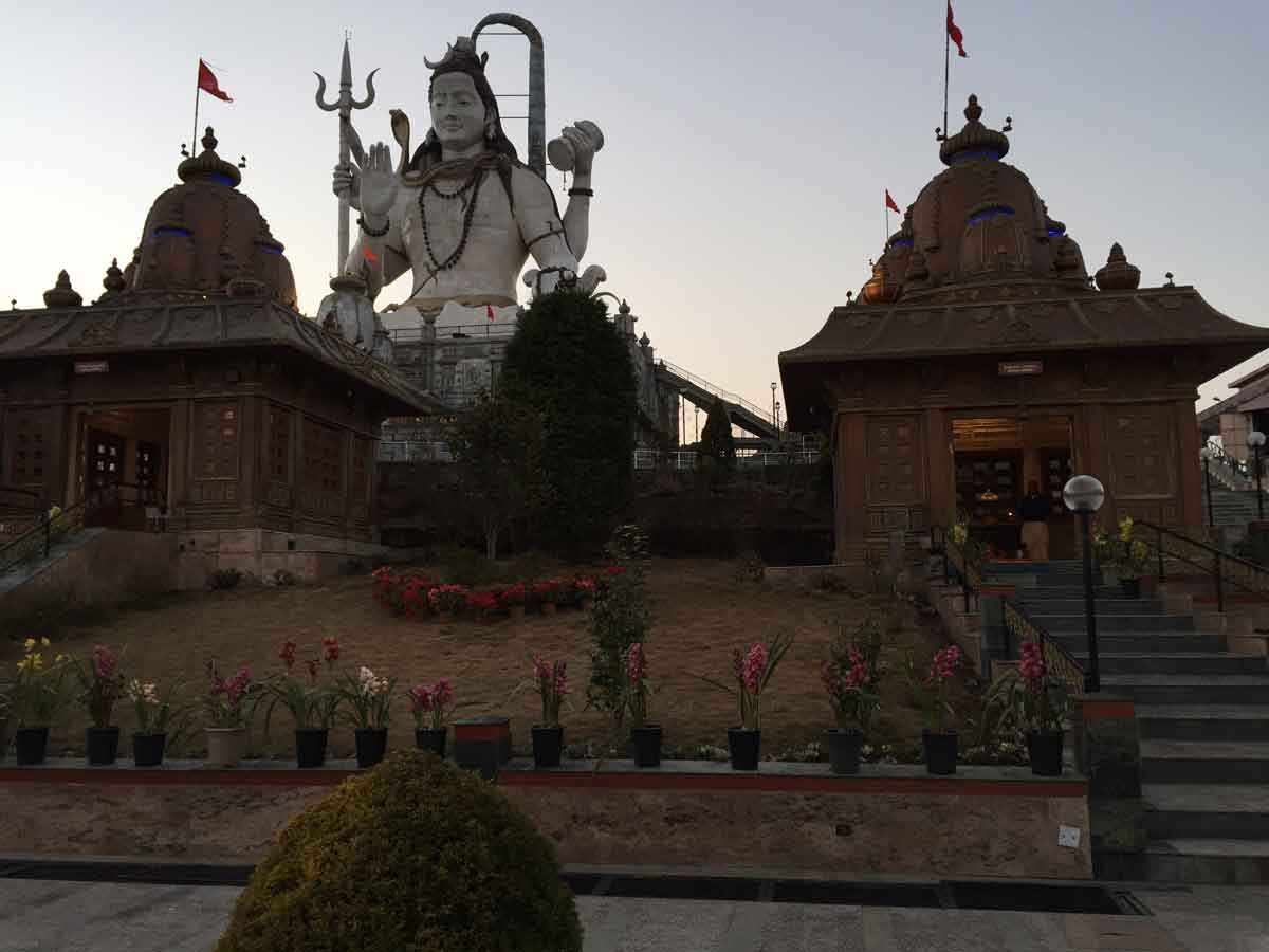
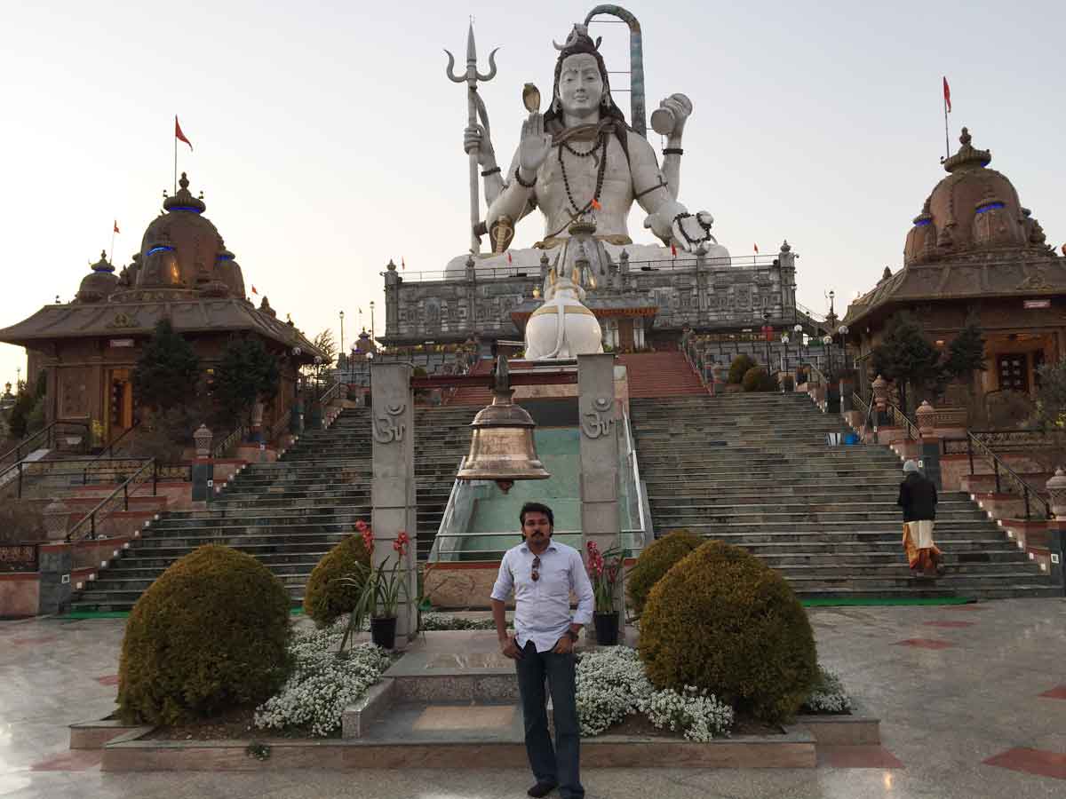
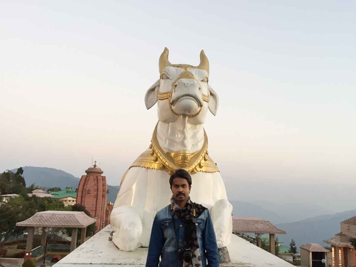
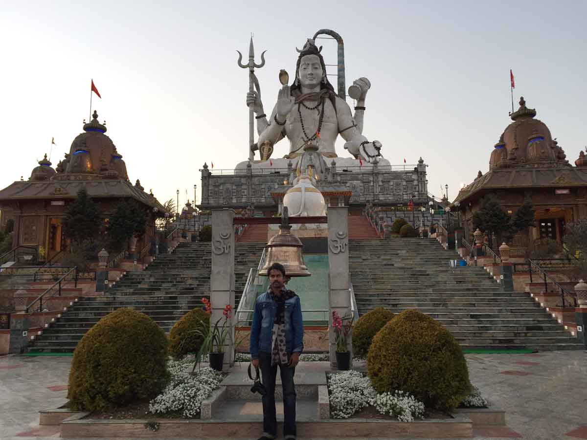
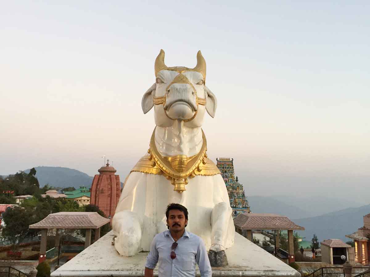
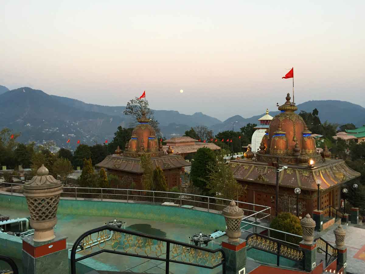
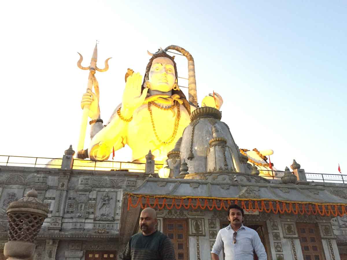
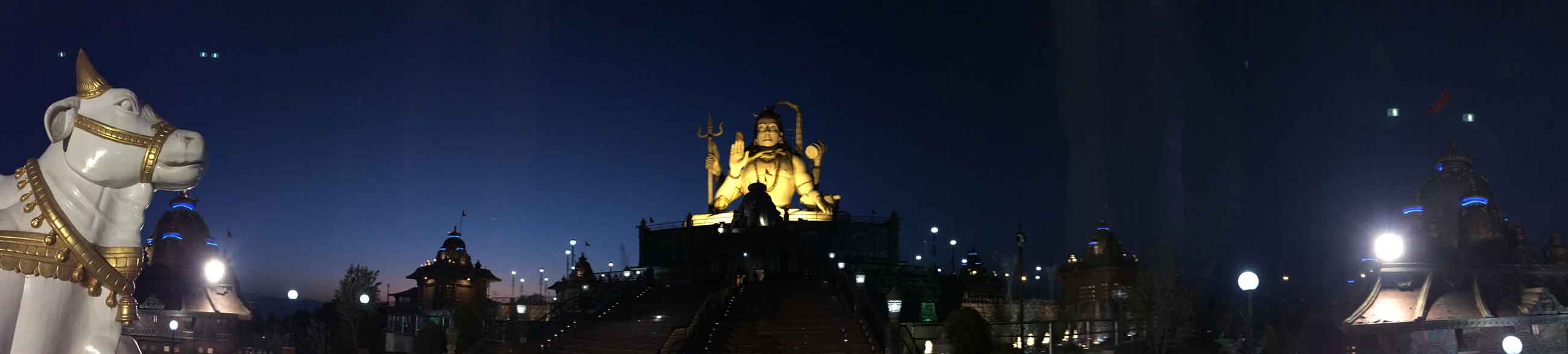
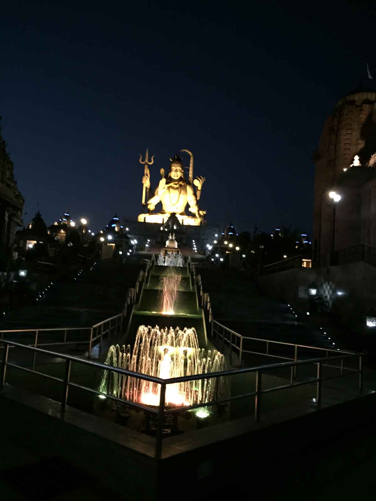
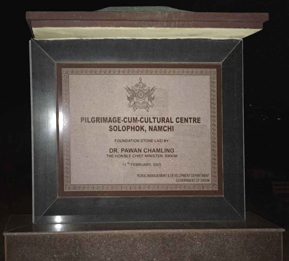
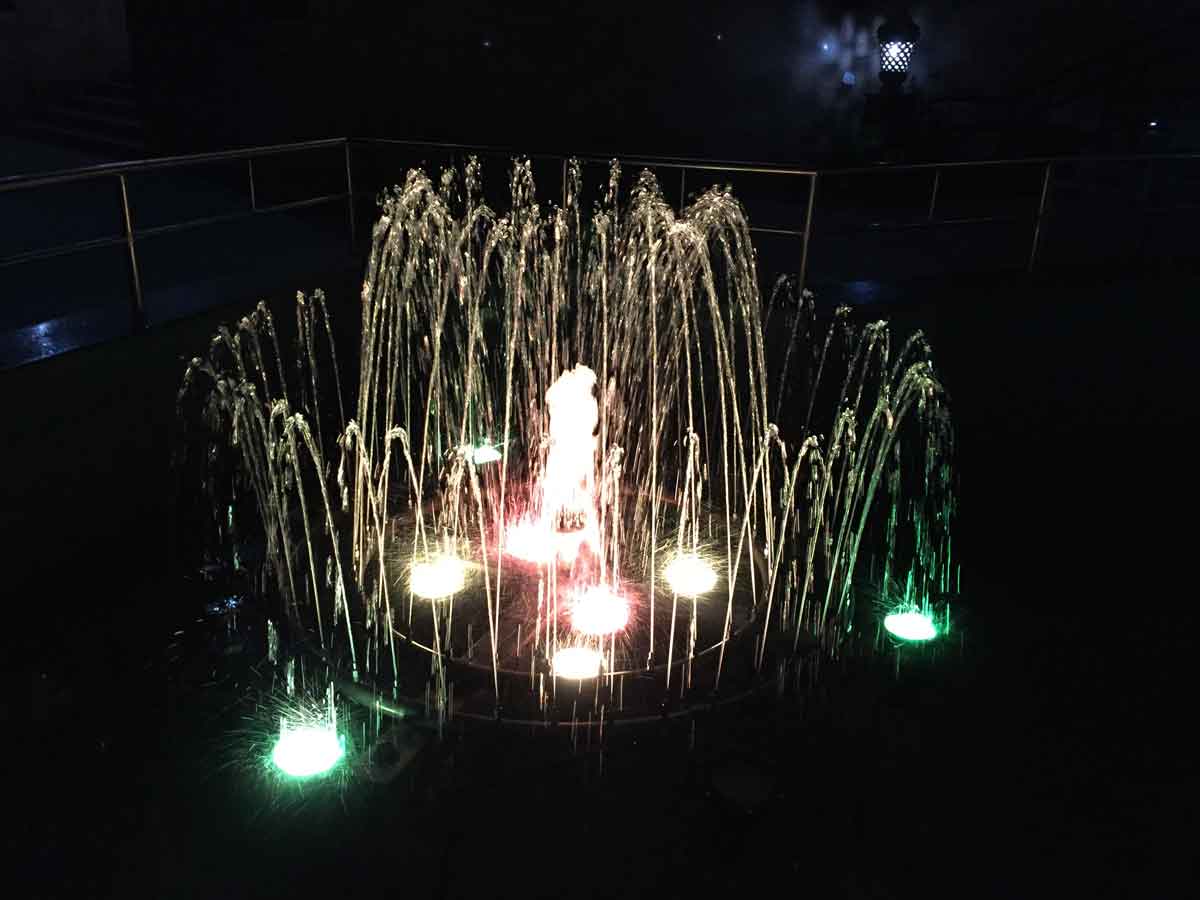
- 05:10 PM | Char Dham, Solophok
-
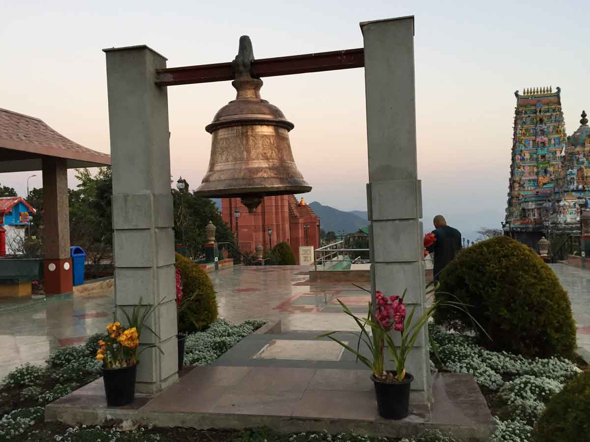
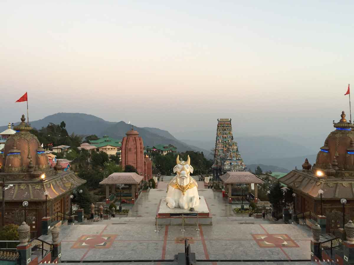
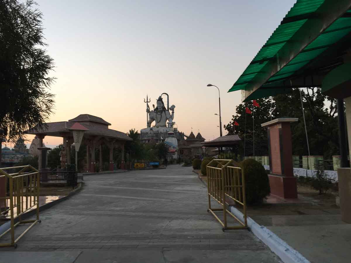
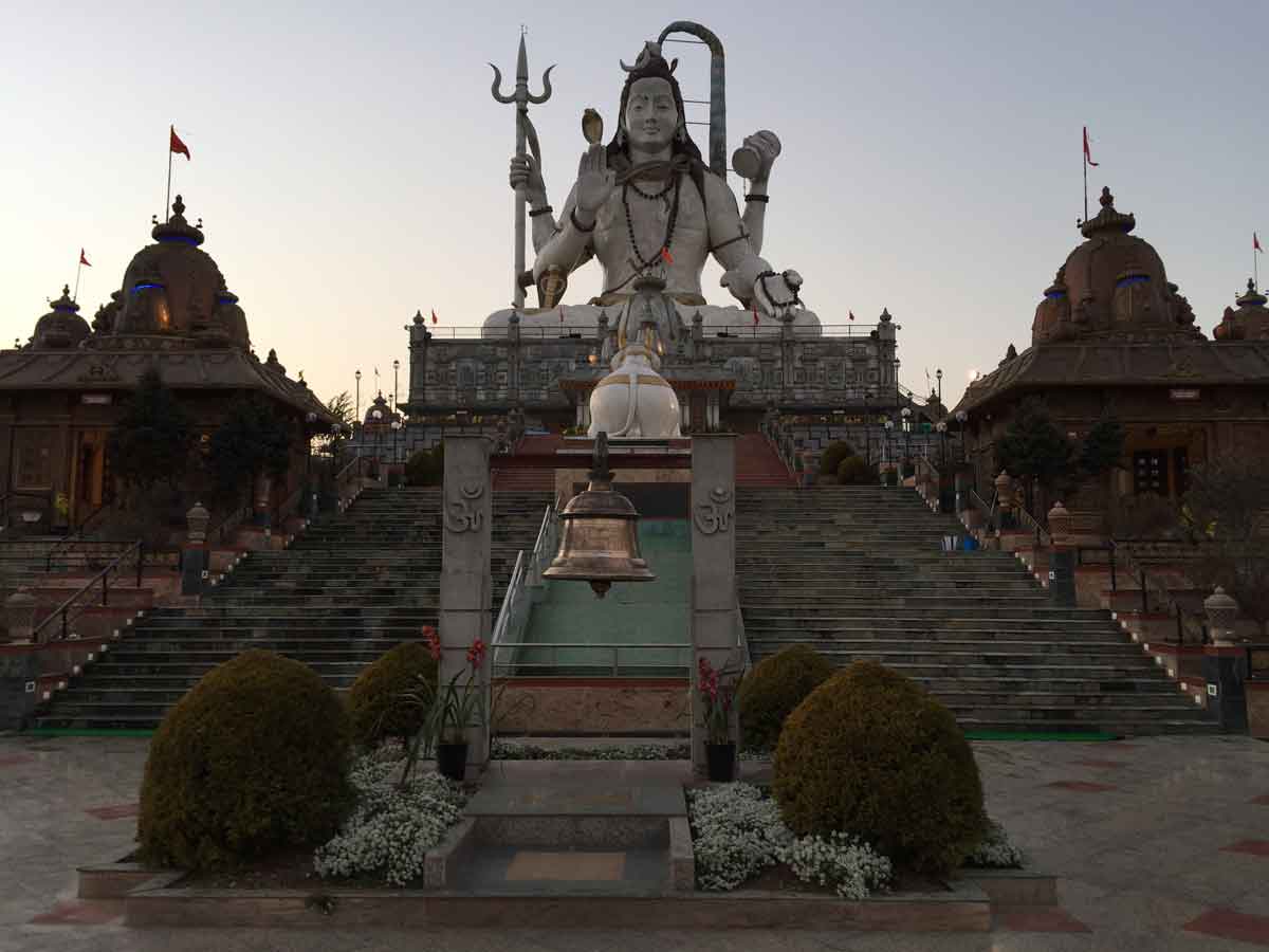
The construction of the Pilgrimage-cum-Cultural Centre at Solophok aims at promoting Religious Tourism, coupled with Village and Eco tourism. This unique Pilgrim Centre has a main temple of 108 feet height on which is based the 87 feet high statue of Lord Shiva on the sitting posture at the Solophok Hill. Apart from Shiva statue, this Pilgrim Centre also has replicas of the twelve Jyotirlingas, to offer one platform for Shiva devotees.
Lord Shiva incarnated as Kirateshwar in Indrakeel (Present Sikkim). Therefore, in this incarnation he is locally worshipped by the people of Sikkim as Lord Kirateshwar. A statue of 16 1/2 feet height of Lord Kirateshwar is also installed in the complex. In order to attain Moksha, the Hindu belief is to perform pilgrimage to all the existing four Dhams. Thereby, replicas of these four Dhams, namely Badrinath, Jaganath and Dwarka dedicated to Lord Vishnu and Rameshwar, dedicated to Lord Shiva is also constructed. Read more...
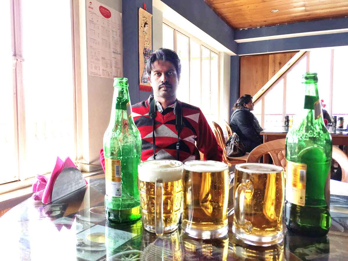
04 February 2015 | West Bengal
- Travel Info
-
aa aa aa aa aa aa aa aa aa aa aa aa aa aa aa aa aa aa aa aa aa aa aa aa aa aa aa aa aa aa aa aa aa aa aa aa
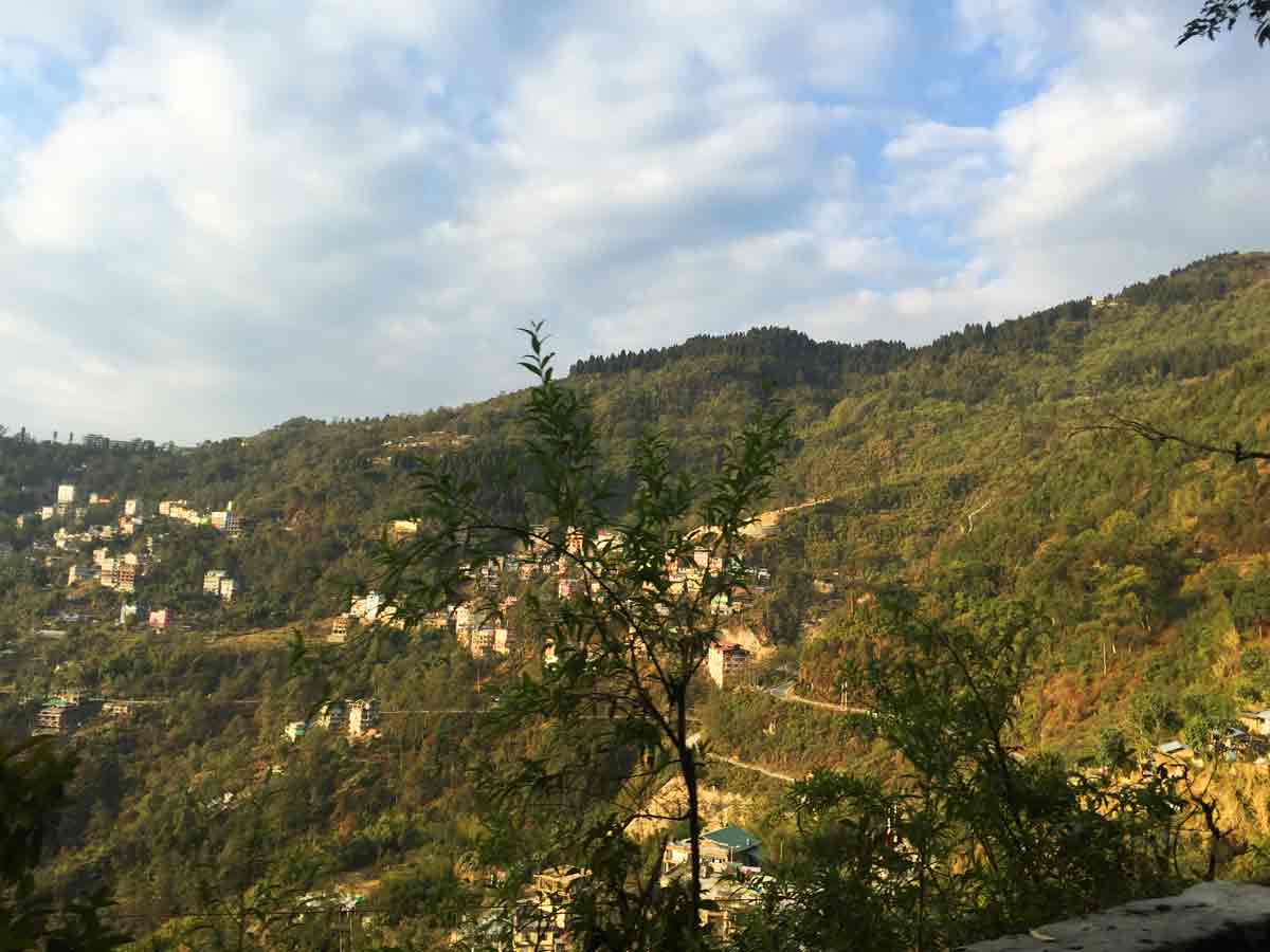
- 11:00 AM | Tiger Hills
-
It is 11 KMs from the town of Darjeeling and can be reached either by Jeep or by foot through Chowrasta, Alubari (incidentally the oldest tea plantation in Darjeeling) or Jorebangla and then climbing up the incline to the summit, which takes about 2 hours at an easy pace.
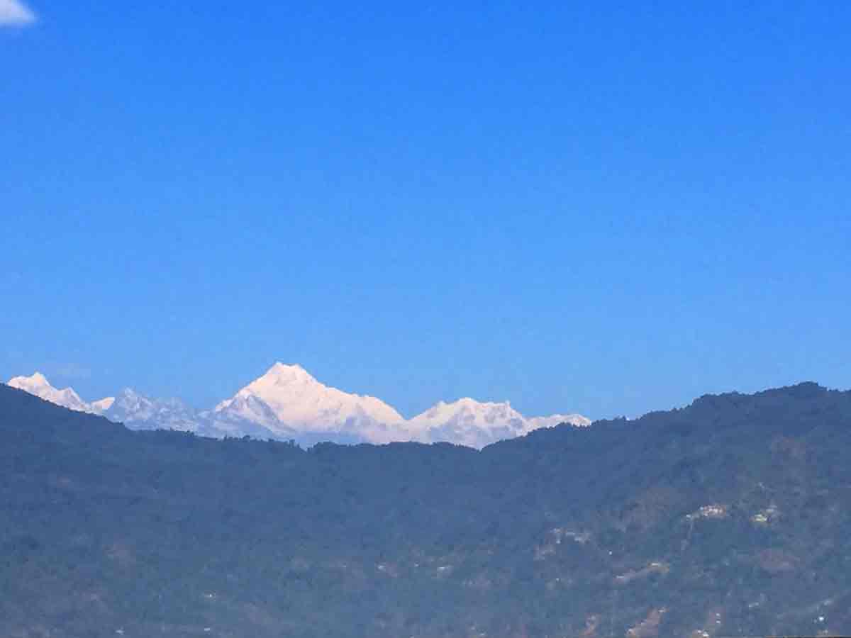
One can see over a spectacular 250 KMs stretch of Himalayan horizon including Everest (8848 M), Lhotse (8501 M) and Makalu (8481 M) from Tiger Hills. The first rays of the sun shoot ahead and shed light on the twin peaks of Kangchenjunga painting it pink and then bathing it in a beautiful orange colour. From Tiger Hill, Mount Everest is just visible, peeping out through two other peaks standing by its side. Makalu looks higher than Mt. Everest, owing to the curve in the horizon, as it is several miles closer than Everest. The distance in straight line from Tiger Hill to Everest is 107 Miles. Read more from Wiki or Darjeeling Tourism.
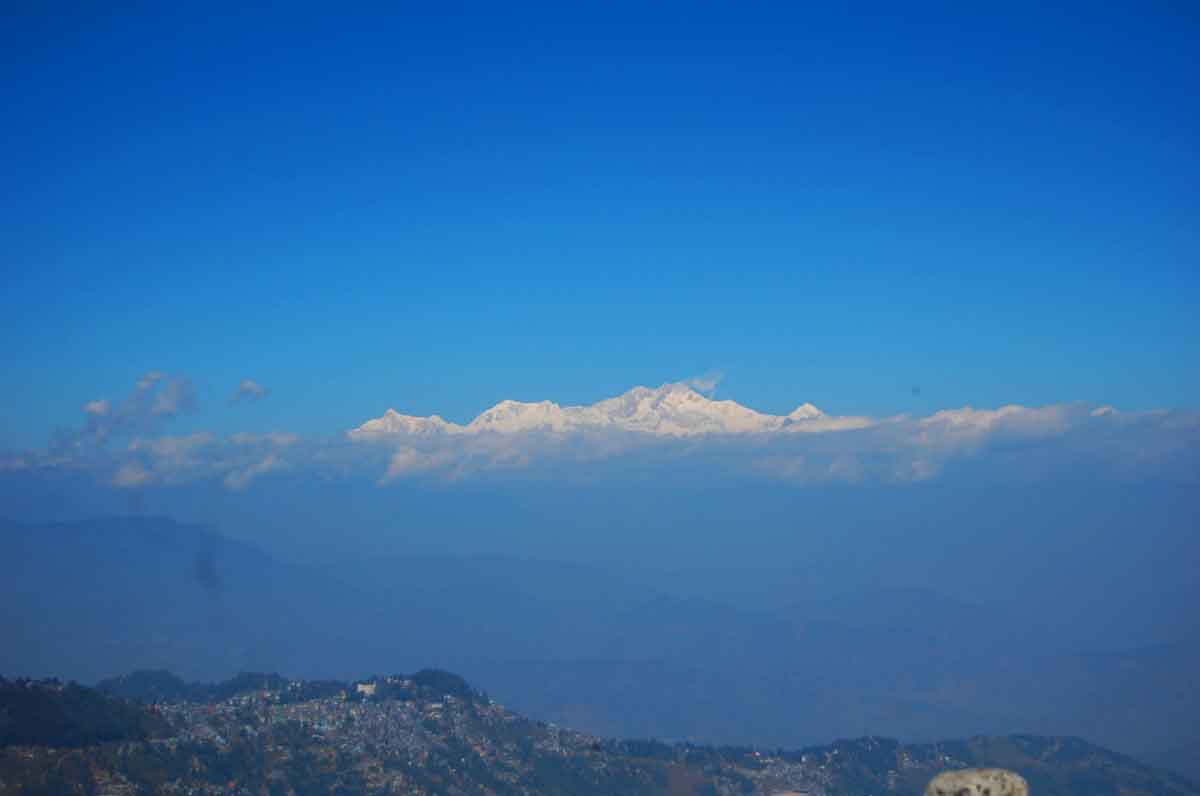
Kanchenjunga from Tiger Hill
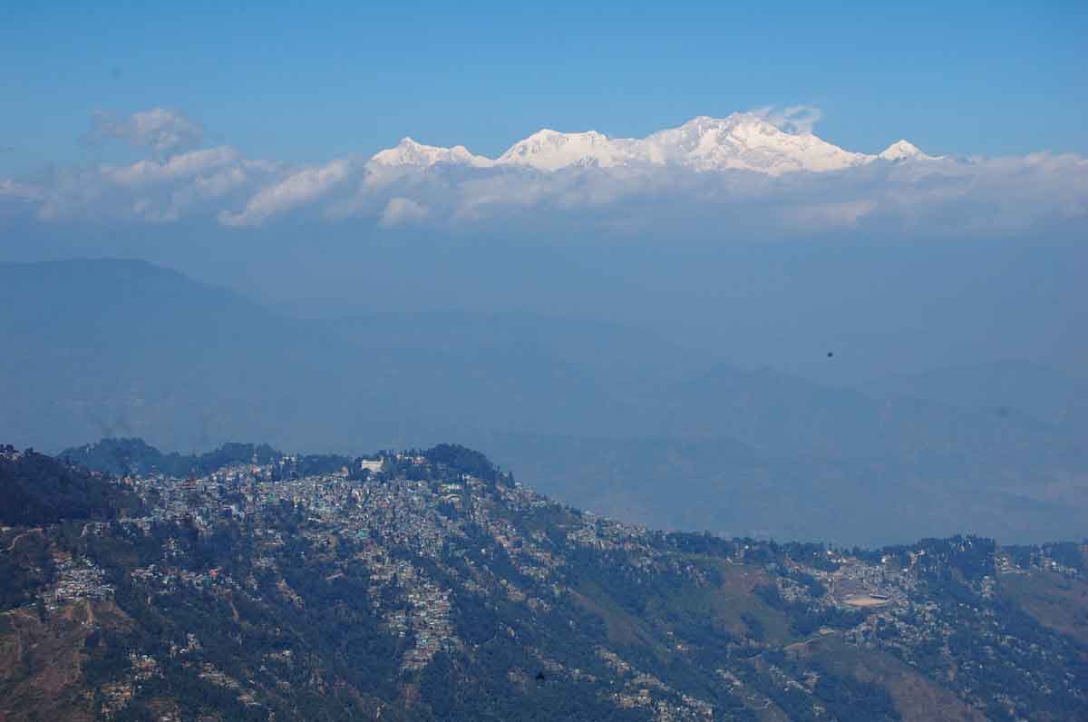
Kanchenjunga from Tiger Hill
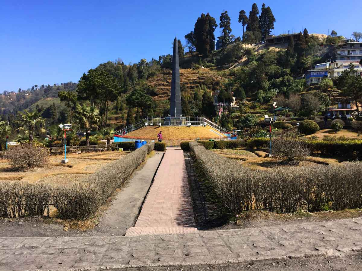
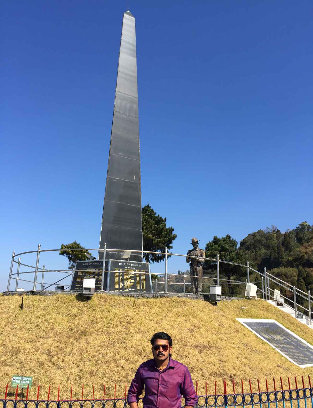
- 12:20 PM | Batasia Loop
-
The Batasia Loop is a spiral railway created to lower the gradient of ascent of the Darjeeling Himalayan Railway in Darjeeling district of West Bengal, India. At this point, the track spirals around over itself through a tunnel and over a hilltop. It was commissioned in 1919. It is 5 km from Darjeeling, below Ghum. There is also a memorial to the Gorkha soldiers of the Indian Army who sacrificed their lives after the Indian Independence in 1947.
- 12:30 PM | Toy train, Dargeeling
-
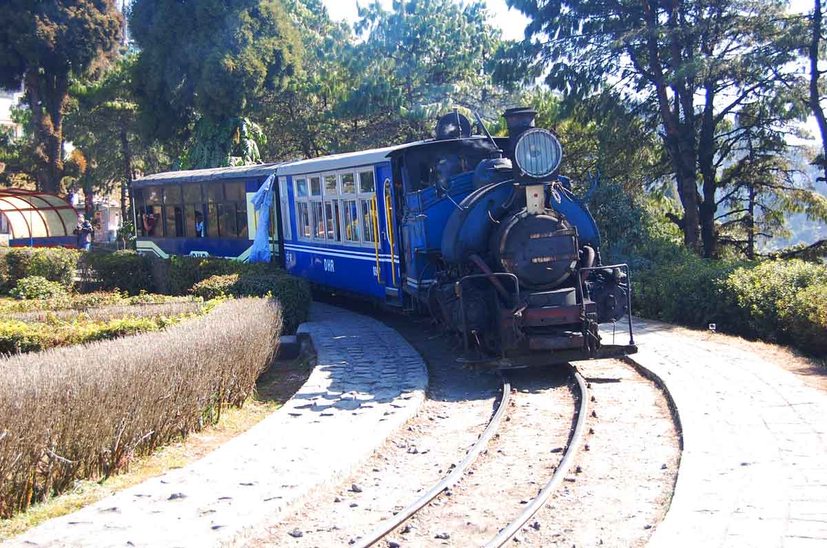
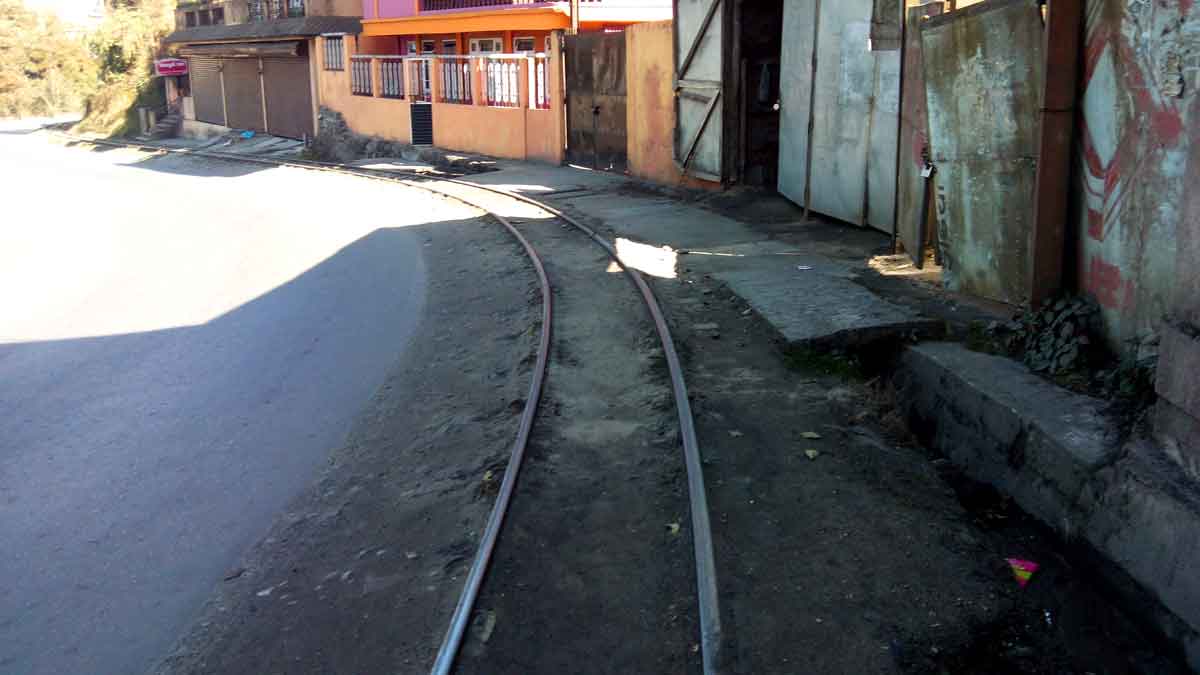
Operating on narrow gauge tracks since 1880s and providing an important transport link to the various parts of the Himalayan hills, the Toy Train is still unmatched when it comes to absorbing the magnificent beauty of Darjeeling hills.
Toy train joy rides operate from Darjeeling Railway Station. It's a 2-hour round trip from Darjeeling up to Ghum and back covering a total distance of 14kms. There are four such round trips in a day, two in the morning half and two in the afternoon. The train stops for 10 minutes at the Batasia Loop. At Batasia the train makes a loop around a wonderful manicured garden. The view of Darjeeling town and the snow peaks of Kanchenjunga from here are unparalleled. The War Memorial built in honor of the Gorkha soldiers who sacrificed their lives is located at the center of the Garden.
Ghum is the highest altitude station on the Darjeeling Himalayan Rail track. It's at an altitude of 2225.7 meters (7407 ft). Here the toy train stops for 30 minutes for a visit to Darjeeling Himalayan Railway museum. The DHR Museum is located at the station premises. The highlight here is the oldest toy train engine - The Baby Sivok. The entree fee to the museum is included in the ticket price. So that you can cherish the memories of your ride, DHR sends by post a certificate validating your ride on the toy train. Read more...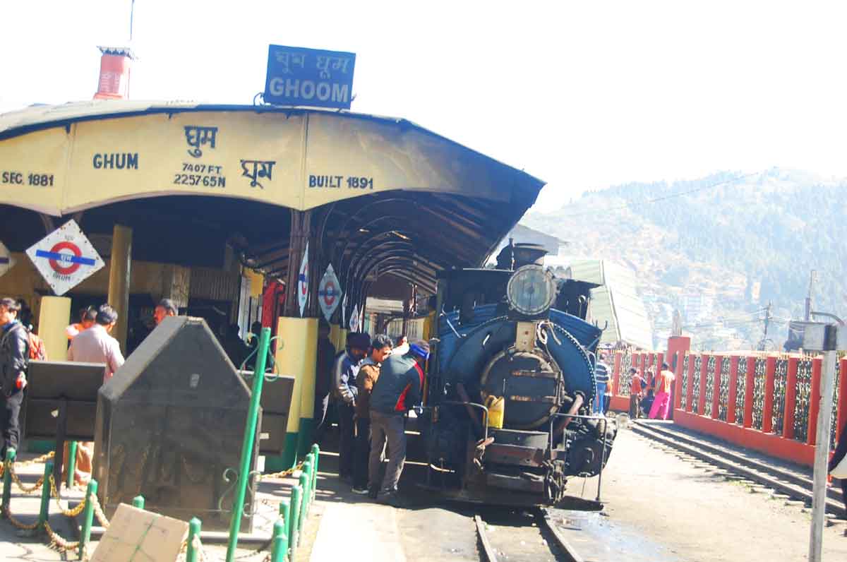
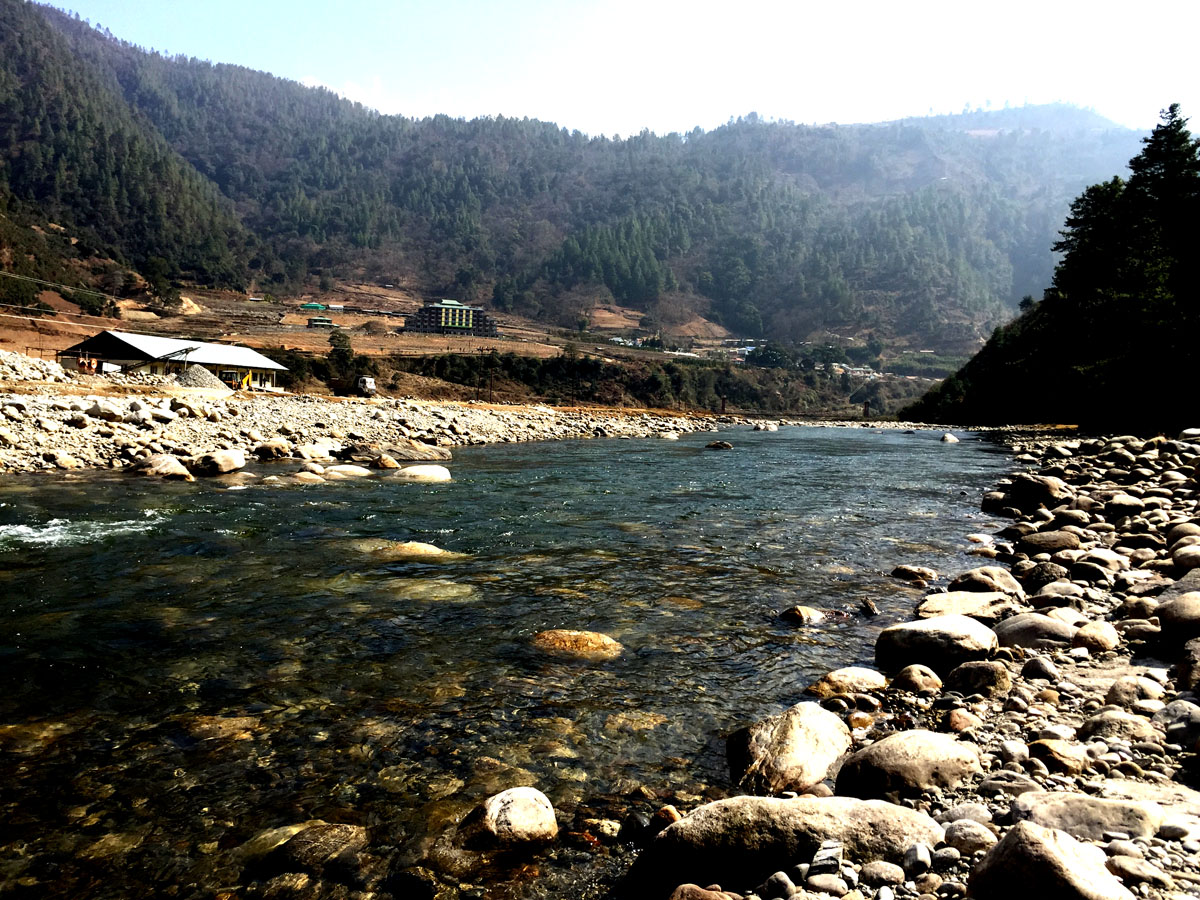
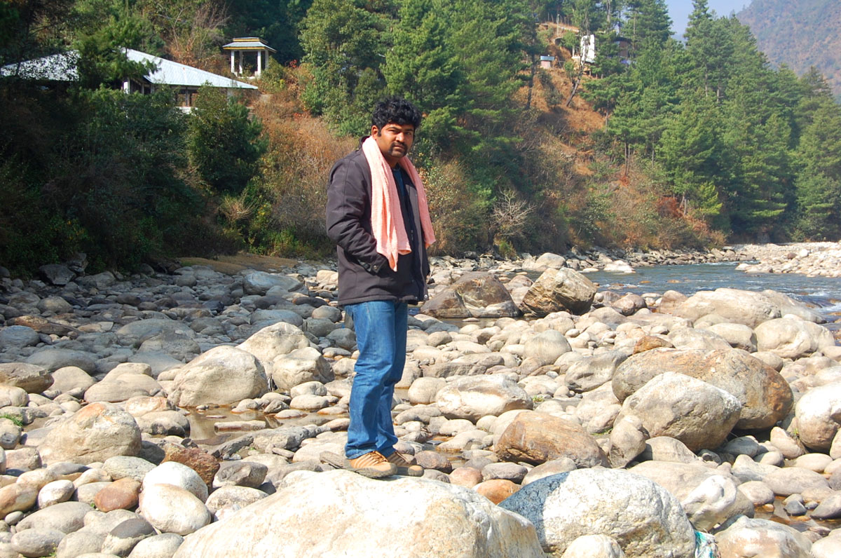
- 02:40 PM | Rock Garden
-
The Rock Garden is also known as the Barbotey Rock Garden which is located some 10kms (or 6.2 miles) away from Darjeeling town in a valley down below. There are sharp hairpin bends on the way and the gradient of the road is very steep. However the view of Darjeeling's landscape and the mountain range from the road is unparalleled.
There is a wonderful waterfall that comes all the way from the top and over the rocks to down below. You will need to keep climbing stairs, go up the ramp and cross small bridges across the rocks to reach up to the top. From the bottom, it's not possible to see the point where this water flow is entering the garden. The climb all the way up may be tiring for some. However, there are beautiful flower gardens, trees and shrubbery at all levels along with nice seating arrangements. So you can rest and relax, enjoy the views around as you go up. Read more...
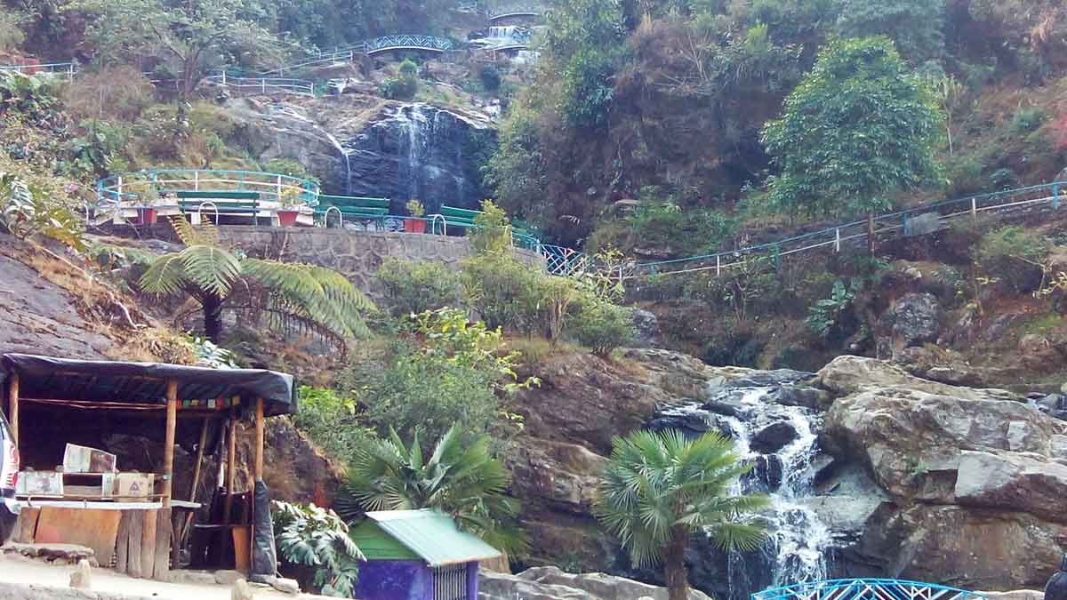
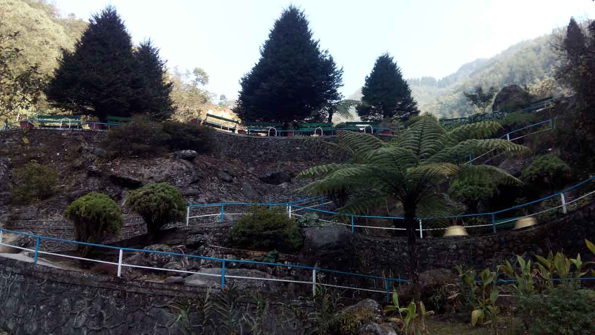
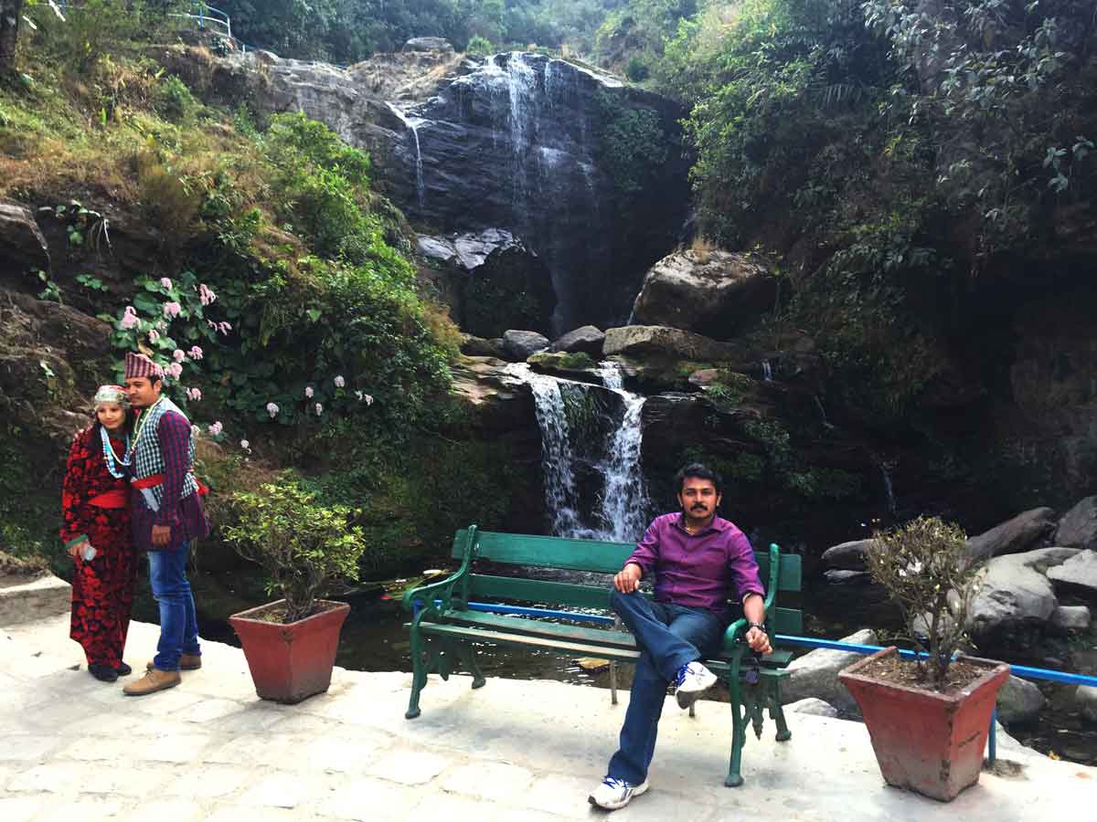
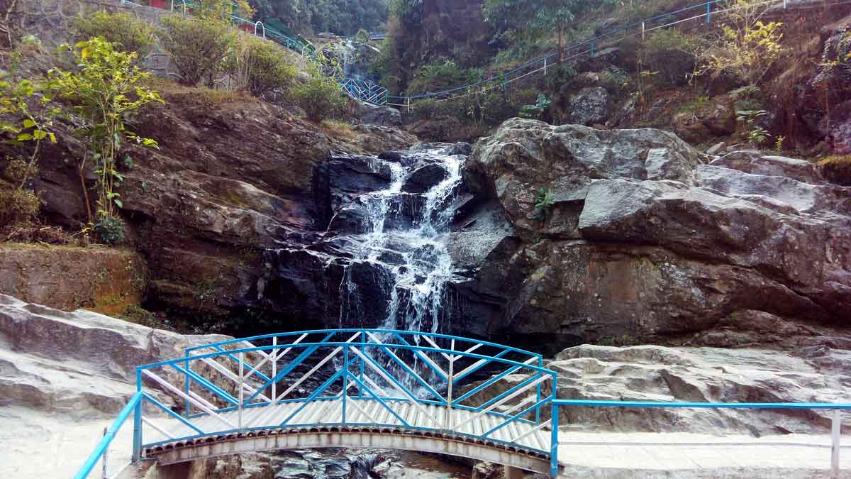
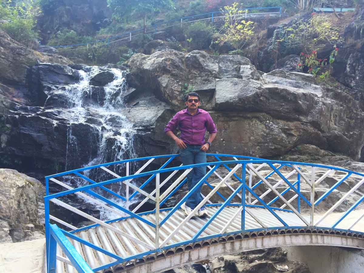
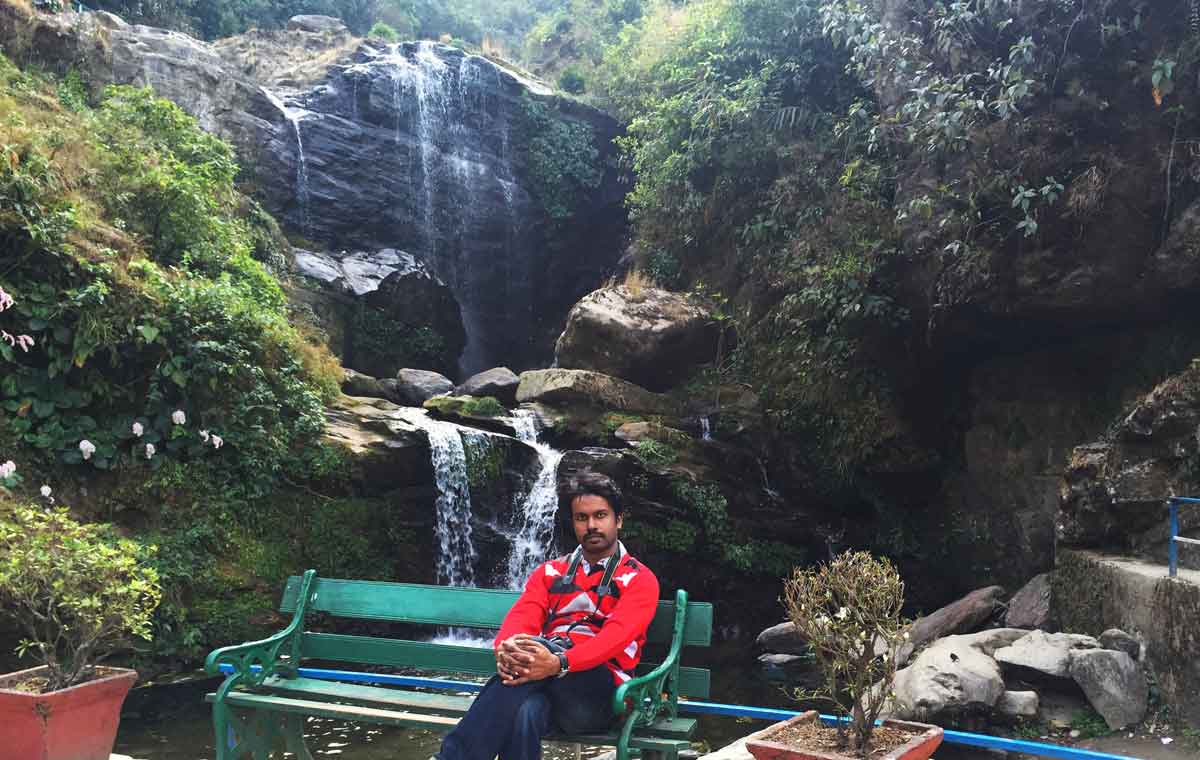
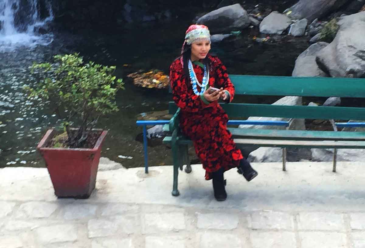
- 03:40 PM | Orange Valley Tea Estate
-
Orange Valley Tea Estate is situated on top of the blue mountain near the Darjeeling town. It offers world's most exclusive and unique flavoured tea which is naturally processed. Sprawling over an area of 347.26 Hectares with an annual production of 1,30,000 kg has been planted by the British. Orange Valley Tea Estate is a Hazard Analysis & Critical Control Point (HACCP) & Safe Quality Food (SQF) certified tea estate by the Societe Generale de Surveillance (SGS).
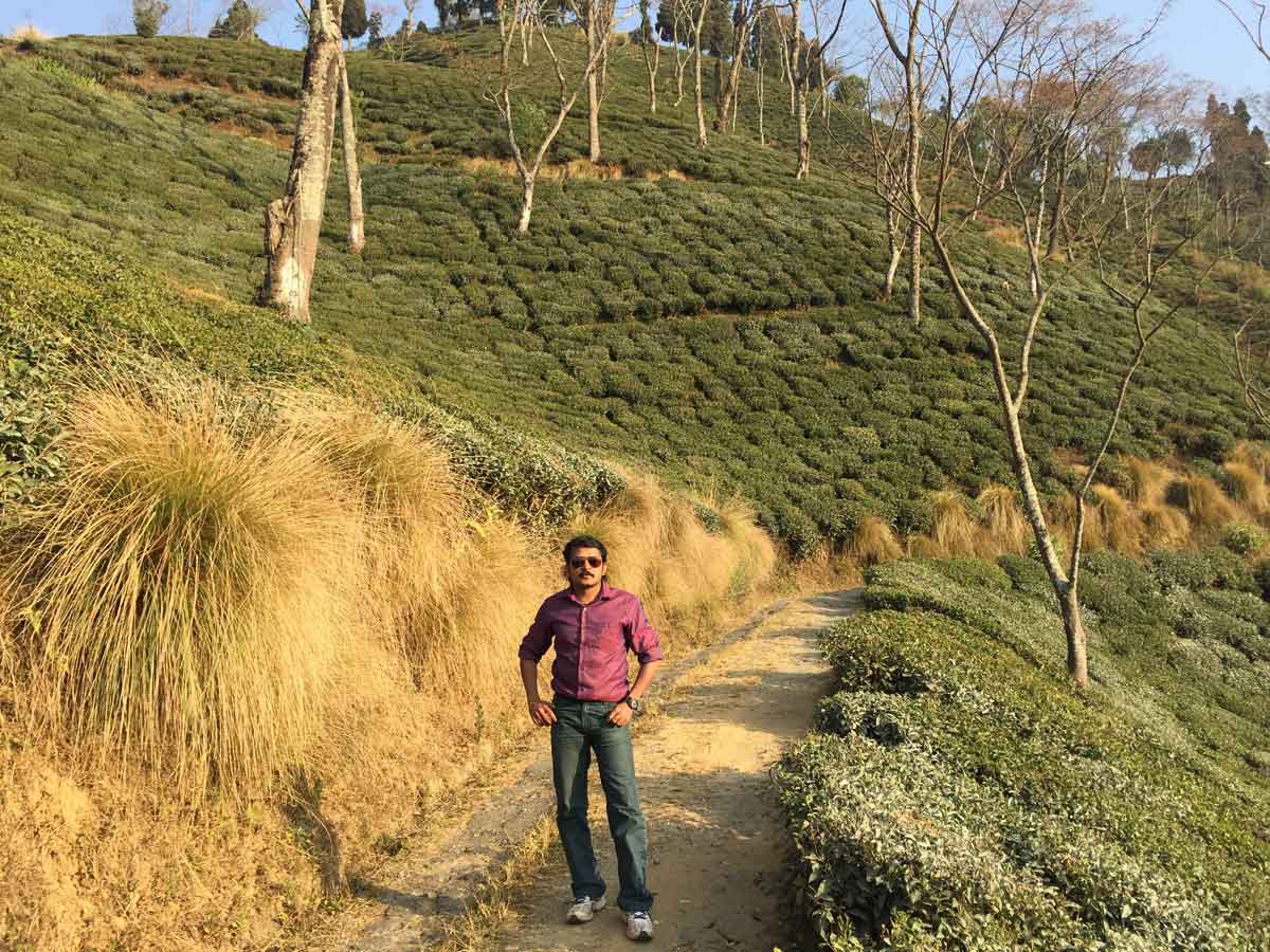
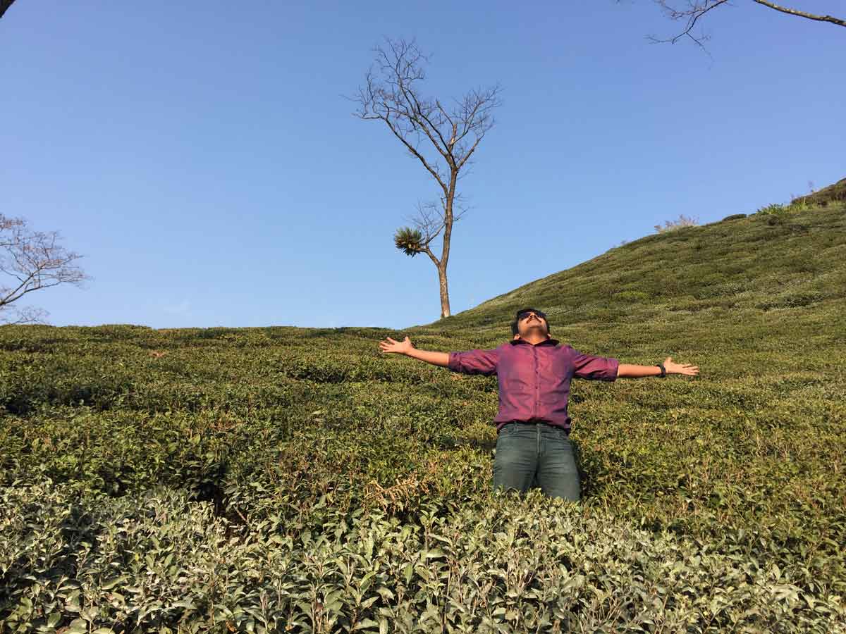
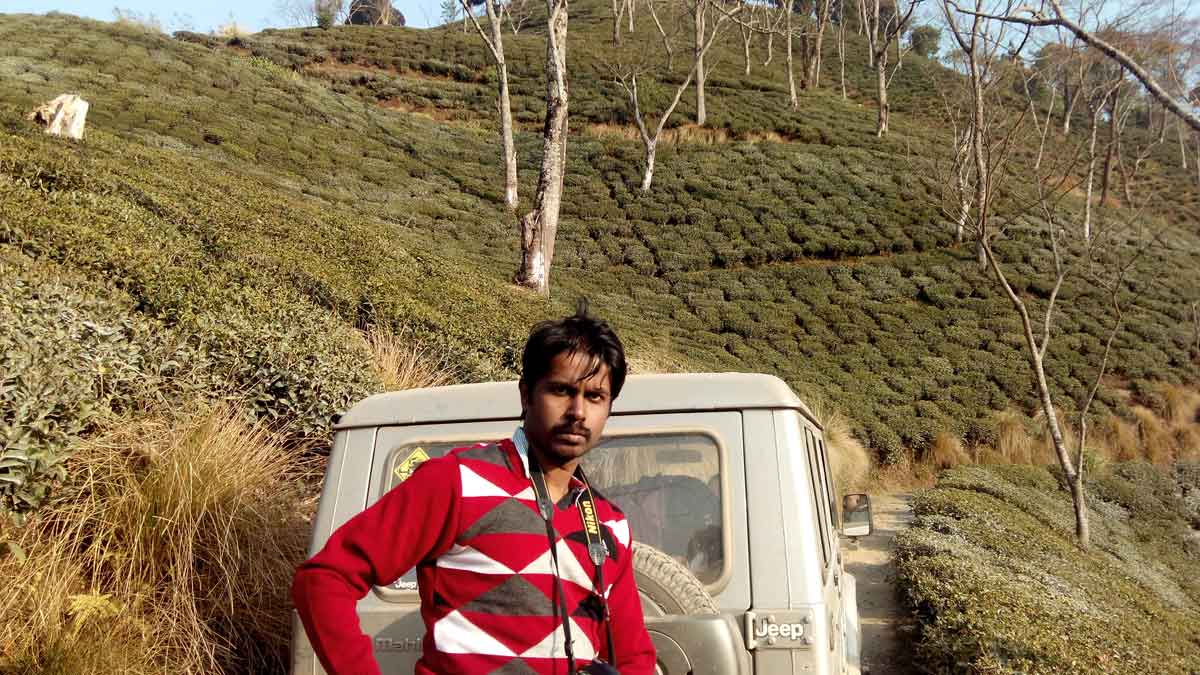
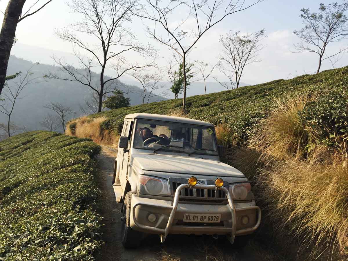
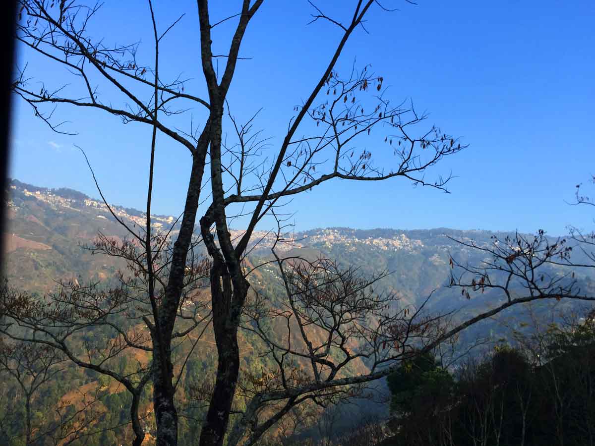
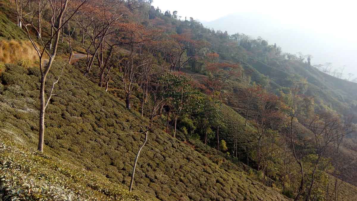
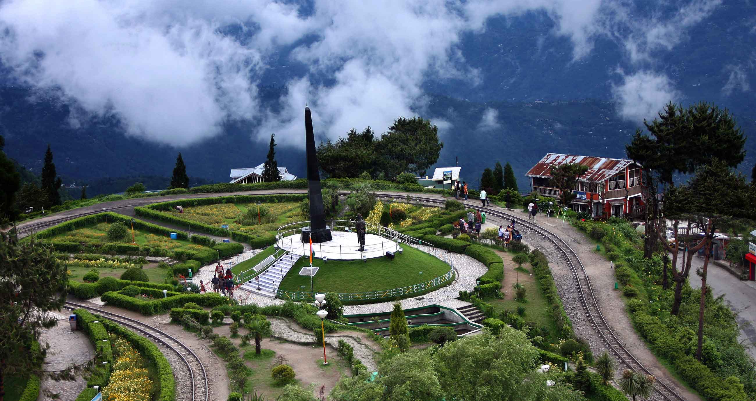
05 February 2015 | Bihar
- Overview
-
Bihar is the 13th largest state in India with an area of 9.5 Million Hectares and 3rd largest by population, and its population is the fastest growing of any other state. 7.2% of its geographical area is forest. In 2000, southern Bihar was separated from Bihar to form the new state of Jharkhand. Close to 85% of the population lives in villages. Almost 58% of Biharis are below the age of 25, which is the highest proportion in India.
Bihar was a centre of power, learning and culture in ancient and classical India. From Magadha arose India's first and greatest empire, the Maurya empire, as well as one of the world's most widely adhered-to religions, Buddhism. Its capital Patna, earlier known as Pataliputra, was an important centre of Indian civilisation. Close to Patna, Nalanda and Vikramshila were centres of learning which were established in the 5th and 8th century respectively in Bihar, and are counted as amongst the oldest international universities of the time. The state has low HDI (0.367), 63.4% literacy(lowest in India) and high population (greater than 10 million) with 1106/KM2 population density. Majority of income is from Services (73%) and then Agriculture (22%). Remaining 5% is from industry.
Since the late 1970s, Bihar has lagged behind other Indian states in terms of its social and economic development. When one drive his vehicle from West Bengal to Benaras crossing Bihar along the NH 31 and NH 30 Highways, the living condition of people can be directly seen. Those are poor villages and cows/buffalo can be seen in homes and majority homes are huts with very low living standard. River Ganges is flowing parallel to the highways and people using Ganges River basin for open defecation is a daily practice here as there is huge area of open land is available as river basin.
- Travel Info
-
We exited from West Bengal from 4th April itself and in the next day nearly 1.00 AM, we crossed the Ganges river bridge Rajendra Setu at Bihar which is a 2 KM lengthy bridge. But at that time, it was night and no clear view to the River. So we continued our driving. Ganges river stretches west to east throughout Bihar. So after a long drive, nearly 6.00 AM, we stopped our vehicle in the Ganges River Shore and spend some time in the River. Then we continued our travel to Uttar Pradesh.
Map of Bihar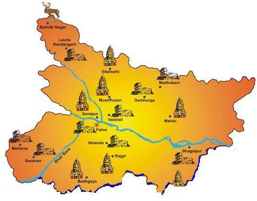
Tourist Map of Bihar - 06:00 AM | Ganges
-
Map of GangesThe Ganges (also known as Ganga or Gonga), is the biggest river in the Indian subcontinent in terms of water flow. The length of the Ganga is 2,510 km or 1,560 miles. The river has its origin in the Western Himalayan Ranges in the state of Uttarakhand. The followers of Hindu religion regard the Ganges to be the most sacred of all the rivers in India. The river is revered as the deity Ganga in Hindu religion. The river also has significant historical values - a number of colonial or royal capitals like Kannauj, Patliputra (modern day Patna), Allahabad, Kara, Baharampur, Murshidabad, and Kolkata are situated on the riverbanks of the Ganges.
The Ganges River Catchment Basin covers an area of 390,000 sq miles (1,000,000 sq km) and supplies to one of the maximum populated areas in the world. The average depth of the Ganges River is 16 m or 52 feet and the highest depth is 30 m or 100 feet. The river has been proclaimed as the National river of India. The first Prime Minister of India, Pandit Jawaharlal Nehru, cited a number of emblematic interpretations regarding the Ganges on the Indian subcontinent in his famous book, the Discovery of India (published in 1946).
The Ganges passes through the states of Uttarakhand, Uttar Pradesh, Bihar, Jharkhand, and West Bengal.
Even though the mighty river Ganga is the most sacred river in India, in the other side, the river is a victim of human cruelty as well as absence of civilization and is considered as the 6th most polluted river in the world and most polluted river in India. If you want to read more, click here. Also see some interesting images here.
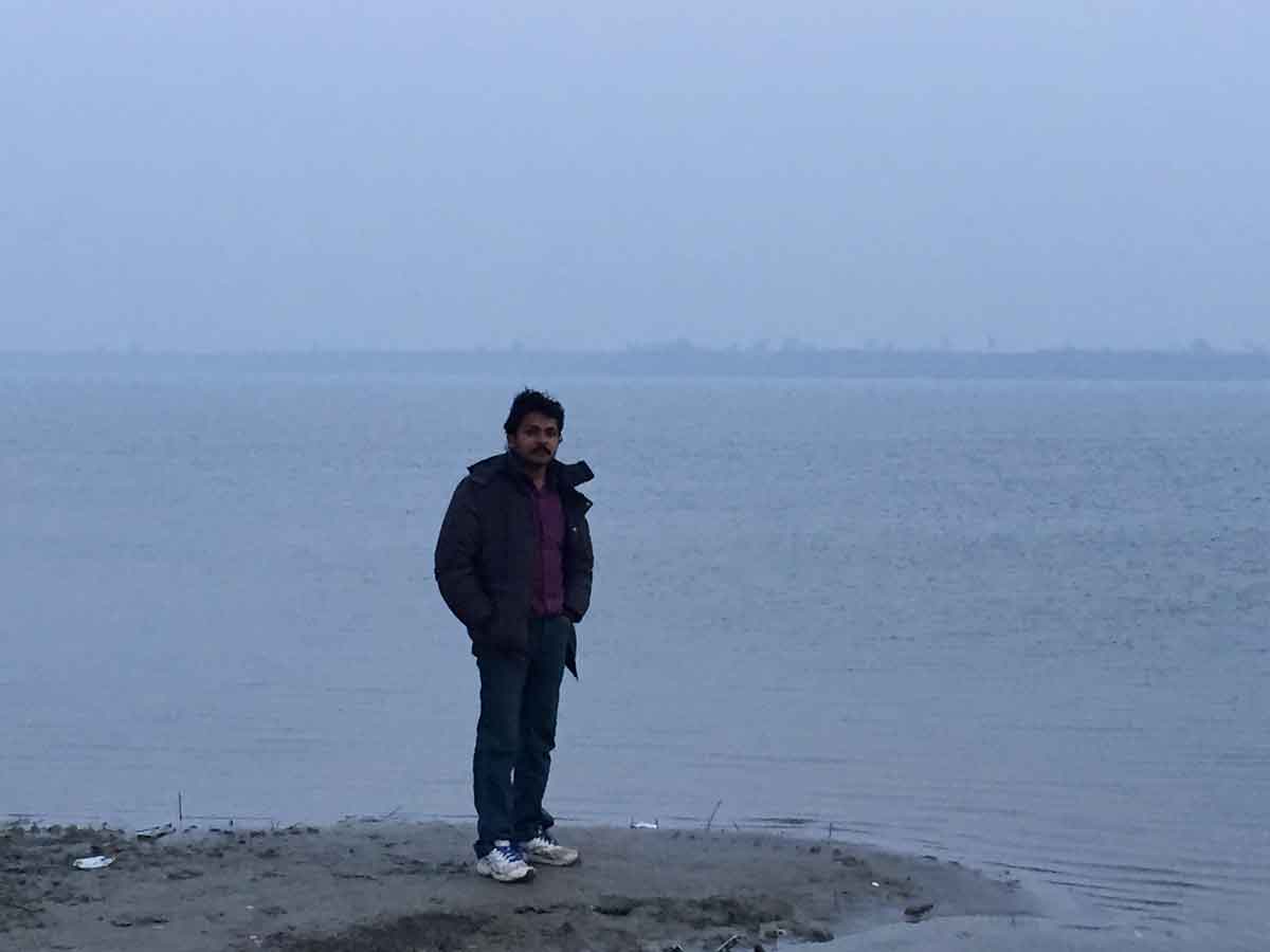
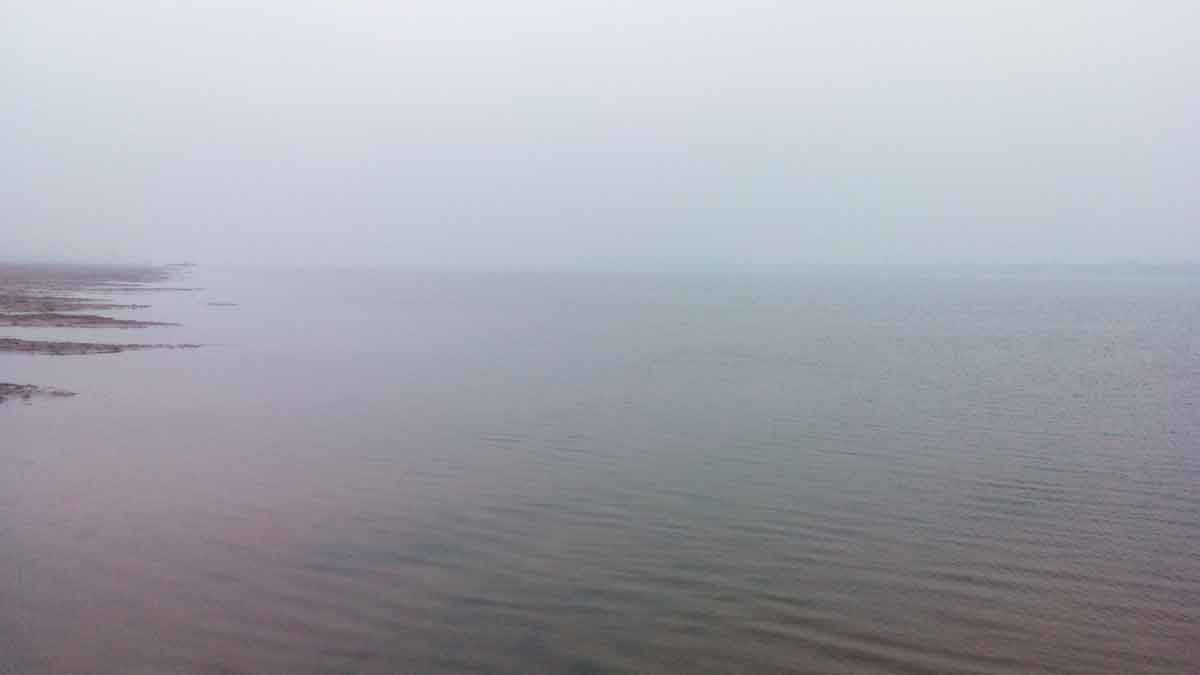
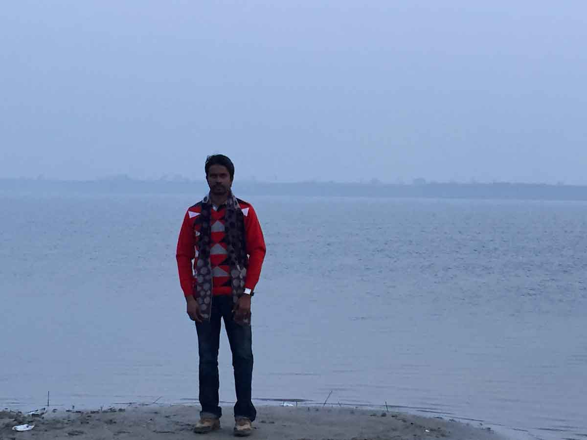
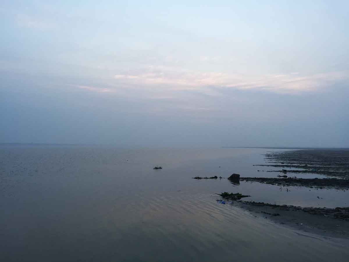
- 11:20 AM | Koilwar Bridge
-
Koilwar Bridge, now named Abdul Bari Bridge, at Koilwar spans the River Sone. The bridge has been named after Professor Abdul Bari, academic and social reformer. The Koilwar Bridge (known as Sone Bridge when it was built) is amongst the older of the longer bridges in this subcontinent. Although construction started in 1856, it was disrupted by uprisings in 1857 and completed in 1862. It was inaugurated by the Viceroy Lord Elgin, who said, "... this magnificent bridge was exceeded in magnitude by only one bridge in the world". The 4,726 feet (1.44 KM) bridge was designed by James Meadows Rendell and Sir Matthew Digby Wyatt. It remained the longest bridge in the Indian subcontinent till was overtaken by the Upper Sone Bridge in 1900. The steel rail-road bridge is shown in the film Gandhi. A two lane road (NH 30) runs just under the double rail tracks. Sand mining near the pillars of this old bridge has created structural problems recently.
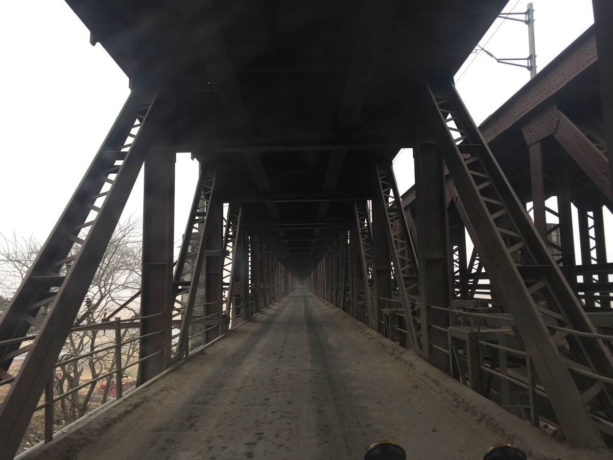
05 February 2015 | Uttar Pradesh
- Overview
-
The greatness of Uttar Pradesh lies not only in this confluence, but also in the emergence of cultural and religious traditions along some of the greatest rivers in the Indian sub-continent - the Ganga and the Yamuna. Throughout history, great cities have emerged and established along great rivers. Within India, the Ganga and the Yamuna have nurtured a culture because of which religious faith, rituals, culture and intellectual enlightenment have evolved in places along the two rivers.
Uttar Pradesh covers 24.33 Million Hectares, equal to 6.88% of the total area of India, and is the fourth largest Indian state by area. With over 200 million inhabitants in 2011, it is the most populous state in the country as well as the most populous country subdivision in the world. Uttar Pradesh is the fourth largest Indian state by economy. Agriculture and service industries are the largest parts of the state's economy. The service sector comprises travel and tourism, hotel industry, real estate, insurance and financial consultancies. The state has a low Human Development Index(0.38) which ranks 18th among other states in India. Literacy is 69.7% and population density is 820/KM2.
Uttar Pradesh ranks first in domestic tourist arrivals with more than 71 million, owing to its rich and varied topography, vibrant culture, festivals, monuments, ancient places of worship, and viharas. Thousands gather at Allahabad to take part in the Magh Mela festival on the banks of the Ganges. This festival is organised on a larger scale every 12th year and is called the Kumbha Mela, where over 10 million pilgrims congregate in one of the largest gatherings of people in the world.
A major part of river Ganges and Yamuna are flowing along Uttar Pradesh, and this state has a major role for polluting these rivers by industriously as well as religiously. For reading more amout Riven Ganges, click here.
 Ganga and Yamuna along Uttar Pradesh
 - Travel Info
-
We reached Uttar Pradesh at around 6.30 PM. Vehicles are not allowed near to Temple, so we parked our vehicle at Bhelupur, nearly two kilometres away from Kashi Viswanath Temple. Cycle Rickshaws were the normal travelling mode and were very cheap. We, the first time, called a Cycle Rickshaw for travelling. We actually not enjoyed the travel when seeing the human effort for riding the Rickshaw by the Rickshaw Puller even though those were their usual practices. We went to Dashashwamedh Ghat and then Kashi Vishwanath Temple. We had some food and immediately started our travel to Nagpur.
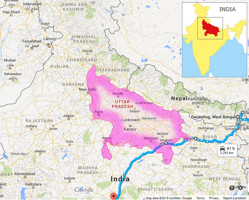 Tamil Nadu map and our travel path
 - 06:45 PM | Dashashwamedh Ghat
-
Dashashwamedh ghat is one of the oldest, most spectacular and important ghat, located at the bank of the river Gange near to the old Vishwanath Temple in Kashi (Varanasi or Banaras). The literal meaning of the Dashashwamedh is the Ghat (river front) of the ten sacrificed horses (dash means 10, ashwa means horse, medh means sacrifice).
At the great festivals, Hindu devotees come in huge number because of the different religious significance of the ghat. The ghat has retained its beauty with the various Hindu God temples and religious sites. Pilgrims come here to perform a variety of rituals and religious activities. The evening Aarti of the Gange at this ghat attracts huge crowd from every corner of the city. Some of the devotees come here daily in the morning to pay homage to their Lord after having a holy bath in the Gange water.
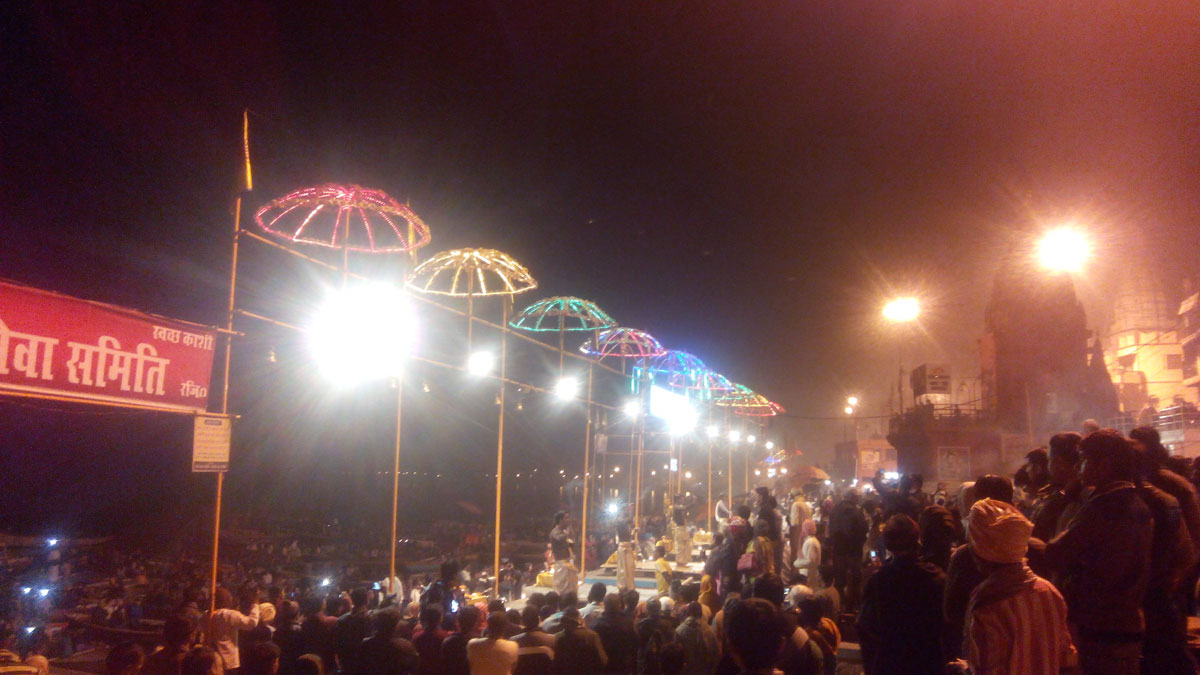
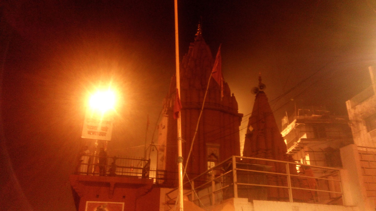
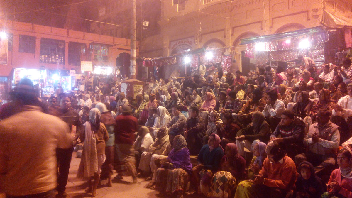
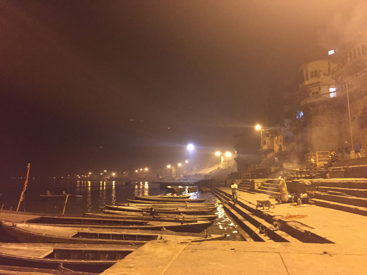
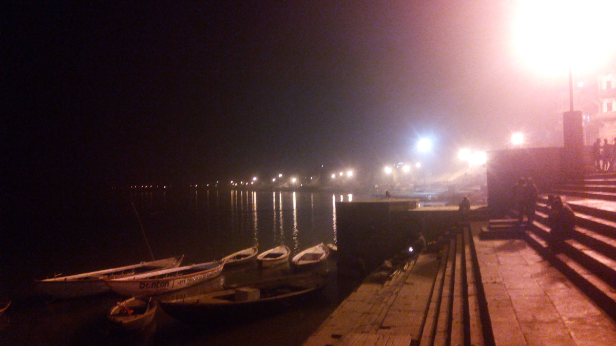
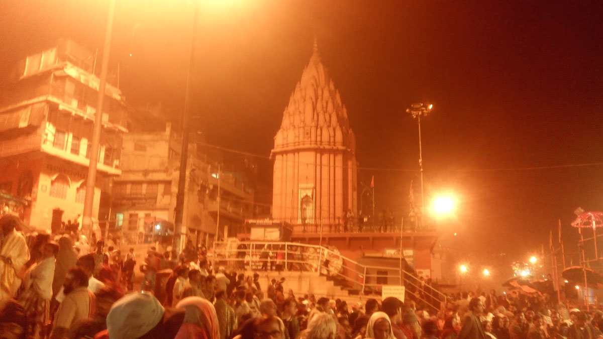
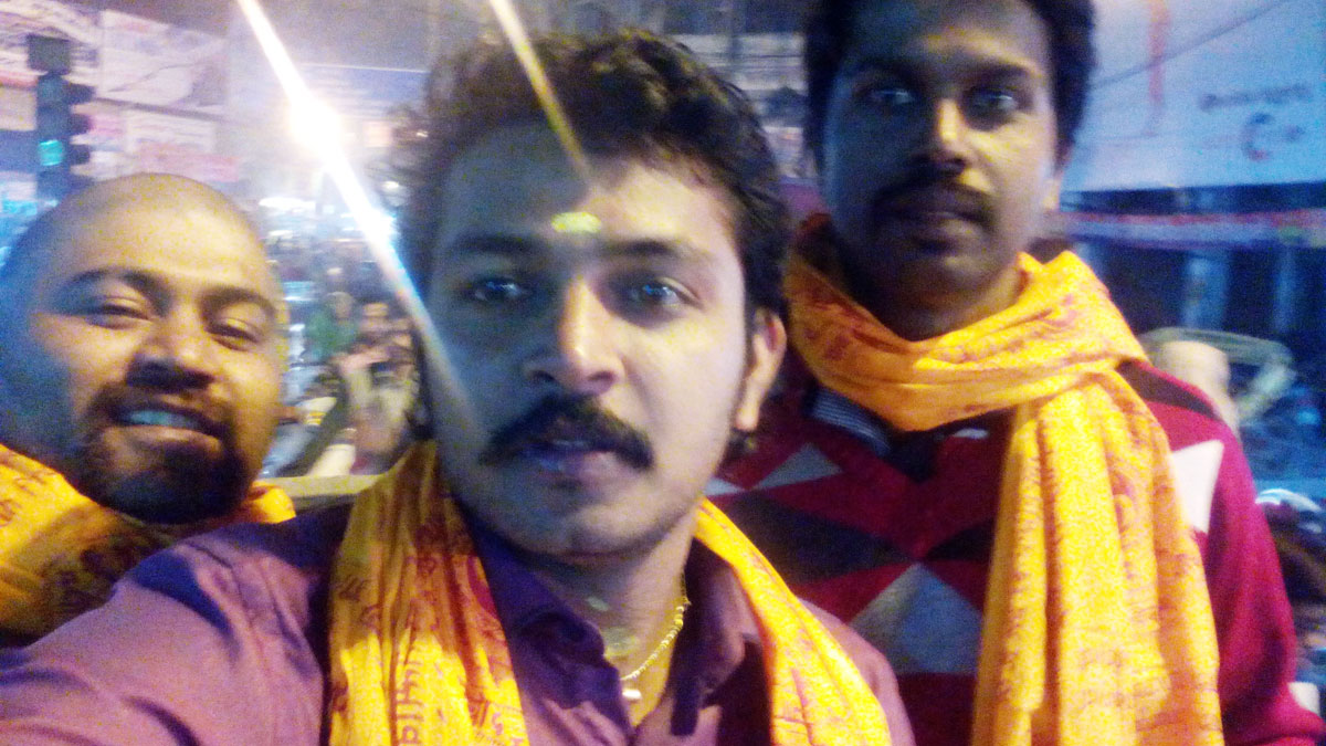
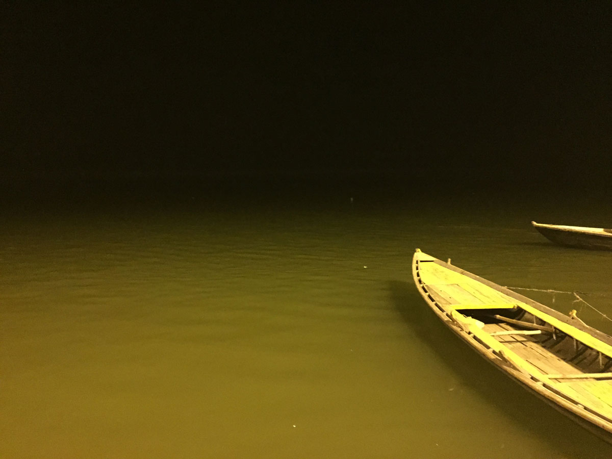
- 07:15 PM | Kashi Vishwanath Temple
-
The Kashi Vishwanath temple is located in the heart of the cultural capital of India, Varanasi. It stands on the western bank of India's holiest river Ganges. The Kashi Vishwanath temple is the center of faith for millions of Hindus. The Jyotirlinga of Shiva, Vishweshwara or Vishwanatha, is enshrined in the Kashi Vishwanath temple, considered as one of the holiest temples of India. In Hindu religion it is believed that a simple glimpse of the Jyotirlinga is a soul-cleansing experience that transforms life and puts it on the path of knowledge and Bhakti (devotion). A single darshan of Vishweshwara Jyotirlinga is considered to merit more than the darshan of other jyotirlingas, scattered in various parts of India. The Kashi Vishwanath Temple has been a living picture of the timeless cultural traditions and highest spiritual values.
For further information, visit their official website.
06 February 2015 | Uttar Pradesh
- Travel Info
-
From Kashi, we started our travel at around 9.00 PM and drove continuously in night and in 06th February nearly 7 A.M, we reached Madhya Pradesh.
06 February 2015 | Madhya Pradesh
- Overview
-
The State of Madhya Pradesh is centrally located and is often called as the "Heart of India". The State is home to a rich cultural heritage and has practically everything; innumerable monuments, large plateau, spectacular mountain ranges, meandering rivers and miles and miles of dense forests offering a unique and exciting panorama of wildlife in sylvan surroundings.
Madhya Pradesh is the 2nd largest state in the country by area and 5th largest state by population (75 million inhabitants). The state has relatively low Human Development Index (0.375). Literacy is 70.6%. 26.5% of economy is from Agriculture, 15.87% from industry and 57.63% is from Services. 28.27% of the land area is forest (8.7 Million Hectares) which is highest forest contribution of a state in India by geographical area. Arunachal Pradesh comes next.
Madhya Pradesh is one of the best place for tourism and you can read more about MP tourism from their website.
- Travel Info
-
MadhyaPradesh has good roads passing through beautiful forests and one can enjoy while driving. Madhya Pradesh is a good place for tourism, but our limited time didn't allow us to explore. We had only two places in front of us to visit. One was Nagpur and other was Bangalore. So by enjoying the beauty of Madhya Pradesh, we directly drove to Nagpur.
06 February 2015 | Maha Rashtra
- Overview
-
Maharashtra offers many attractions to the tourists coming from all across the globe. The place is famous for hundreds of caves, and architecture developed by cutting the rocks. Mumbai is one of the most visited cities in the state. One may enjoy the film industry, Gateway of India, Marine Drive, Juhu Beach, Essel World, Siddhi Vinayak Temple, Haji Ali Dargah, Mani Bhawan, Jahangir Art Gallery, etc. One may visit Appu Ghar and Baneshwar in Pune, Ajanta and Ellora caves in Aurangabad, Bhahmagiri in Nashik, several dams all across the major cities like the Khadakwasla and Panshet Dam in Pune and many more. The Sahyadris, the Rajmachi Forts and the Waki woods are the places visited by the trekkers. The state is a home to several national parks and wildlife sanctuaries like Bor Wildlife and Pench National park. Several places like the Ambarnath temple, Kailash temple, Afgan memorial, Osho Ashram, Shri Hazur Sahib and Bibi ka Maqbara may be visited for historical interest and religious fervor. The state has a number of beaches like Madh Island beach, Kihim and Mandwa, harnai and several hill stations to be visited like the Amboli, Lonavala, Khandala and Panchgani. There are several monuments like the Chand Minar, Lal Mahal and Kesari Wada and forts like the Mumbai Fort, Pratapgarh Fort and the Daulatabad Fort, which the tourists can witness once they reach the place.
Mumbai is the capital of Maharashtra as well as the financial capital of the entire country. Nagpur is known as the auxiliary capital of the state. Also known as the wealthiest state, Maharashtra contributes around 15% of the industrial output of the country and around 14% of its gross domestic product. The state has several wildlife sanctuaries, few national parks, and patronizes project Tiger which is an attempt to preserve the endangered species like the Bengal tiger, only to conserve the bio-heritage of the country.
Maharashtra happens to be the third largest state in the nation (30.7 Million Hectares) and stands second in population among all Indian states. The state ranks 12th in Human Development Index and literacy rate is 82.9%.
- Travel Info
-
We purchased lots of items from different locations that we covered. But those were special items indigenous to that area. We had to buy some items for our family and friends. So we actually aimed Nagpur Sitabuldi market for our purchasing place. But unfortunately we met with our third big accident. After that for some time we were in big shock. People behaves differently which should be based on their culture, life style and so many factors relating to it. Never expect good personality from all people... never expect truthfulness from all. So when we met such people, we should get some kind of bad experiences... but those are real experiences... we took that incident very positively and went forward... we went to the market... purchased a lot of items from there and prepared for our travel to Hyderabad.
- 08:15 PM | Sitabuldi market, Nagpur
-
Located in the heart of Nagpur City, Sitabuldi Main Road (Fashion Market) is always a buzzing shopping paradise. A proven pocket friendly shopping destination, it displays the latest trends in most fashion accessories including clothes, shoes and almost everything the young guys & gals are looking for. It is great experience to wander around this street and indulge in window-shopping or walk into posh shopping malls munching local snacks with chosen friends. Providing a whole range of snacky options including desi restaurants to fast food outlets, whether you intend to indulge in any serious shopping or not, Sitabuldi Main Road (Fashion Market) is a great place to kill time.
07 February 2015 | Telangana
- Overview
-
Telangana is the 29th state of India, formed on the 2nd of June 2014. The state has an area of 11.5 Million Hectares and has a population of 3,52,86,757. The Telangana region was part of the Hyderabad state from Sept 17th 1948 to Nov 1st 1956, until it was merged with Andhra state to form the Andhra Pradesh state. After decades of movement for a separate State, Telangana was created by passing the AP State Reorganization Bill in both houses of Parliament. Major cities of the state include Hyderabad, Warangal, Nizamabad and Karimnagar.
- Travel Info
-
Morning about 9.00 AM, we reached Hyderabad. One of our friend Kannayya, who was an employee of our company for many years, now he is working at Hyderabad. So we went to his rented apartment. Spent some time... had our grooming activities including bath... As you know, Hyderabadi Biriyani is very tasty and famous. When someone go to Hyderabad, surely they will order Hyderabadi Biriyani. We also had the same feel... so with the help of Kannayya, we went to a restaurant named "SHAH GHOUSE Cafe & Restaurant". The Biriyani was really good... we ended our lunch with a lassi and prepared for our next destination - Golconda fort. It was a very nice fort with great architectural wonders. After that we went to Charminar. Nearly 8.00 PM night, we said good bye to Kannaya. Our next destination was Bangalore.
- 12:30 PM | Lunch with Kannayya
-
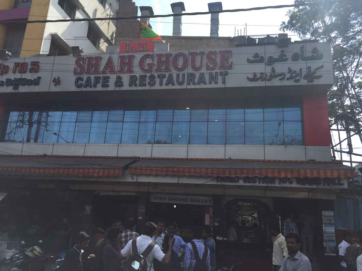
- 02:00 PM | Golconda Fort, Hyderabad
-
Golconda (sometimes spelled as Golkonda) Fort was the capital of the ancient kingdom of Golconda which flourished in the 14th to 16th century. It is situated 11 kilometers from Hyderabad, the capital of the state of Andhra Pradesh. With walls ranging from 17 to 34 feet broken by 87 semi-circular bastions, some reaching 60 feet in height, and built on a granite hill that is 400 feet high, it remains one of India's most magnificent fortress complexes.
Today, even after almost 800 years, the fort still stands as one of Hyderabad's greatest architectural wonders. One of it's gratest engineering marvels is the fantastic acoustic effects: one handclap at a certain point below the entrance dome can be heard at the highest point of the pavilion almost a kilometer away. This was said to be used for warning the royals in case of an attack.
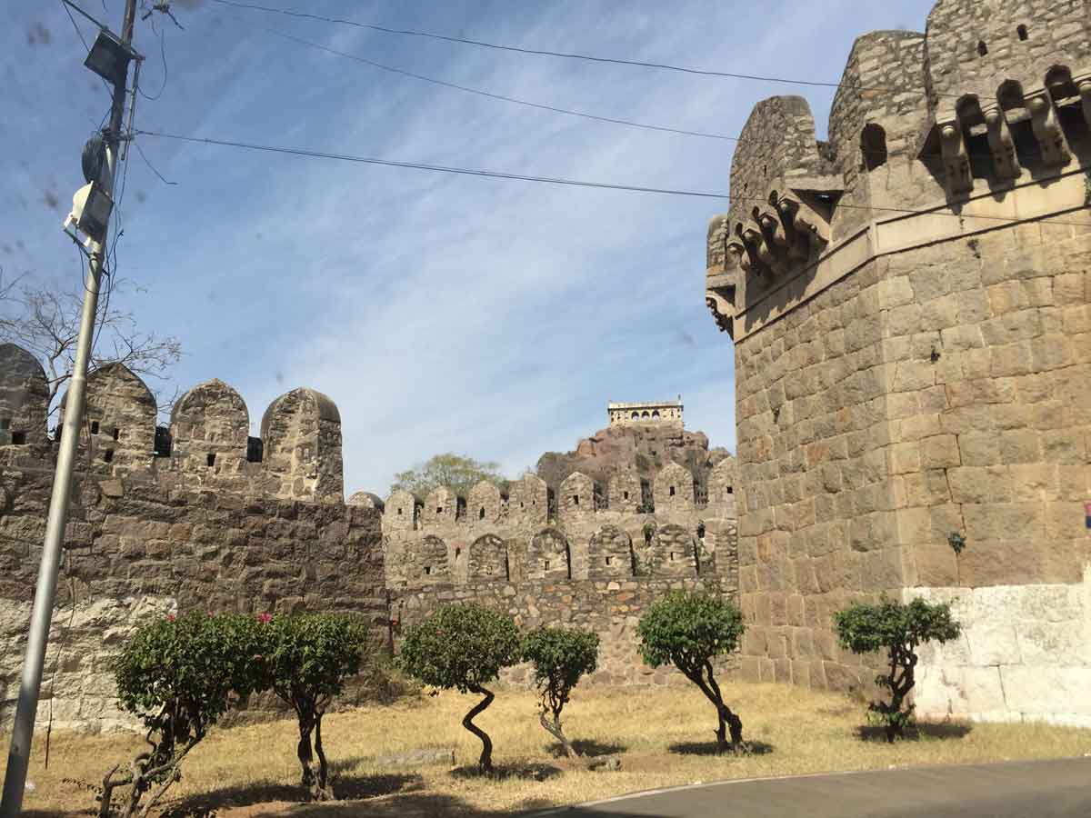
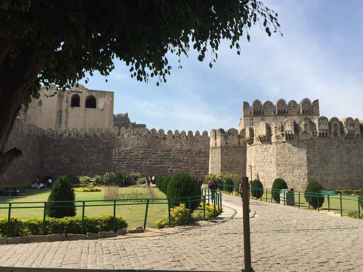
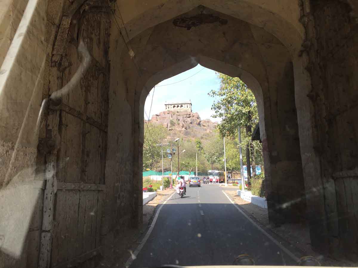
- 03:20 PM | Charminar, Hyderabad
-
This building is an ancient building built in 1591 AD by Muhammad Quli Qutb Shahi to celebrate the end of a deadly plague and is a monument and Mosque in Hyderabad. It is the most famous building of Hyderabad and also one of the most famous buildings in India. The Charminar lies near the bank of the river Musi and is close to Laad Bazaar and Makkah Masjid. Charminar was the first structure to be constructed in the newly built city of Hyderabad. It is said that Quil Qutb Shahi prayed for the end of the plague and vowed to build a mosque if it was eradicated. Mir Momin Astarabadi, the prime minister of Qutb Shah played an important role in the design and layout of Charminar and the city of Hyderabad. The structure is of Indo-Islamic architecture with some Persian elements. The city of Hyderabad was divided into four divisions equally around the Charminar.
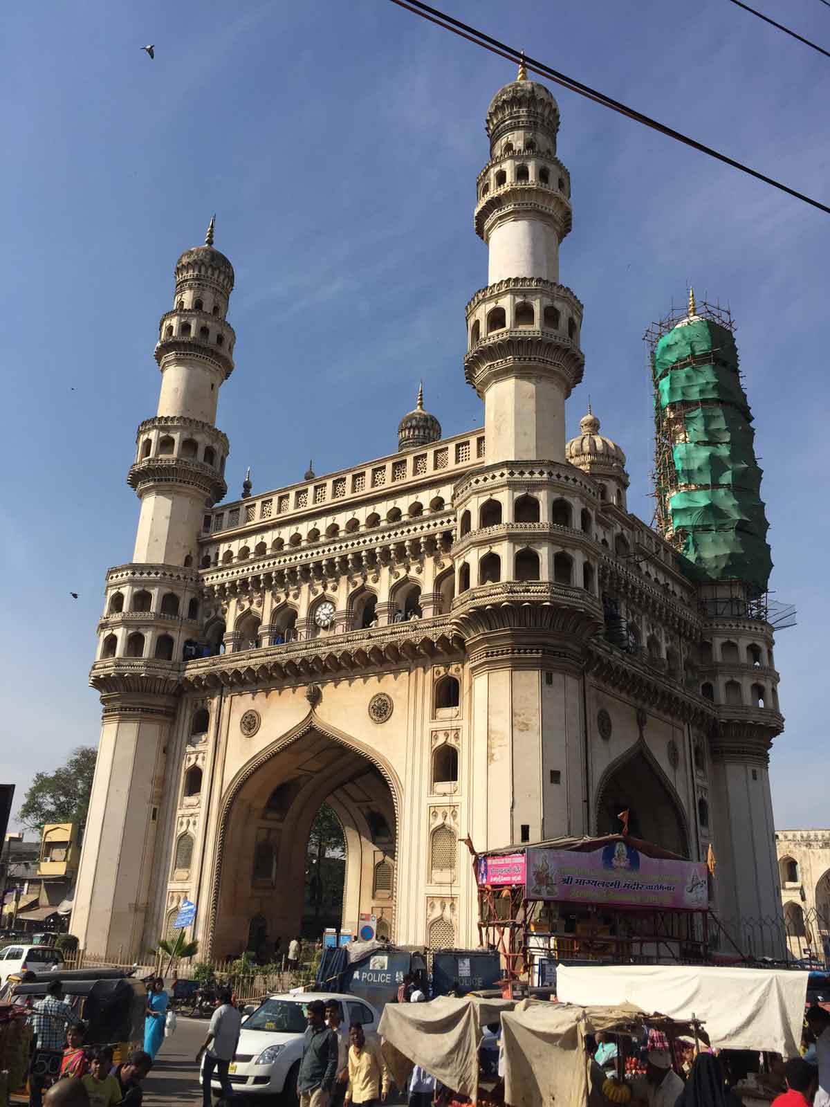
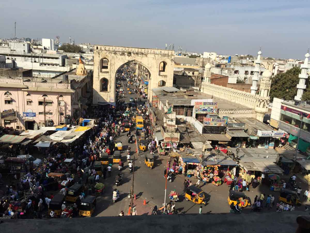
08 February 2015 | Karnataka
- Overview
-
Karnataka is a very beautiful place for tourism and the most famous place is Bangalore, which is the capital of Karnataka. Badami, Badipur National Park, Chikmangalur, Gokarna, Bangalore, Shravanabelagola etc are some of the main tourist attractions. Jog Falls is the beautiful and highest plunge waterfall in India. Western Ghat passes along the State from south to north and so, very beautiful hills, forests, landforms and diverse flora and fauna can be seen here. A good number of National Parks are available in Karnataka. Also a lot of rivers originating from the state Karnataka. It is home to 507 of the 3600 centrally protected monuments in India, the largest number after Uttar Pradesh. The State Directorate of Archaeology and Museums protects an additional 752 monuments and another 25,000 monuments are yet to receive protection. The state previously known as Mysore.
5% of the total India's population is living in Karnata which have an area of 19.17 million Hectare (6% of total area) . Majority of workforce (56%) is working in agriculture and relative activities. Since the 1980s, Karnataka has emerged as the pan-Indian leader in the field of IT (information technology). In 2007, there were nearly 2,000 firms operating in Karnataka.
- Travel Info
-
In early morning, we reached Bangalore. Krishna Kumar had a plan to meet his cousin sisters studying at Banglore and spend some time with them. So he dropped us near the Majestic Bus station and went to his cousin's location. We both booked a hotel room and slept well. Then we went to Majestic Shopping Market for purchasing the remaining items. When our purchasing was over, we went to our room and after bath vaccated it. In front of the hotel we again met together and started our travel back to our home nearly 6.00 PM.
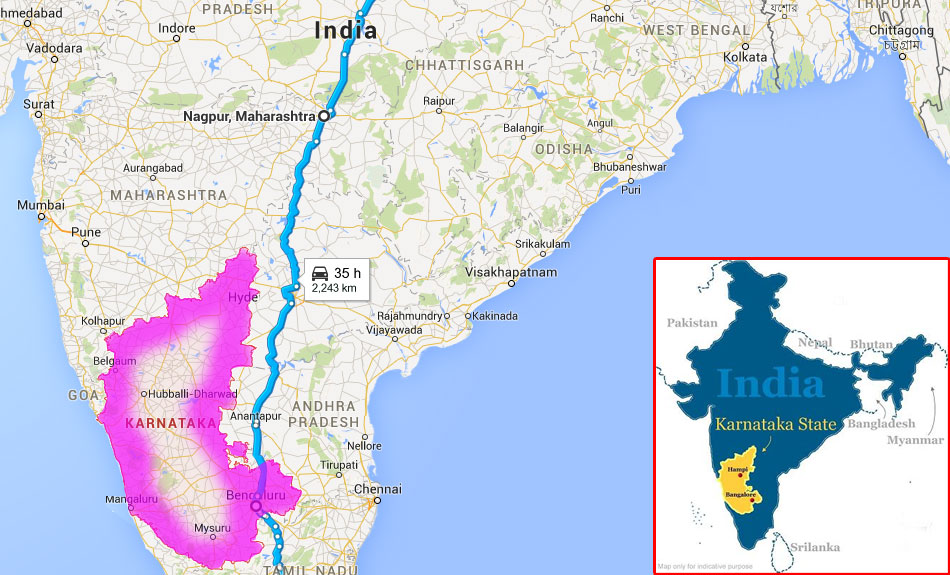
- 02:00 PM | Majestic, Bangalore
-
At Majestic you can get almost everything you wish to buy. You can buy clothes, accessories, foot wears and electronics. You also can go to the markets close by to buy accessories.
08 February 2015 | Tamil Nadu
- Travel Info
-
This is the way back to our home. We only spent some time for tea and dinner purpose in Tamilnadu. We speed up our travel as fast as possible to reach the destination.
09 February 2015 | Tamil Nadu
- Travel Info
-
This is the continuation of the previous day's travel back to our home.
09 February 2015 | Kerala
- Travel Info
-
Nearly 4.00 AM in the morning we reached our home. We went to bed with the ultimate satisfaction of our success of completion of the long travel. Our travel gave us lots of entertainment and experience in our lives. 19 days was not enough to travel all these places. Lot of places still pending to see. But our aim was satisfied. We did our longest road trip with 100% success !!
Back to Top
 digitizing dreams
Appfabs provides end to end software development services for companies and technology driven businesses to transform and succeed in the new digital era.